
Cruggleton Castle
An arch. That is all you see now: a stub of barrel-vaulting, three metres tall, planted on the edge of a 40-metre cliff above the Irish Sea. Locals call it simply 'The Arch,' and it is the last visible bone of a fortress that excavations have shown was occupied, in one form or another, from the first century AD until the seventeenth. The shale outcrop at Cruggleton Point has been a sentinel for nearly two thousand years, and the wind that scours it now has been doing so for every one of them.
Layers in the Shale
Dig into the ground at Cruggleton and the centuries come apart in neat strata. Archaeologists in the 1970s and 1980s peeled back a late Iron Age hut circle, then a timber hall from the early medieval period. Sometime in the 12th or 13th century, someone raised the rock itself, piling earth and stone to create a motte, and crowned it with a wooden tower. The first stone keep and curtain wall followed between the late 13th and early 15th centuries. The name 'Cruggleton' is thought to come from the sheer rocky nature of the place, and every generation that built here was responding to the same brute fact: the cliff edge is defensible, the views command the bay, and the promontory has a broad ditch cutting it off from the land.
Wallace and the Black Rock of Cree
Cruggleton was a prize worth fighting for. In the 1290s John Comyn, Earl of Buchan, had a licence from Edward I to dig lead on the Calf of Man to roof eight towers here, which gives some sense of the castle's scale. According to the blind 15th-century minstrel Harry, the same fortress, known to him as 'The Black Rock of Cree,' was stormed by William Wallace with his companions Stephen of Ireland and Kerle. Scottish forces retook it in 1307 and pulled it down. King David II later handed the lordship to Gilbert Kennedy, and in 1424 the castle and its lands were granted to the Prior and Canons of nearby Whithorn, tying this military stronghold to the religious heart of Galloway.
Two Royal Bastards and a Siege
The Reformation broke church lands open and tipped Cruggleton into a sixteenth-century soap opera. Lord Robert Stewart, the commendator of Whithorn Priory and an illegitimate son of James V, claimed the castle. John Fleming, 5th Lord Fleming, disagreed. In 1569 Fleming actually besieged Stewart inside the walls. His half-brother, James Stewart, Earl of Moray and another illegitimate son of James V, wrote to Sir Patrick Vaus of Barnbarroch begging him to relieve the siege. The courts eventually awarded Cruggleton to Margaret Stewart, Mistress of Ochiltree, in the 1580s. The castle changed hands again and again through the seventeenth century, but the iron law of Scottish castles caught up with it. By 1684 a survey described Cruggleton as 'wholly demolished and ruinous.'
The Church That Outlived the Castle
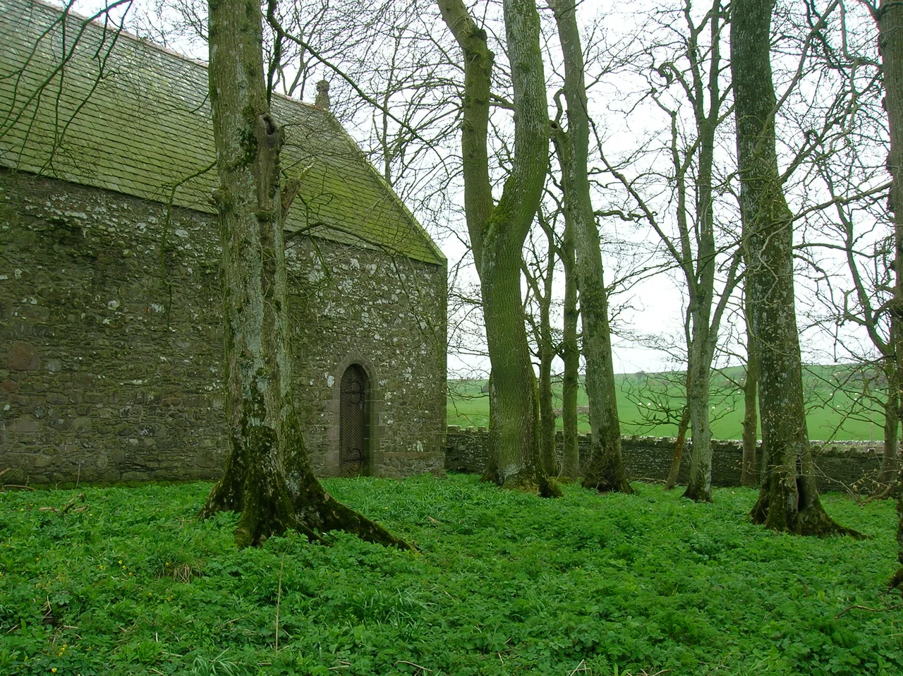
About 750 metres west of the ruins stands a survivor. Cruggleton Church was founded in the early 12th century by Fergus, Lord of Galloway, and is the most complete Romanesque church in the area. By the late 19th century it had collapsed into ruin, but William de B M Galloway restored it in the 1890s on the orders of the 3rd Marquess of Bute. Today it is a category A listed building, and once a year, in September, an ecumenical service is held inside its small Romanesque walls. The church may mark the approximate site of the lost village of Cruggleton, a community that has otherwise vanished into pasture. From the air, the church and the lonely arch are visual rhymes: two medieval bones in the same windswept skeleton.
From the Air
Cruggleton Point sits at 54.7572N, 4.35733W on the east-facing coast of the Machars peninsula, about 40 m above the Solway Firth. The arch is clearly visible from the B7063 Garlieston-to-Isle-of-Whithorn road and recognisable from low altitude as a solitary stub on a cliff promontory. Best viewed at 1,500-3,000 ft on a clear day. The nearest airports are Dumfries (EGDD) to the east and Prestwick (EGPK) to the north. The broad ditch across the promontory and the rectangular outline of the motte are most visible in low oblique sunlight.
Nearby Stories
- Ardwell 2.1 km away
- Point of Ayre Lighthouse 8.7 km away
- Battle of Glen Trool 9.8 km away
- Ballantrae Lifeboat Station 11 km away
- Solway Firth 13 km away
- Dumfries 17 km away
- St Bees Lifeboat Station 17 km away
- Portavogie 34 km away