
Portavogie
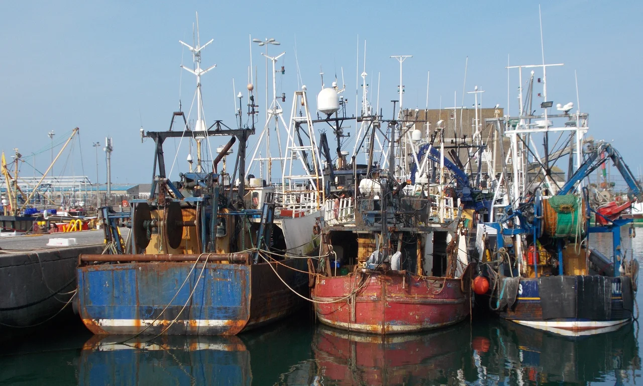
Most evenings around the same hour, a small crowd gathers on the quay at Portavogie. The boats are coming back, and there's a fish auction about to start. This is the easternmost settlement in Ireland - a strip of houses and a working harbour pressed against the Irish Sea on the seaward side of the Ards Peninsula. The village has roughly 2,100 residents, eighteen old family names that recur down the centuries, and a fleet of prawn boats that has somehow survived the long contraction of European inshore fishing. Three murals on the side of the primary school tell the whole story of how this place came to be: by sea, for the sea, because of the sea.
From Stable Hole to Modern Quay
The first settlers came in around 1555 to a spot called Stable Hole, at the bottom of what is now Warnocks Road. The site was chosen for the same reason every other fishing hamlet on this coast was chosen: rocks for shelter, a sandy shore where boats could be drawn up beyond the tide. Most of the founders were families who had crossed the Irish Sea from the Solway coast - working fishermen looking for a better living. The Anglo-Norman lords ignored them, since the Stable Hole shore had no strategic value. The records of 1620 call the place Portabogagh, from the Irish Port a' Bhogaigh, the harbour of the soft ground. By 1810 the spelling had settled into Portavogie. The harbour today is a thoroughly modern industrial facility, rebuilt over the past half-century from what older residents still remember as a 'pretty' anchorage.
Little Holland on the Irish Sea
Looking inland from the village, the past becomes visible in a different way. The route north to Newtownards was historically flood-prone at spring tide, and the western boundary of Portavogie was simply called 'the Bogs.' To drain land and grind grain, residents of the Ards Peninsula built windmills - at one point as many as 82 of them along its length, giving rise to the local nickname 'Little Holland.' In 1735 a man called Charles Echlin bought a house here from Reverend Hugh Maxwell, renamed the surrounding area Echlinville, and set about the slow work of draining the Bogs. That drainage is the reason the area now produces some of the most fertile arable land on the peninsula. Echlinville is still the name of a working distillery on the site - the spelling holds, the bogs do not.
Eighteen Names, One Industry
In 1900 the village register listed eighteen family names: Adair, Pyper, Warnock, Boyd, Rutherford, Lawson, Ambrose, Thompson, McKee, Clint, Hughes, Cully, Edmund, Palmer, Young, McVea, McClements, and Coffey. Most of these lines have continued unbroken to the present day - read the headstones in the graveyard or the side of any working trawler, and the same surnames appear. Many of the original settlers were Presbyterian Covenanters who had fled Scotland during the religious persecution of the seventeenth century, and the dominant church here remains Presbyterian. In 1985 Princess Anne came to officially open the new harbour and toured a fishing boat called Willing Lad with its skipper, James McClements. She returned in 1999 to open the community centre. That a member of the royal family came to christen a harbour rebuild speaks to how seriously Northern Ireland treats this last fishing port at its easternmost edge.
The Troubles, the Cost
Two men died near Portavogie during the Troubles, both shot, both on dates in early April two decades apart. David McQueen, a 28-year-old Protestant civilian, was shot at the side of the road in April 1973 by an unidentified loyalist gunman. William Killen, 36, was killed in his bed at his home in Westlea Gardens in April 1993 during an internal UDA dispute. Two deaths might seem like a small number set against the broader scale of the Troubles, but for a village of two thousand people, both losses carried weight that lasted long after the funerals. The names appear in no museum, but the families remained in the village, and the village remembered.
Game Days and the George Best Trophy
Sport keeps the village together when the boats are quiet. Portavogie Rangers FC hosts an annual football tournament called the George Best Trophy in memory of the Manchester United and Northern Ireland striker, an icon born just down the coast in Belfast. A five-a-side tournament runs every July 11th, looped into the broader calendar of Orange parades that mark this Protestant village's summer. There's one primary school and one nursery, and the murals on the primary school's outer wall - commissioned in 2001 from artists Gary Drostle and Rob Turner - give the children a daily reminder of who lived here, what they did, and why the sea outside still pays the bills.
From the Air
Portavogie sits at 54.46N, 5.44W on the eastern coast of the Ards Peninsula. As the easternmost settlement in Ireland, it marks the boundary between land and the open Irish Sea. From altitude, look for the modern harbour breakwaters projecting into the sea south of Ballyhalbert. Nearest airport is Belfast City (EGAC), about 20 nautical miles northwest. Recommended viewing altitude 2,000-3,500 feet. The peninsula tapers below Portavogie toward the Strangford Narrows entrance, and the contrast between the sheltered Strangford Lough on the western side and the open Irish Sea on the eastern is dramatic at any altitude.
Nearby Stories
- Silent Valley Reservoir 1.7 km away
- Drummore 3 km away
- Copeland Islands 5.2 km away
- Castle Upton 8.4 km away
- Hillsborough Castle 9.5 km away
- Bradda Head 11 km away
- Pasages (steam trawler) 20 km away
- Chicken Rock Lighthouse 41 km away