
Crummock Water
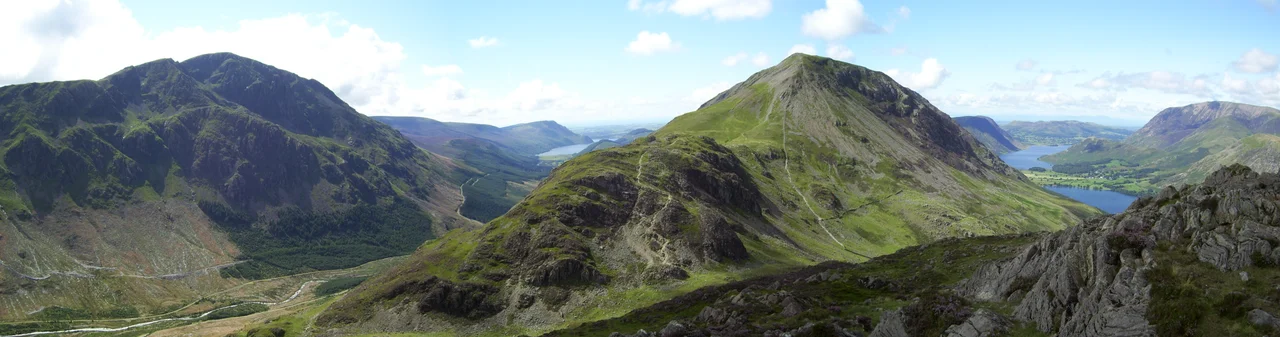
Alfred Wainwright, who walked these fells more meticulously than anyone before or since, wrote that 'no pairing of hill and lake in Lakeland have a closer partnership' than Crummock Water and the hill of Mellbreak that runs the full length of its western shore. He was right. From the south-eastern end, Mellbreak rises straight out of the water as if pushed up by the lake itself, and from any other angle the two are inseparable. The name does not strain for grandeur. 'Crummock' comes from Brythonic Celtic crumbaco - simply, 'the crooked one'. The lake bends gently, and a thousand years ago someone described that bend, and the description stuck.
A Lake Held by Three Owners
Crummock Water measures two and a half miles long, six-tenths of a mile wide, and 140 feet deep, with an area of two and a half square kilometres. It is fed by Buttermere Dubs - the short stream from Buttermere immediately to its south - and drains north as the River Cocker, the same river that gives Cockermouth its name before joining the Derwent and running on to the Irish Sea at Workington. The lake belongs to the National Trust. So does much of its shoreline. The combined effect is a remarkably preserved valley: no road runs along the western shore, no marina interrupts the view, and the visual unit of Mellbreak-and-water that Wainwright loved is essentially unchanged from any walker's first visit fifty years ago to today.
Scale Force
Tucked into the south-western slopes above Crummock Water is Scale Force, the highest waterfall in the Lake District. It drops 170 feet through a narrow gorge before its water makes its way into the lake. Getting there requires a walk - the falls are not visible from the road, and the boggy approach has tested generations of visitors - but the reward is one of the most dramatic single drops in northern England, hidden from the obvious sightlines and rewarding those willing to leave the lakeside path. From the falls, the water joins the lake and continues a journey that will end, eventually, in the sea forty miles to the west.
Drinking Water for the Coast
For most of the 20th century, Crummock Water did a quiet, vital job. Its water was treated at Cornhow works near Loweswater and piped out across West Cumbria, supplying drinking water to Silloth-on-Solway, Maryport, Workington, and dozens of smaller settlements. Generations of west-coast Cumbrians grew up drinking lake. That role ended in March 2023 when United Utilities completed a new pipeline carrying supply from Thirlmere instead, easing the abstraction pressure on Crummock and allowing the lake's natural levels to return. It is a small environmental restoration, but a real one. The water that once ran from taps in Maryport now stays in the lake.
A Body in the Lake
In 1988 the lake briefly entered the national news for the wrong reason. The body of Sheena Owlett was found in Crummock Water, and the discovery initially baffled investigators. She had not died here. She had been murdered in Wetherby, more than seventy miles away in West Yorkshire, and her body brought across the Pennines to this remote western lake. The case is a reminder that even the quietest landscapes can become the unwilling settings of someone else's crime. Sheena Owlett was a real person, and what was done to her was done elsewhere; the lake bore her body for a time and then gave it up to the people searching for her.
Walking the Eastern Shore
The road that runs alongside Crummock Water on the east hugs the lake closely between Buttermere village and Lanthwaite. Stop almost anywhere along it and you get the classic view: Mellbreak rising sheer to the west, Grasmoor and Whiteless Pike to the north-east, and Rannerdale Knotts marking the eastern shore. Spring brings the famous Rannerdale bluebells, growing not in the usual woodland but in the open hillside. Local legend ties them to the supposed last stand of Jarl Buthar against the Normans - the bluebells reputedly grew from the blood of Norman soldiers. Whether or not that is true, the flowers come every year, and the lake bends quietly past them.
From the Air
Coordinates 54.55 N, 3.30 W. Crummock Water lies immediately north-west of Buttermere in a continuous glacial valley, the two lakes separated by a narrow strip of pasture and the village of Buttermere. From the air the pair appears as a long, gently curved waterway running north-west to south-east. Mellbreak rises steeply on the western shore. Recommended altitude 3,000-4,500 ft AGL. The valley is open at its northern end toward Lorton; Honister Pass closes it to the south-east. Nearest airports: Carlisle Lake District (EGNC) and Blackpool (EGNH). Watch for orographic cloud forming on Grasmoor.
Nearby Stories
- Lowther Castle 5.5 km away
- Black Combe 6.6 km away
- Levens Hall 6.8 km away
- Threave Castle 13 km away
- Ruthwell Cross 18 km away
- Raeberry Castle 24 km away
- RAF Spadeadam 24 km away
- Cashtal yn Ard 33 km away