
Cullera
Follow the Valencian coast south and the shoreline stays flat for miles - dune, beach, orchard, repeat - until one rocky hill breaks the rhythm, topped by a castle and a whitewashed hilltop sanctuary. That hill is Cullera, and just below it the Xúquer River (the Júcar, in Castilian) empties into the Mediterranean after crossing half of eastern Spain. People have settled this meeting point of river, mountain and sea since Neolithic times; the surrounding slopes are scattered with the archaeological remains that prove how long the site has been prized.
The Castle on the Rock
The mountain that rises straight out of the beach resort is the reason Cullera exists where it does. Whoever held the summit controlled the river mouth and the coast road, so the crag has been fortified for a thousand years and more. The Castell de Cullera still crowns it, a medieval fortress of pale stone with the sea on one side and a plain of rice fields and orchards on the other. Beside the walls stands the Santuario de la Virgen del Castillo, its white sanctuary a landmark visible far out to sea. Climb up on a clear afternoon and the whole geography arranges itself below you: the silver thread of the Xúquer, the long ribbon of sand, and the Mediterranean stretching to a flat horizon.
The Barri Pou
Cullera's oldest streets are gathered on the lower slopes in the Barri Pou, the former Arab quarter, where lanes climb the hillside in tight switchbacks and stairs. This coast was long a frontier of raids and defensive towers, and Cullera did not escape the danger. In May 1550 the Ottoman corsair Dragut sacked the town, seizing goods and carrying off much of the population into slavery in Algiers - a raid the town still remembers. Watchtowers like the Torre de la Reina Mora, also called Santa Ana, are relics of a period when a sail on the horizon could mean disaster. Today the quarter is a quiet warren of old houses, but the layout still tells the story of a place that had to guard itself.
Fifteen Kilometres of Sand
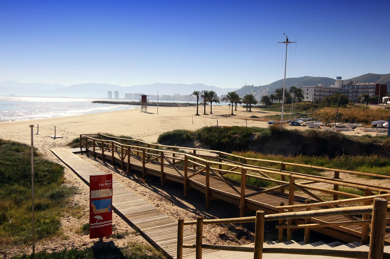
Modern Cullera is defined by its beaches - more than fifteen kilometres of them, each with its own character. Playa de San Antonio is the busy urban strand, backed by promenade and restaurants, while Playa del Racó keeps a calmer mood. Windsurfers favour Cap Blanc for its wind, families gravitate to the sheltered Playa de los Olivos, and divers slip into the small cove of Playa del Faro beneath the lighthouse. Dogs are welcome on the more isolated Playa de la Escollera, the breakwater beach at the river's edge. In July and August lifeguards, first-aid posts and accessible ramps appear along most of the shore, turning the coast into the summer heart of the town.
At the Table
Cullera sits between two larders: the Mediterranean on one side and, just to the north, the great rice paddies of the Albufera on the other. That geography shows up on the plate. The town has built a serious reputation for its cooking, especially the rice dishes and seafood that define this stretch of coast, and destination restaurants such as Casa Salvador draw diners from Valencia and beyond. It is an easy place to spend a long lunch, watching the water while working through a paella or an all i pebre, then wandering back into town as the light softens on the castle above.
Getting There
Cullera makes an easy escape from the city. Valencia's airport lies about 40 kilometres north, and regular Cercanías trains and the Alsa coastal bus line - which threads together Valencia, Gandía, Dénia, Calpe, Altea and Benidorm - all stop here. Once you arrive, a local circular bus loops between the old centre and the beaches, so a car is optional. For all its summer crowds, Cullera stays a working Valencian town, one where the castle, the river mouth and the sea have shaped daily life for far longer than the tourists have been coming.
From the Air
Cullera sits at 39.166°N, 0.253°W, roughly 40 km south of the city of Valencia at the mouth of the Xúquer (Júcar) River. The unmistakable visual landmark is the isolated rocky mountain rising abruptly from an otherwise flat coastline, crowned by the Castell de Cullera and the white Santuario de la Virgen del Castillo, with a lighthouse on the seaward flank and fifteen kilometres of beach running north and south. Nearest airports are Valencia (LEVC) about 40 km north and Alicante–Elche (LEAL) to the south; Murcia (LEMI) lies farther south. A low viewing altitude of 2,000–4,000 ft best reveals the castle hill and river delta; the Mediterranean's typically clear summer skies make the site legible from well offshore.
Nearby Stories
- La Tomatina 9 km away
- Cova de les Dones 9.2 km away
- La Bastida de les Alcusses 9.2 km away
- Taifa of Dénia 11 km away
- El Cabanyal 17 km away
- Illa Grossa 65 km away
- Illa de s'Espartar 75 km away
- Capture of the galleon Lion Couronné 89 km away