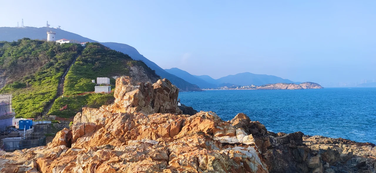

D'Aguilar Peak
Most of Hong Kong's mountains carry Cantonese names that describe their shape or character — Lion Rock, Dragon's Back, Needle Hill. D'Aguilar Peak carries the name of a British general who never climbed it. Major-General Sir George Charles d'Aguilar commanded British forces in China and Hong Kong in the mid-nineteenth century, and the peak on the southeastern tip of the island was named for him, along with the cape below it. The Cantonese name, Hok Tsui Shan — roughly Red Beak Mountain — is older and more specific. Both names are still in use, which is Hong Kong all over: a landscape written in multiple scripts, where a hill can hold two names and two stories at once.
The View From Dragon's Back
Hikers who walk the Dragon's Back trail — one of the most popular routes in Hong Kong — see D'Aguilar Peak clearly for much of the journey. It rises to 325 meters in the southeastern corner of the island, Shek O Peak sitting to its north, the South China Sea spreading out beyond. The Dragon's Back trail does not cross the summit of D'Aguilar Peak; it runs along the neighboring ridge, offering the peak as a visual companion rather than a destination. This creates a particular quality of presence: the summit is always in view but not underfoot. Hikers who want the top itself must approach from a different direction.
Getting There
Two routes reach the summit. The easier approach follows Cape D'Aguilar Road to a trailhead, from which the climb takes about 30 minutes — a modest effort that rewards with a significant view back over Shek O, the surrounding coastline, and the islands scattered into the South China Sea. The second route is steeper and rockier, ascending from Shek O Beach in a more demanding scramble. Both trails pass through the kind of secondary forest and open scrubland that covers much of Hong Kong's country parks: dry hillside vegetation, exposed granite, and the particular smell of sun-warmed rock that defines the territory's upland character. The summit itself is not marked by any dramatic infrastructure — no pavilion, no trig point visible from afar. It is simply the highest ground available.
Protected Ground
A site on the northwestern slope of D'Aguilar Peak, south of Windy Gap, was designated a Site of Special Scientific Interest in 1975. The designation protects the area's ecological value — the peninsula's coastal grasslands, rocky shores, and freshwater streams support species assemblages that would not survive in Hong Kong's more developed districts. The D'Aguilar Peninsula as a whole is one of the territory's most ecologically intact corners: remote enough from urban development, rugged enough in terrain, and consistently enough managed as country park to retain the kind of biodiversity that elsewhere in Hong Kong has been pressured or lost. The SSSI status formalizes what hikers and naturalists have long recognized about this southeastern tip of the island.
At the Edge of Hong Kong
Cape D'Aguilar is the southernmost point of Hong Kong Island, and the peak above it is a natural terminus — the end of the ridge system that runs the length of the island. From the summit on a clear day, the view extends far out into the South China Sea, past the outlying islands, toward the horizon. The sense of being at the edge of something is unusual in Hong Kong, where the city reasserts itself quickly and completely. Here, the city is absent. The MTR doesn't reach here; the skyscrapers are not visible; there are no apartment towers on the horizon. There is the mountain, the sea, the wind at Windy Gap, and the Cantonese name that describes a red beak — whatever the original speaker saw that made that name seem right.
From the Air
D'Aguilar Peak sits at 22.2168°N, 114.2489°E at the southeastern tip of Hong Kong Island, rising to 325 meters. From the air it is the prominent high point on the island's eastern end, with the Shek O coastline and rocky cape visible below it. Hong Kong International Airport (VHHH) is approximately 40 km to the northwest on Lantau Island. Approaching VHHH from the southeast, the peak is visible off the left side on standard approach paths — a useful geographic anchor marking the transition between open ocean and the urban harbor. At lower altitudes, the Dragon's Back ridge running northwest from D'Aguilar Peak is one of the most distinctive topographic features on the island, its undulating crest separating the developed south shore from Tseung Kwan O to the northeast.
Nearby Stories
- Lok Ma Chau Loop 2.3 km away
- Portas do Cerco 2.3 km away
- Kweilin Incident 17 km away
- Wanshan Archipelago Campaign 34 km away
- Nanxiong Formation 115 km away
- Battle of Nanpeng Island 148 km away
- Heyuan 169 km away
- Cape Maobitou 632 km away