De Biesbosch National Park
On the night of 18 November 1421, a storm surge in the North Sea met unusually high river levels in the Rhine and Meuse. The Saint Elizabeth's Flood broke through a stretch of dike in the southwest of the Grote Hollandse Waard, a polder where farmers had been cultivating crops behind century-old dikes for generations. The dike had been built on ground everyone knew was unstable, and nobody had wanted to pay to fix it. Within hours, water was moving through villages that had been farmland the day before. Tradition says seventy-two villages were lost and the death toll was either two thousand or ten thousand people. Modern researchers think the casualty numbers may have been smaller. The wetland that swallowed the Grote Waard is still here. It is now a national park, and it is one of the last places in Northwestern Europe where you can still see what a tidal freshwater delta looks like.
A Disaster That Took Decades
The popular image of the Saint Elizabeth's Flood is of a sea that came in overnight and left for good. The reality is more patient and somehow more terrible. The dikes broke that November night. The flooding spread over days. The reshaping of the landscape took decades. The people who survived the immediate inundation watched the land they had farmed slowly become unfarmable, the drainage streams of the old polder dying one by one as the rivers found new beds. The Dubbel, the Eem, the Werken, the Graaf, the Alm, the old Oude Maas: each lost most of its connection to the main rivers. Their names survive as place names. Dubbeldam, Werkendam, Almkerk. Each one a small monument to a stream that used to drain a polder that used to exist.
Who Lived There
It is easy, six centuries later, to talk about the flood as a geological event. The villagers who drowned that night were neither geology nor statistics. They were people who had built churches and houses and bought cattle and made the choice to live behind a dike that, as it turned out, no one had maintained well enough. The economic situation in the Grote Waard had been difficult for years. The Hook and Cod civil wars had divided the political authorities who should have been coordinating dike maintenance. When the storm came, the warnings that had been raised for decades about that southwestern dike were proven correct in the worst possible way. The Island of Dordrecht survived to the west. The Land van Altena, with the city of Woudrichem, survived to the east. Between them, where the villages had stood, were brackish swamps. The water did not give the land back.
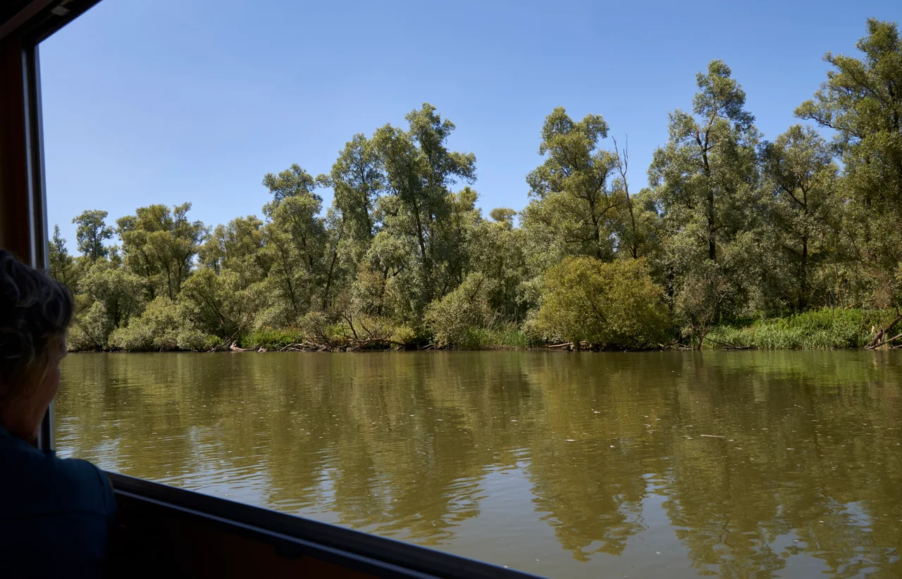
The Inland Delta That Grew Back
Over the next centuries, the rivers' sediment began to rebuild parts of the drowned land. Mudflats appeared. Willow forests took root. Reeds and sedges spread, giving the new landscape its name: Biesbosch, the forest of rushes. The area became an inland delta of the Rhine and Meuse, a network of creeks and islands and tidal flats. Reclamation slowly clawed back about half of the original area as farmland over the following centuries. The other half remained the Biesbosch proper, a place that combined elements no other Dutch landscape combined: freshwater tides, brackish reaches, willow forest, navigable channels, and a population of fish, birds, and mammals adapted to all of it. Before 1970 the average tidal range here was two meters, sustained by a connection to the sea via the Haringvliet.
The Delta Works Closed the Door
When the Delta Works closed the Haringvliet in 1970, the Biesbosch lost its sea connection. The two-meter tides collapsed to near nothing, except in the northernmost Sliedrechtse Biesbosch where 20 to 80 centimeters of tidal difference still remained. The brackish reaches turned fresh. The willow forest expanded as the dynamic delta stilled. Migrating fish lost their main route between river and sea. The transformation was dramatic enough that the park itself looked like a different ecosystem within a decade. Then came the floods of 1993 and 1995, which forced a national reconsideration of how the Dutch hold back water. The conclusion was unexpected: in some places, give it back. The Noordwaard polder was reconnected to the Merwede in a process called depoldering, completed in stages through 2008 and into the 2010s, restoring tidal influence and allowing the new wetlands to absorb peak river discharges that would otherwise threaten dikes downstream.
Beavers, Eagles, and the Long Way Back
The new Biesbosch is, in part, the old Biesbosch returning. Beavers, reintroduced to the Netherlands in the late twentieth century, found the depoldered creeks and expanded their range significantly by 2014. White-tailed eagles bred in the park for several years running by the mid-2010s. The first Dutch-born ospreys hatched here in 2016. Great egrets and little egrets have become familiar. Bitterns and kingfishers are increasing. Plans now include partial opening of the Haringvlietdam sluices, restoring some tidal exchange without making the surrounding farmland unusable, and creating a route for migrating salmon, trout, shad, and smelt back into the Rhine and Meuse. Seals were a common sight here before 1970, despite the freshwater conditions, and might return. Moose may eventually be reintroduced. During the Second World War, the channels and willow thickets that had grown from the 1421 disaster hid Dutch resisters, smuggled medicine north, and helped refugees cross from the German-occupied north to the Allied-held south. The Biesbosch crossers are still remembered as national heroes. The park is a place built out of a catastrophe, slowly remembering how to be itself.
From the Air
De Biesbosch National Park stretches across the area at roughly 51.76N, 4.76E, southeast of Dordrecht and northwest of Werkendam. From cruising altitude the network of creeks and islands is unmistakable against the surrounding agricultural land. Rotterdam The Hague Airport (EHRD) is about 25 km northwest. Eindhoven Airport (EHEH) is roughly 50 km southeast. The Hollands Diep and the Nieuwe Merwede are the major waterways framing the park.
Nearby Stories
- Ockenburg 3.2 km away
- Zundert 7 km away
- 's-Hertogenbosch 9.1 km away
- Hellevoetsluis Dry Dock 9.2 km away
- 1996 Belgian Air Force Hercules Accident 9.2 km away
- Battle of the Scheldt 10 km away
- Woerden 11 km away
- Kamp Amersfoort 13 km away