,reading_D%C3%A9dougou,BF_thu05mar2015-1032h.jpg)
Dédougou
Every other February, the dust of Dédougou fills with spirits. Masks of fibre and leaf and carved wood emerge to the beat of drums - towering forms that twirl, charge, and bow before crowds packed in from across West Africa. This is FESTIMA, the International Festival of Masks and the Arts, and for a few electric days it turns an unremarkable provincial town in western Burkina Faso into the masked capital of the region. The rest of the year, Dédougou returns to its quieter self: a market town of around 64,000 people, capital of the Boucle du Mouhoun, going about its business under the Sahelian sun.
The Masks Come Out
FESTIMA was born here in 1996, founded by the Association for the Safeguarding of Masks - ASAMA - to keep ancient traditions alive in a fast-modernizing age. Held every two years, it gathers masks from some twenty Burkinabè villages and from neighbouring countries like Mali and Benin, the single greatest concentration of West African masking you can witness in one place. Fibre masks shake like living haystacks. White masks float with ancestral solemnity. Each carries the identity of a specific community and a specific spirit, danced not as performance but as the continuation of something old and serious. That this gathering happens in Dédougou is no accident: the surrounding region, home to the Bwa and Marka peoples, is one of the great mask-making heartlands of the continent.
Crossroads of the Mouhoun
Dédougou is the capital of Mouhoun Province and the wider Boucle du Mouhoun Region - the great loop of the Mouhoun, the river the colonizers called the Black Volta. Among the ten largest cities in Burkina Faso, it sits where roads converge: National Road 10, paved, runs down to the major city of Bobo-Dioulasso and onward north to Ouahigouya, while Road 14 strikes east toward Koudougou and west toward the Malian border and the town of San. Most people here speak Jula, the language of trade across this whole region, though as anywhere in Burkina you will find a mosaic of ethnic groups - chiefly the Marka and the Bwa - and the languages that come with them. It is a town built on movement, on the bush taxis and crowded buses that thread the region together.
A Town's Small Pleasures
Daily life in Dédougou has its own modest delights. The market runs every day, much like any market in Burkina, but the town hides a few surprises. One well-known boutique stocks treasures rarely found outside the capital - canned vegetables, juices, even mushrooms and bean sprouts for a stir-fry. Ask there for cheese, and they will summon Camembert made at a nearby Catholic mission, delivered the following day. The street running from the bus station to the market fills with vendors selling the usual Burkinabè street food, and there are bars aplenty, including, locals will tell you, one genuinely cool dance club. At the heart of town stands the curious civic monument that residents fondly nickname the "Golden Chicken Nugget" - officially the Place de la Femme.
The Writer's Country
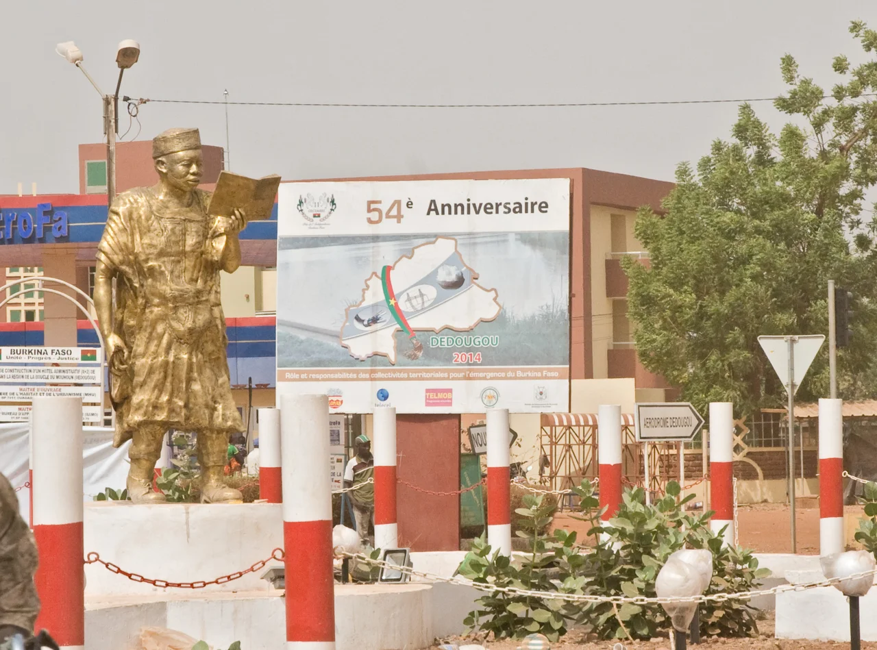
Dédougou and its region gave West Africa one of its important literary voices: Nazi Boni, the politician and writer whose monument stands in town. His novel Crépuscule des temps anciens, published in 1962, drew on the history and folklore of his Bwa homeland - including the memory of the great anti-colonial uprising that swept this very region in 1915. To walk Dédougou's streets, then, is to move through a landscape thick with story: the spirits danced at FESTIMA, the river looping through the savannah, and the long memory of a people who have always known how to keep their past alive - on the page, on the road, and behind the mask.
From the Air
Dédougou lies at 12.47°N, 3.47°W in western Burkina Faso, on the plains within the great loop of the Mouhoun (Black Volta) River. From altitude it appears as a compact town set in dry savannah and farmland, with paved roads radiating toward Bobo-Dioulasso, Koudougou, and the Malian border. The nearest major airport is Bobo-Dioulasso (DFOO) to the southwest; Ouagadougou (DFFD) lies to the east. Best viewed in the clear, dusty light of the dry season.
Nearby Stories
- Koudougou 51 km away
- Mare aux Hippopotames 64 km away
- Tominian 105 km away
- Yacouba Sawadogo 109 km away
- Republic of Upper Volta 121 km away
- Grand Mosque of Bobo-Dioulasso 143 km away
- Ouahigouya 144 km away
- Gwollu Defence Wall 177 km away