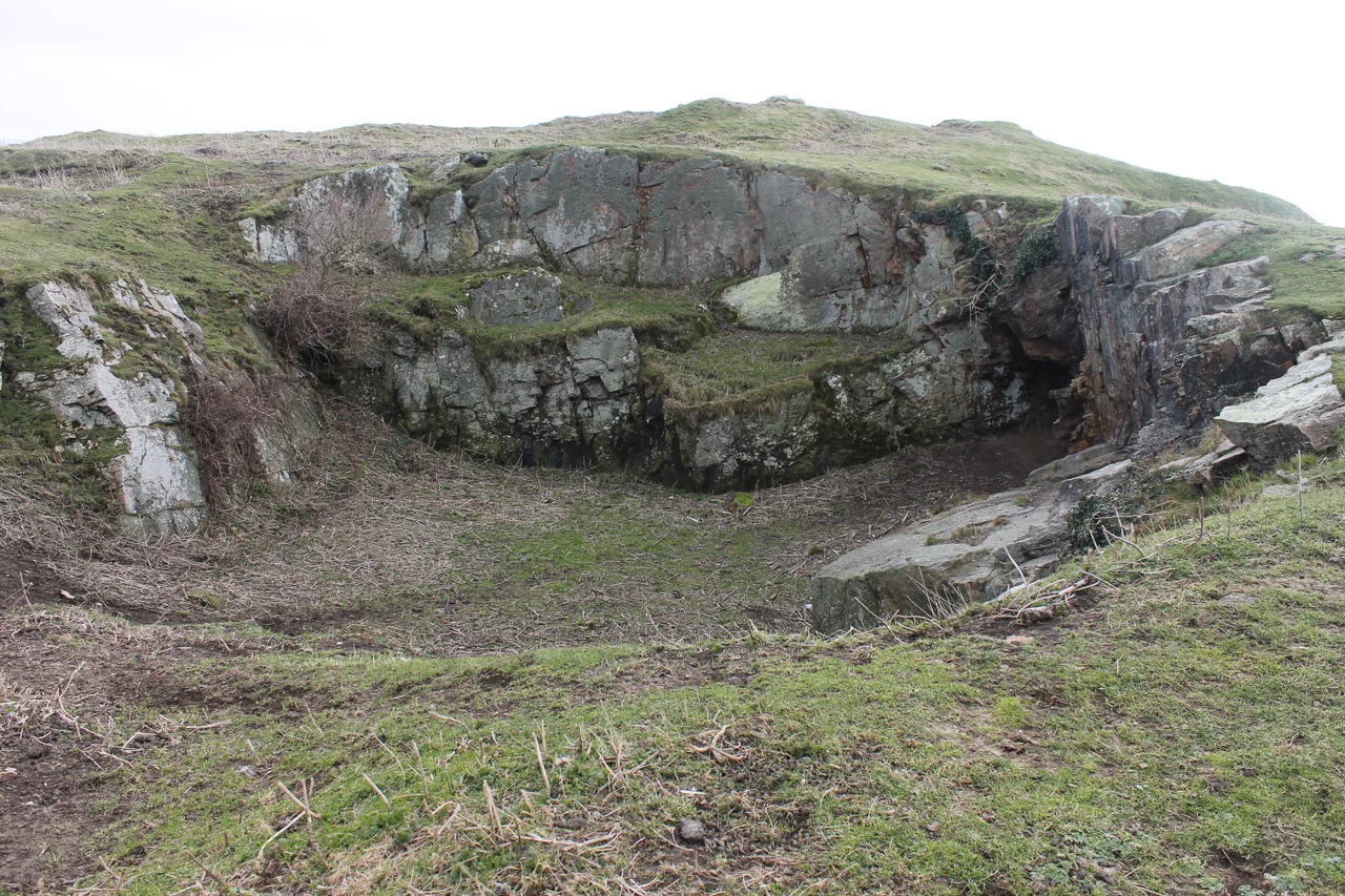

Deganwy Castle
Climb up the Vardre - the limestone outcrop on the east side of the Conwy estuary, the twin summit you can see from Llandudno - and you will find ditches, a few mounded earthworks, the trace of a fallen tower, and a panoramic view across the river to the great Edwardian castle of Conwy that replaced this place in 1283. Deganwy is what is left of one of the oldest defended sites in Wales. Maelgwn Gwynedd, king of Gwynedd in the early sixth century, is traditionally said to have ruled from here. Lightning struck the wooden stronghold in 812 and burned it down. Welsh princes destroyed it, Norman lords rebuilt it, Henry III spent more than two thousand pounds on it, and Edward I finally decided that a fresh castle on the other side of the river would serve him better. The Vardre has been quiet for seven and a half centuries.
Maelgwn and the volcanic plug
Geology gave Deganwy its purpose. The Vardre is a volcanic plug, 110 metres high, rising abruptly out of an area of limestone in what is now the suburbs of Llandudno. It commanded the mouth of the Conwy estuary, the natural crossing point for east-west traffic along the north Welsh coast. People had lived on or near the rock since the Roman period, and possibly earlier. The early-medieval timber fortress on top was traditionally the headquarters of Maelgwn Gwynedd, king of Gwynedd around 520 to 547 - one of the more important early Welsh kings, the subject of much later legend and not a little ecclesiastical disapproval. Several nearby places still carry his name, including the hill called Bryn Maelgwyn, where in July 1979 a hoard of 204 silver pennies from the reign of Cnut was unearthed.
Norman lord, Welsh prince
After the Norman conquest of 1066, William the Conqueror installed Hugh d'Avranches as Earl of Chester, and Hugh's nephew Robert of Rhuddlan was given the campaign against Gwynedd. Robert built a castle at Rhuddlan and, according to the chronicler Orderic Vitalis, another at Deganwy - probably no earlier than 1073. The exact location and layout of his castle are uncertain. Robert was killed by Welsh forces in 1093, and the following year Gwynedd pushed the Normans back out. The twelfth century is largely silent. The Welsh chronicle Brut y Tywysogion records, somewhere in this period, that 'the earl of Chester again built the castle of Degannwy, which Llywelyn ap Iorwerth had destroyed for fear of the king.' Castle, ruin, rebuilt castle, ruin again - the cycle of medieval frontier sites.
1241: scorched earth
Dafydd ap Llywelyn, son of Llywelyn the Great, inherited Deganwy along with the rest of Gwynedd. In 1241, ahead of an English advance into north Wales, Dafydd had his own castle destroyed rather than let it fall into Henry III's hands. The Annales Cambriae records the demolition. King Henry took the site anyway. Between 1245 and 1254 he poured more than two thousand two hundred pounds - an enormous sum - into rebuilding Deganwy into a serious English royal castle, with stone walls, towers, and a complicated bailey threading between the two summits of the Vardre. Excavations on the site found a dozen fragments of imported Mediterranean pottery from this period, a small reminder that the royal court of Gwynedd had been connected, in trade and culture, to a much wider European world.
1283: replaced
Edward I's conquest of Wales in 1282-83 made Deganwy strategically redundant. The new Edwardian programme called for a fresh chain of castles built to a single design vocabulary by Master James of Saint George - Caernarfon, Harlech, Beaumaris, Conwy. Edward chose the west bank of the estuary, on the old Aberconwy Abbey site, as the location for his new fortress. Deganwy, the older Welsh and English stronghold on the east bank, was abandoned and never rebuilt. From that day to this, the Vardre has been a place of grass, gorse, scrambling sheep, and a few collapsing walls. Conwy Castle, just over a mile away across the water, kept the strategic role Deganwy had held for eight centuries.
What remains
The site today is a scheduled monument, graded II* listed, free to walk. Two hills are joined by a saddle. On the eastern summit, the foundations of Mansell's Tower are still visible. The western summit holds the trace of another tower. Between them runs the line of the bailey, with mounds and ditches that geophysical survey in 2009 (by the Gwynedd Archaeological Trust) suggested may hide a substantial amount of undiscovered medieval stonework. The view from the saddle is the real exhibit: south across the estuary to Conwy Castle and its town walls, west into the Carneddau, north to the Great Orme and the open sea. For a thousand years this was where the watch was kept. It is still the best place to see why.
Flight Context
Deganwy Castle sits at 53.298 north, 3.829 west, on the Vardre - the twin-summit volcanic plug visible at the south end of Llandudno, just east of the Conwy estuary. From the air the two rocky hillocks and the saddle between them are unmistakable, with the modern town of Deganwy spread around their feet. Best viewed at 1,500 to 2,500 ft AGL flying north or south over the Conwy estuary. Nearest airports: Caernarfon (EGCK) twelve miles west, RAF Valley (EGOV) on Anglesey, Hawarden (EGNR) east toward Chester.
From the Air
53.298°N, 3.829°W. Volcanic plug at south end of Llandudno, east of the Conwy estuary. Twin summits with saddle. Best viewed at 1,500-2,500 ft AGL. Nearest airports: EGCK Caernarfon, EGOV Valley, EGNR Hawarden.
Nearby Stories
- Caldy 1 km away
- Moelfre, Anglesey 1.2 km away
- Pen-yr-Orsedd Quarry 2.5 km away
- Ysbyty Ifan 7.5 km away
- Birkdale Palace Hotel 9.5 km away
- Wrexham County Borough Museum 12 km away
- Celtic Array 22 km away
- Southport Lifeboat Station 45 km away