Den Hulst
Locals do not pronounce it Den Hulst. They say Nulst, eliding the article, the way a place name softens with daily use. The hamlet that goes by both names stretches along the provincial road N377 in central Overijssel like a ribbon laid down on flat farmland. Drive through and you might not notice you have entered or left it. But underneath that motorway, almost exactly along its trajectory, used to run a canal that carried the peat of the Dutch east toward the urban hearths of the west, and for most of the 19th century, that canal was the reason Den Hulst existed at all.
Along the Vaort
When Willem Jan baron Van Dedem began cutting his Dedemsvaart canal westward from Hasselt in the autumn of 1809, Den Hulst was a cluster of twelve houses on the flat land north of Nieuwleusen. By 1811 the channel had been dug as far east as the Oosterhuizer field, about seven kilometers past the hamlet, a distance the baron himself reckoned as five hours' walk from Hasselt. Lock number three and the Ommerdieker bridge sat right at Den Hulst's doorstep. People here did not live in a village so much as an de vaort, along the canal. The south side, where the towpath was bedded in sand, got its own name: the zaandkaante, the sand side. Rijkman Wicherson's cafe along the towpath did good trade with the peat skippers walking their horse-drawn barges between locks.
The Mansion That Moved
In 1821, Van Dedem did something unusual. He had a country house called Rollecate that had been built around 1654-1655 in Vollenhove, on the other side of the province. He took it apart and rebuilt it in Den Hulst, on a spot where he could see his canal from the windows. Nearly a century later, in 1913, the mansion lent its name to a different project: a state college for training rural women in landbouwhuishoud, the combination of housekeeping, farming, and horticulture that organized so much of country life. The school was led first by the pedagogue Theda Mansholt, and later by Greta Smit. In 1930 it moved to Deventer. The Rollecate mansion itself was demolished, leaving the name behind in road signs and institutional letterheads but little else.
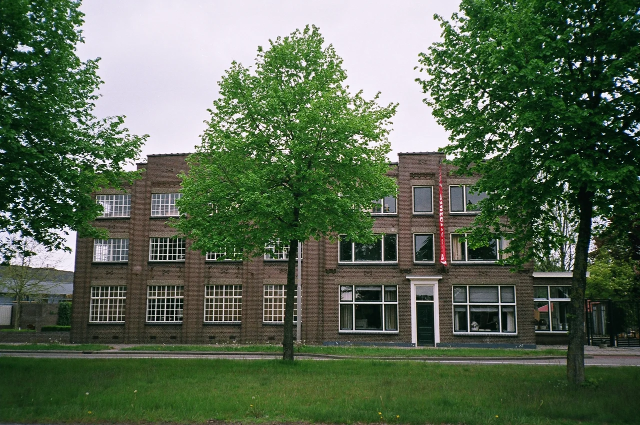
Union
In 1904, the Van den Berg brothers opened a small factory in Den Hulst making bicycles. They called it Union. Within a couple of decades it was the largest employer in the merged Nieuwleusen-Den Hulst area, with sidelines in building materials, lumber, and eventually mopeds. There was a marketing problem in those early years: nobody outside Overijssel had heard of Den Hulst. So Union printed Dedemsvaart on its publicity, the canal being more famous than the hamlet, with the result that customers and historians both sometimes attributed the factory to the wrong town. The original Union factory burned down in 1979 under circumstances that were never satisfactorily explained. The company limped through three more decades of mismanagement and labor conflict before going bankrupt in 2001 and being sold off in 2005. Another fire in 2009 finished most of what remained of the buildings.
When the Canal Disappeared
The Dedemsvaart did not die in a single moment. After the Second World War, lorries took the freight that had once moved by barge, and by the 1960s long stretches of the canal were being filled in and paved over for motorways. In 1969 the Den Hulst section was filled. The sand came from a piece of farmland just south of the old canal, which was scooped out in turn and left to fill with water. That hole is now Hulsterplas, a small lake that locals walk dogs around. Just to the west, in the neighboring hamlet of De Meele, a short stretch of the old canal is still open water, a fossil of the network it once belonged to.
Nieuwleusen-Noord
Officially, Den Hulst no longer exists as its own settlement. It is Nieuwleusen-noord, the north end of a village that absorbed it. The old Ommerdiek road that connected the two halves was renamed Burgemeester Backxlaan. Between the two halves, sports fields fill what used to be open farmland. The two centers still operate as semi-independent commercial nodes: a small Saturday market rotates between north and south every six months, and each end has its own retailers and its own habits. The name Den Hulst survives as it usually does in this part of the world, in street names like Hulstkampenweg and Hulsterpad, and in the retirement home de Hulstkampen, where the name outlasts the place.
From the Air
Coordinates 52.5917 N, 6.2853 E, in central Overijssel north of the Vecht valley. From altitude, Den Hulst reads as a thin built-up line along the N377 motorway, with the small round Hulsterplas lake immediately south of the road and the broad agricultural plain of Salland stretching in every direction. The A28 motorway crosses the N377 at De Lichtmis a few kilometers west, a useful navigation hinge. Lelystad Airport (EHLE) is 55 km southwest; Teuge (EHTE) is 45 km south. Best views in low afternoon light when the polder ditches catch the sun.
Nearby Stories
- H. J. Lovink Pumping Station 1.5 km away
- Urk 2.6 km away
- Coevorden 5.2 km away
- Olst-Wijhe 6.6 km away
- Heeg 6.7 km away
- Afrika Festival Hertme 8.7 km away
- Heerenveen 9.2 km away
- Zuidlaren 21 km away