Department of San Martín
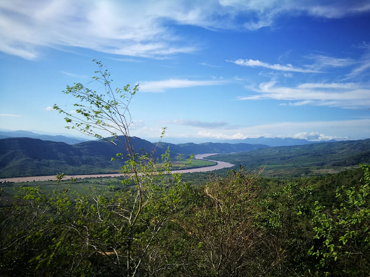
Most of the department lies under the canopy. San Martín is where Peru becomes Amazonia - the Andes shedding their eastern flank into cloud forest and then into lowland jungle that eventually feeds the great river itself. The Huallaga River does the work of drainage, winding north through stepped terraces and wide valleys before joining the Marañón on its way to the Amazon proper. On August 19, 1821, Moyobamba became the first Peruvian city to formally declare its independence from Spain. The city sits at the department's western edge, close to the Andean wall, while modern commercial weight has shifted east to Tarapoto, now the largest settlement. The department's name honors José de San Martín, the Argentine general who helped liberate Peru - another place on Peru's map carrying the handprint of 1821.
Four Landscapes in One Department
San Martín divides itself into four distinct zones that together cover just about every kind of terrain the Andes-Amazon transition produces. In the west, the eastern slope of the Andean plateau falls steeply in ravines and rough topography. Next, wide valleys open with stepped terraces along the Huallaga and its tributaries - the agricultural heart of the region, where cattle and farms have replaced forest. To the southwest, the Cordillera Azul descends with lower elevation, creating a dramatic canyon called Cajón de Sión and ending in the Cayumba rapids. Finally, a small patch of low-lying jungle floods easily when the rivers rise. Aircraft crossing this region see every transition visible at once: snow-capped Andean peaks to the west, green valleys in the middle distance, and unbroken forest to the east where the Huallaga becomes part of the Amazon system.
The Inca Reached Here
The conventional picture of the Inca Empire is mountain civilization. But the Inca Tupac Yupanqui pushed east into the montaña and absorbed Moyobamba - then known by its indigenous name, Muyupampa - into his dominion. In 1539, the Spaniard Alonso de Alvarado reached the Mayo River and founded Santiago de los Valles de Moyobamba, which eventually became the capital of Maynas province covering enormous stretches of what is now northeastern Peru. Between 1787 and 1790, a priest named Manuel Sobreviela accomplished something no Spaniard had managed: a full traverse of the Huallaga, documented in a map titled Planning for the course of the Huallaga and Ucayali Rivers and for the Pampa del Sacramento. Before modern roads, the rivers were the only way in or out. Missions, traders, and rubber tappers all followed the water.
The Monkey That Almost Wasn't
San Martín is home to the San Martín titi monkey, known locally as mono tocón, scientific name Callicebus oenanthe. The animal is endemic: it exists nowhere else on Earth. It is also, according to the IUCN, critically endangered - one of the most threatened primate species in Peru. Conservation International Peru maintains an office in Rioja and leads the Alto Mayo Protected Forest Conservation Initiative. The Alto Mayo forest is one of the last places where the titi hangs on, alongside the spectacled bear and several dozen endemic bird species. The pressures are familiar: deforestation for coffee, cattle, and coca over the last half-century has fragmented the small ranges these animals need. Whether the mono tocón survives depends on choices being made right now, in towns most travelers have never heard of.
Gran Pajatén, the Ruins You Cannot Visit
On the border with La Libertad, in the cloud forests above the Marañón and Huallaga, sits Gran Pajatén - a pre-Inca complex of circular slate buildings decorated with carved condors and human figures. Twenty-six circular structures cluster on terraces cut from a ridge. Access requires a multi-day trek through Río Abiseo National Park, and since the 1960s - when a government helicopter landing destroyed much of the protective vegetation - Peru's government has prohibited tourism to protect the fragile ruins. Most people learn about Gran Pajatén through photographs they will never duplicate, or descriptions by the handful of archaeologists who have permits to work there. The site is attributed to the Chachapoyas culture, whose territory extended into what is now Amazonas department. They built in stone high above the jungle, a society that chose elevation over rivers, mist over lowland heat. Gran Pajatén sits as they left it, slowly being reclaimed by the clouds.
Ten Provinces, One River System
The department is divided into ten provinces - Bellavista, El Dorado, Huallaga, Lamas, Mariscal Cáceres, Moyobamba, Picota, Rioja, San Martín, and Tocache - covering 78 districts in total. Lamas, a short drive from Tarapoto, preserves a Quechua Lamista cultural enclave descended from Chanka refugees who fled the Inca. Juanjuí, capital of Mariscal Cáceres, provides the jumping-off point for expeditions into Río Abiseo. Tarapoto itself has grown into a noisy, humid commercial hub - three-wheeled motokars darting between waterfalls and ayahuasca retreats, tourism pushing outward into places like the Lamas highlands and Laguna Azul. The highway that connects San Martín to the coast transformed the economy in recent decades. Before it arrived, the rivers were everything, and the Huallaga still remembers being the only road.
From the Air
Located at 7.20°S, 76.80°W in Peru's north-central region. Recommended viewing altitude 12,000-18,000 feet (3,700-5,500 m) for valley views, higher to clear Cordillera Azul. Tarapoto's Cadete FAP Guillermo del Castillo Paredes Airport (SPST) is the primary gateway; Moyobamba has a smaller regional field. Look for the Huallaga River snaking north through green valleys with the Andes rising to the west. Cloud cover is common over the eastern jungle - early morning offers the clearest views.
Nearby Stories
- Laguna de las Momias 39 km away
- Gran Pajatén 40 km away
- Pirca Pirca 47 km away
- Huamachuco 91 km away
- Moyobamba 93 km away
- Peruvian Amazonia 184 km away
- Pucallpa 222 km away
- Huallaga River 237 km away