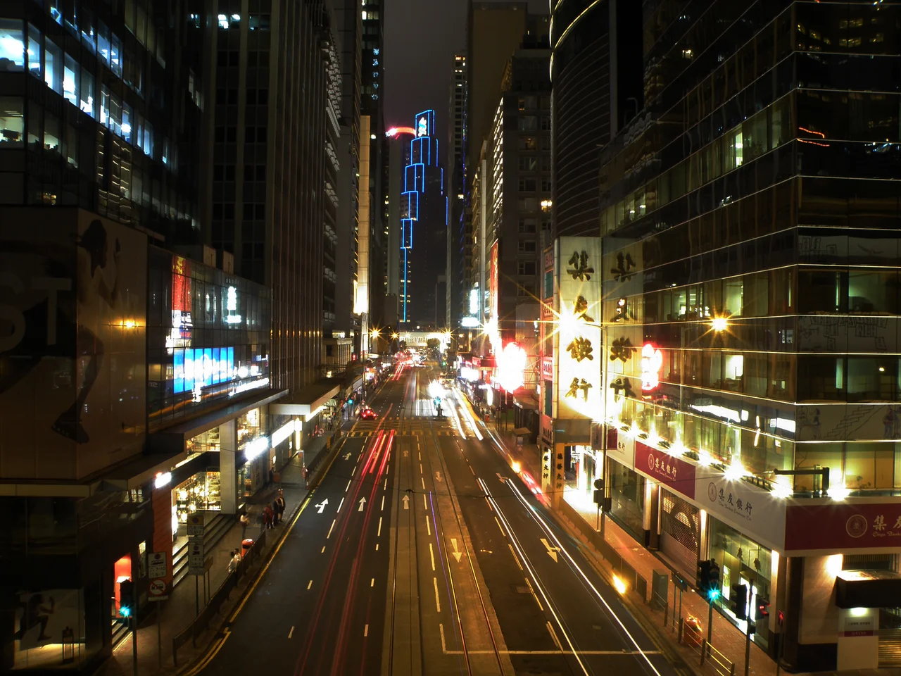

Des Voeux Road
The road runs along land that did not exist when the colony was founded. Des Voeux Road Central and Des Voeux Road West — their Chinese name, 德輔道, honouring the tenth Governor of Hong Kong, Sir William Des Voeux — occupy a strip of reclaimed shoreline on the north coast of Hong Kong Island, a surface that was harbour water as recently as the 1850s. The colonial government pushed the sea back in successive campaigns, first under Governor Bowring from 1857, then under Governor Des Voeux himself from 1887, creating the level ground on which Hong Kong's financial district now stands. The road was renamed from Bowring Praya to Des Voeux Road in 1904. For three years during the Second World War, the Japanese occupation renamed it Shōwa-dori. Now it carries trams, buses, and the footsteps of one of the world's most concentrated financial centres.
The Making of the Shore
Land reclamation is Hong Kong's defining infrastructure act, and Des Voeux Road is its oldest major product. Governor John Bowring initiated the Praya Reclamation Scheme in 1857, intending to expand the northern shoreline of Hong Kong Island westward from Central. British merchants holding land in the Central area opposed the plan, forcing the government to begin reclamation instead in the Chinese-populated Western District. By the time work extended to Central, a discontinuity had developed between the western and central portions of the new shoreline — a gap visible today in the break between Des Voeux Road West and Des Voeux Road Central, which do not connect directly. The tram line navigates this split by detouring along Morrison Street and Connaught Road rather than running straight through.
A Name Changed Twice
When the road was first completed, it carried the name Bowring Praya — the governor who ordered the reclamation memorialised in asphalt. In 1890, during the Duke of Connaught's visit to Hong Kong, then-Colonial Secretary and acting Governor Francis Fleming ordered the road renamed Des Voeux Road, honouring the governor under whom the second round of reclamation had been completed. The formal renaming came into effect in 1904, once the western extension was finished. Then, in 1942, Japan's occupation government renamed it Shōwa-dori — after the Shōwa period, the reign name of Emperor Hirohito. The name lasted until 1945. The colonial name was restored, and Des Voeux Road resumed its place in the city's address system. Names are fragile records of who held power when.
The Architecture of a Financial Artery
Walk Des Voeux Road Central today and the landmarks accumulate rapidly: the HSBC Building, the Bank of China Building at number 2A (which houses the China Club), Statue Square, Prince's Building, Alexandra House, The Landmark, Standard Chartered's headquarters, the restored Central Market, and Hang Seng Bank's headquarters at number 83. The road is shared between tram tracks — laid in the median, reserved for the Hong Kong Tramways — a bus lane, and motor traffic. Beneath it, the MTR Island Line runs underground, carrying passengers whose above-ground counterparts compete for space at street level. The Central–Mid-Levels escalator system begins at Des Voeux Road Central and climbs through Cochrane and Shelley Streets to Conduit Road in the Mid-Levels — one of the longest covered outdoor escalator systems in the world.
The Campaign to Give It Back to Walkers
Since 2000, planners and civic groups have argued that a stretch of Des Voeux Road Central should be pedestrianised. The Hong Kong Institute of Planners first proposed the idea as a transport improvement, and a 2014 study in collaboration with the MTR and traffic consultants MVA concluded the scheme was feasible. The proposal involves converting 1.4 kilometres between Pedder Street and Western Market into a pedestrian zone, with tram tracks remaining in place, cross-streets staying open to vehicles, and bus routes diverted to Connaught Road. On 25 September 2016, the 'Very DVRC' event temporarily closed the road to most traffic for a single day — a trial that demonstrated no significant harm to business or traffic flow. Walk DVRC Ltd, the NGO formed in January 2017 to advance the initiative, continues to press the case.
The Road That Crossed the Water
There was once a second Des Voeux Road, on the Kowloon side. It ran along the shore of Hung Hom Bay, carrying the same governor's name across the harbour. Extensive redevelopment erased it; the name no longer appears on any Kowloon street map. The disappearance of the Kowloon Des Voeux Road is a small but telling episode in Hong Kong's urban history — a reminder that even the most imposing colonial commemorations are subject to the city's appetite for renewal. On the island, Des Voeux Road Central persists, carrying its double legacy of reclamation and colonial naming through one of Asia's most contested and consequential commercial zones.
From the Air
Des Voeux Road runs along the northern shore of Hong Kong Island, centred at approximately 22.28°N, 114.16°E. Approaching from VHHH (Hong Kong International Airport, 22.31°N, 113.92°E) from the west, the road is part of the dense linear fabric of Central visible as a narrow strip between the hillside and Victoria Harbour. At 1,500 to 2,500 feet, the tram tracks in the median are distinguishable, and the HSBC Building's distinctive architecture is recognisable from above. Victoria Harbour to the north is one of the world's great natural anchorages; Kowloon lies across the water approximately 1.5 kilometres to the northeast.
Nearby Stories
- Lok Ma Chau Loop 2.3 km away
- Portas do Cerco 2.3 km away
- Kweilin Incident 17 km away
- Wanshan Archipelago Campaign 34 km away
- Nanxiong Formation 115 km away
- Battle of Nanpeng Island 148 km away
- Heyuan 169 km away
- Cape Maobitou 632 km away