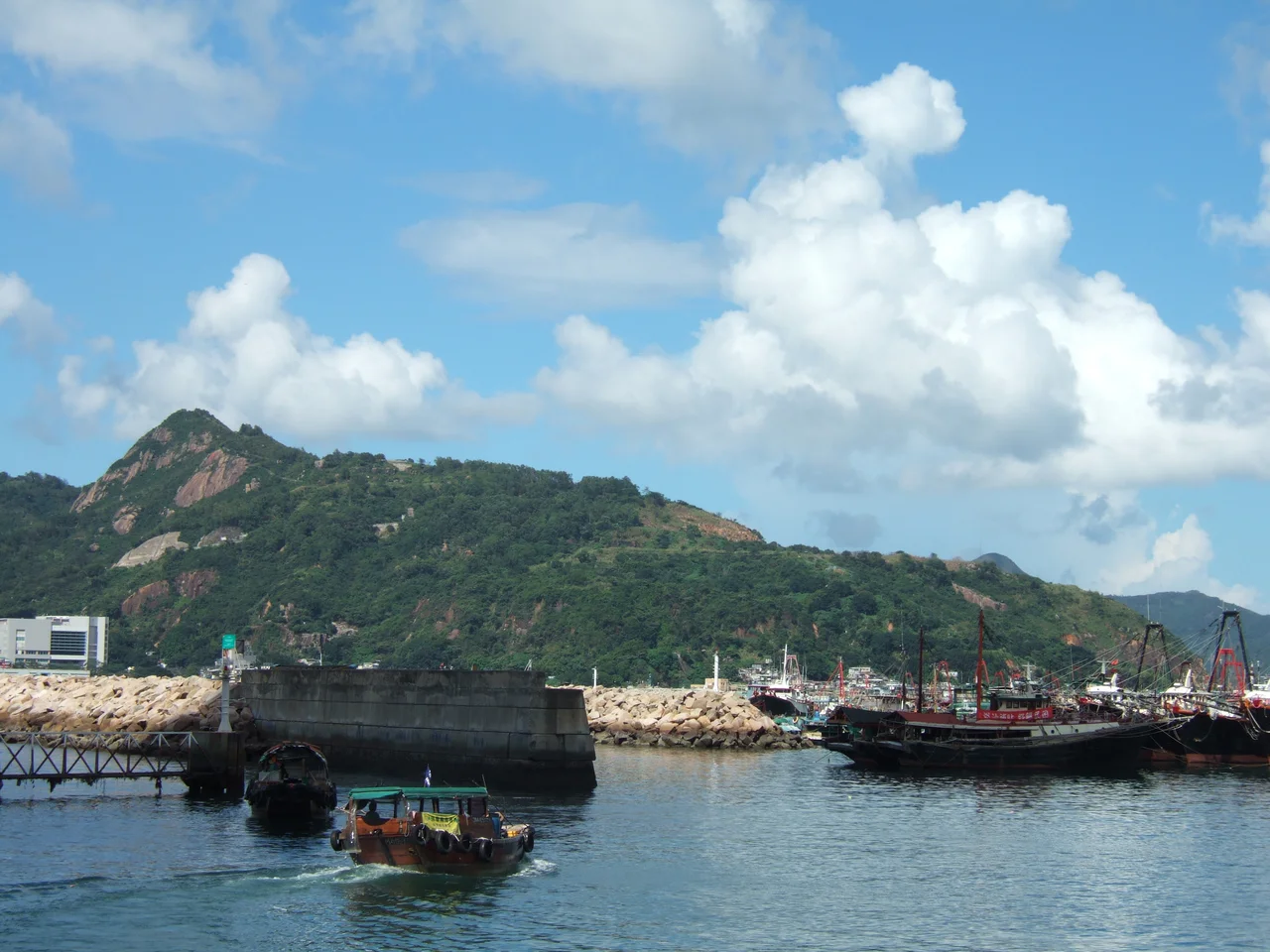

Devil's Peak, Hong Kong
Before the British Army arrived, pirates used this hill. The narrow Lei Yue Mun channel — barely 300 metres wide at its tightest, the eastern gateway to Victoria Harbour — was too valuable a choke point to leave uncontrolled. Whoever held the high ground above it could tax, threaten, or wreck any vessel attempting to pass. In the 19th century, the occupants were local pirates. After Britain leased the New Territories in 1898, they were soldiers. Devil's Peak, rising 222 metres above the communities of Tiu Keng Leng, Lei Yue Mun, and Yau Tong in Sai Kung District, became one of the most fortified positions in colonial Hong Kong — a layered system of gun batteries and a summit redoubt that took nearly two decades to complete and was designated a Grade II historic building in December 2009.
The Channel Worth Guarding
Lei Yue Mun is not a wide passage. Ships moving from the open waters east of Hong Kong toward the sheltered Victoria Harbour must thread through it, and from the peak above, every vessel is visible and within range. The British recognised this immediately after the New Territories lease in 1898. Control of the channel meant control of the eastern approach to the harbour — the same logic that had attracted pirates for generations. Devil's Peak faces the channel directly. On clear days, the view from the summit takes in both the Lei Yue Mun narrows below and the full breadth of Victoria Harbour stretching westward, with the high-rises of Kowloon and Hong Kong Island framing the water on either side.
Building the Fortress
Construction of the military installations on Devil's Peak began in 1898 and continued until 1914. The work produced four distinct clusters of structures, each positioned at a different elevation to cover different firing arcs and approach angles. At the summit, at 222 metres, stands the Devil's Peak Redoubt, completed in 1914. Below it at 196 metres is a smaller defensive site. Gough Battery, named for Hugh Gough, 1st Viscount Gough — former Commander-in-Chief of British Forces in China — occupied the upper slopes at 160 metres. It was built in 1898 with two 6-inch guns, one later replaced by a 9.2-inch gun; the armaments were removed in 1936 to Stanley Fort. Pottinger Battery, named for Governor Sir Henry Pottinger, sat lower on the hillside at 81 metres, also equipped with 9.2-inch guns, its armaments relocated in 1936 to Bokhara Battery at Cape D'Aguilar.
The Soldiers Who Held the Hill
During the Second World War, Devil's Peak was manned largely by Indian Army troops and Hong Kong garrison forces. The 5th/7th Rajput Regiment and the 1st Mountain Battery of the Hong Kong Singapore Battalion of the Royal Artillery were among the units stationed here. These soldiers found themselves defending a position that had been designed for naval gunnery against an approach from the sea — not for the kind of land assault that came during the Battle of Hong Kong in December 1941. The Japanese advance, which came from the north through the New Territories and down through Kowloon, outflanked the defensive logic that had guided the original construction. The batteries fell. The guns were gone by 1936 anyway, relocated to other positions.
What Remains on the Summit
The walls of the redoubt and batteries are still standing. Time, vegetation, and the attentions of visitors have worn the structures, and there have been reports of illegal cultivation within the unallocated government land that surrounds them, but the main fabric endures. Section 3 of the Wilson Trail, one of Hong Kong's longest hiking routes, passes through the foot of Devil's Peak, making the hill accessible from both Tiu Keng Leng and Yau Tong via cemetery roads. The Junk Bay Chinese Permanent Cemetery lies to the east; the urban density of Yau Tong presses against the western slope. Between them, the old fortifications sit in a kind of suspended neglect — officially listed, quietly deteriorating, waiting for a more determined conservation effort.
The Hill Between Two Worlds
Devil's Peak occupies an unusual position in Hong Kong's landscape. It stands between the densely developed Kowloon urban mass to the west and the relatively open coastline of Sai Kung to the east, close enough to the city to be reachable by MTR yet high enough to feel removed from it. Its ridge runs north to Chiu Keng Wan Shan and south to the water at Lei Yue Mun. The Grade II historic building designation places it in a conservation framework, but the structures remain on unallocated government land under Lands Department jurisdiction — an administrative limbo that has complicated more active heritage management. The view from the summit, at least, is unchanged: the same channel, the same harbour, the same logic that drew soldiers and pirates to this ground long before either of them.
From the Air
Devil's Peak stands at 22.29°N, 114.24°E in Sai Kung District, at the eastern entrance to Victoria Harbour. Approaching from VHHH (Hong Kong International Airport, 22.31°N, 113.92°E), fly east along the northern coast of Hong Kong Island and over Kowloon before turning south toward Lei Yue Mun. At 1,500 to 2,500 feet, the Lei Yue Mun channel narrows dramatically between Devil's Peak to the east and Shau Kei Wan to the west — the chokepoint that defined the peak's strategic value is visible. The remains of the summit redoubt and gun battery terraces are recognisable on the ridgeline on clear days. Victoria Harbour spreads westward; open Tathong Channel opens to the east.
Nearby Stories
- Lok Ma Chau Loop 2.3 km away
- Portas do Cerco 2.3 km away
- Kweilin Incident 17 km away
- Wanshan Archipelago Campaign 34 km away
- Nanxiong Formation 115 km away
- Battle of Nanpeng Island 148 km away
- Heyuan 169 km away
- Cape Maobitou 632 km away