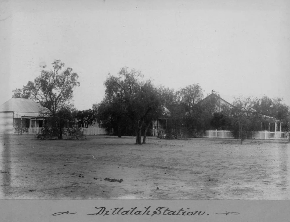

Dillalah
The name comes from a bird at a waterhole. In the local Aboriginal language, dillalah means galah - the pink-and-grey parrot that gathers in noisy flocks across inland Australia - and the name was taken from a waterhole on the Warrego River where the country was first stocked. From that small, specific origin grew one of the great pastoral runs of southwest Queensland: a station that at its peak sprawled across more than a thousand square miles, changed hands again and again as fortunes rose and collapsed, and outlasted a procession of owners whose names survive now mostly in the auction notices of long-dead newspapers.
Stocking the Warrego
Dillalah lies on the western side of the Warrego River, roughly 54 kilometres southwest of Charleville and about 138 kilometres north of Cunnamulla, cut through by the Nimminmulla Creek and its chain of permanent waterholes. That water was the making of it. By 1864 the run was held by W. G. Conn and carried 500 head of cattle, grazing open plains clothed in mulga, saltbush, bluebush, cottonbush and the silvery tussocks of Mitchell grass. In a land of unreliable rain, the permanent waterholes were the difference between a viable run and worthless ground - and Dillalah had them, which is why, again and again, it found a buyer.
A Run That Kept Changing Hands
Few properties illustrate the restless economics of frontier grazing better than Dillalah. In 1869 it belonged to Russell and Company, who offered it for sale with 2,100 head of cattle. By 1873 it was on the market once more, paired with neighbouring Yarronvale Station; together the two runs covered 500 square miles, divided into thirteen blocks and carrying 2,500 cattle, with a house, kitchen, store and stockyards among the improvements. Just three years later, in 1876, Dillalah alone had swelled to 810 square miles, stocked with 4,200 cattle and 45 horses. When it sold at auction in 1877 it fetched £32,000 including stock - a substantial sum for the era - though the buyer's name was never made public.
From Cattle to Sheep
By the late 1870s and 1880s the run was larger still and under new management. Frederick Walters was running it in 1878, and he stayed on as manager when the Dillalah Company took ownership in 1883, by which time the property had reached around 1,000 square miles. That same year the Morgan brothers acquired it and soon introduced sheep alongside the cattle - a common shift across the outback as graziers chased the wool that was making other fortunes. Each change of hands rewrote the run's boundaries and its livestock, a reminder that a pastoral lease was never a fixed thing but a living, tradeable enterprise, expanding and contracting with the markets and the seasons.
A Name From the River
It is easy to overlook how much the land here speaks an older language. Long before W. G. Conn stocked his first cattle, the waterholes of the Warrego carried Aboriginal names, and Dillalah is one of them - the word for galah in the local tongue, fixed to a particular bend of river where the birds came to water. The naming is a small thing, but it carries weight: the pastoral history that fills the record books, with its sales and stock numbers and pound notes, is laid over a much deeper relationship with this country. The galahs still gather along the Warrego in their pink-breasted thousands, indifferent to leases and auctions, doing what they have done at this waterhole far longer than any station has had a name.
Resumed, and Rained On
In 1916 the Queensland government stepped in, resuming the homestead portion of the run - a total of 24,000 acres carrying 3,100 cattle - as part of the era's drive to break up the big leases for closer settlement. The state paid £13,000, with another £10,000 earmarked for future improvements. The land, much reduced, carried on as working country. Its most memorable modern chapter came in 2010, when 200 millimetres of rain fell over just two days and the Balonne, Warrego and Paroo rivers all ran in full flood at once. The owner, Brock Hindmarsh, looked forward to a rare good season - the boom side of the boom-and-bust cycle that has governed Dillalah since the first cattle drank at its waterhole.
From the Air
Dillalah Station occupies the plains west of the Warrego River in southwest Queensland, near 26.87°S, 146.07°E, about 54 km southwest of Charleville and some 138 km north of Cunnamulla. From the air it is classic outback grazing country - flat, red, and clothed in grey-green mulga and pale grasslands - with the Warrego River and the Nimminmulla Creek showing as darker, timbered lines threaded with waterholes, the most reliable landmarks in an otherwise featureless plain. After heavy rain the watercourses and floodouts stand out vividly, as they did in the great floods of 2010. Charleville Airport (YBCV), a significant regional hub to the northeast, is the practical base for the area, with Cunnamulla Airport (YCMU) well to the south. The country is best appreciated in low morning or evening sun, which reveals the subtle relief of the plains and the pattern of the creeks. Expect clear, stable air in the dry season, strong daytime thermals and dust over open ground, and isolated heavy storms during the summer wet.
Nearby Stories
- Langlo River 2.9 km away
- Bowra Sanctuary 20 km away
- Cooladdi 20 km away
- Koroit opal field 61 km away
- Yapunyah waterhole 170 km away
- Carnarvon Gorge 231 km away
- Hornet Bank Massacre 303 km away
- Warialda 475 km away