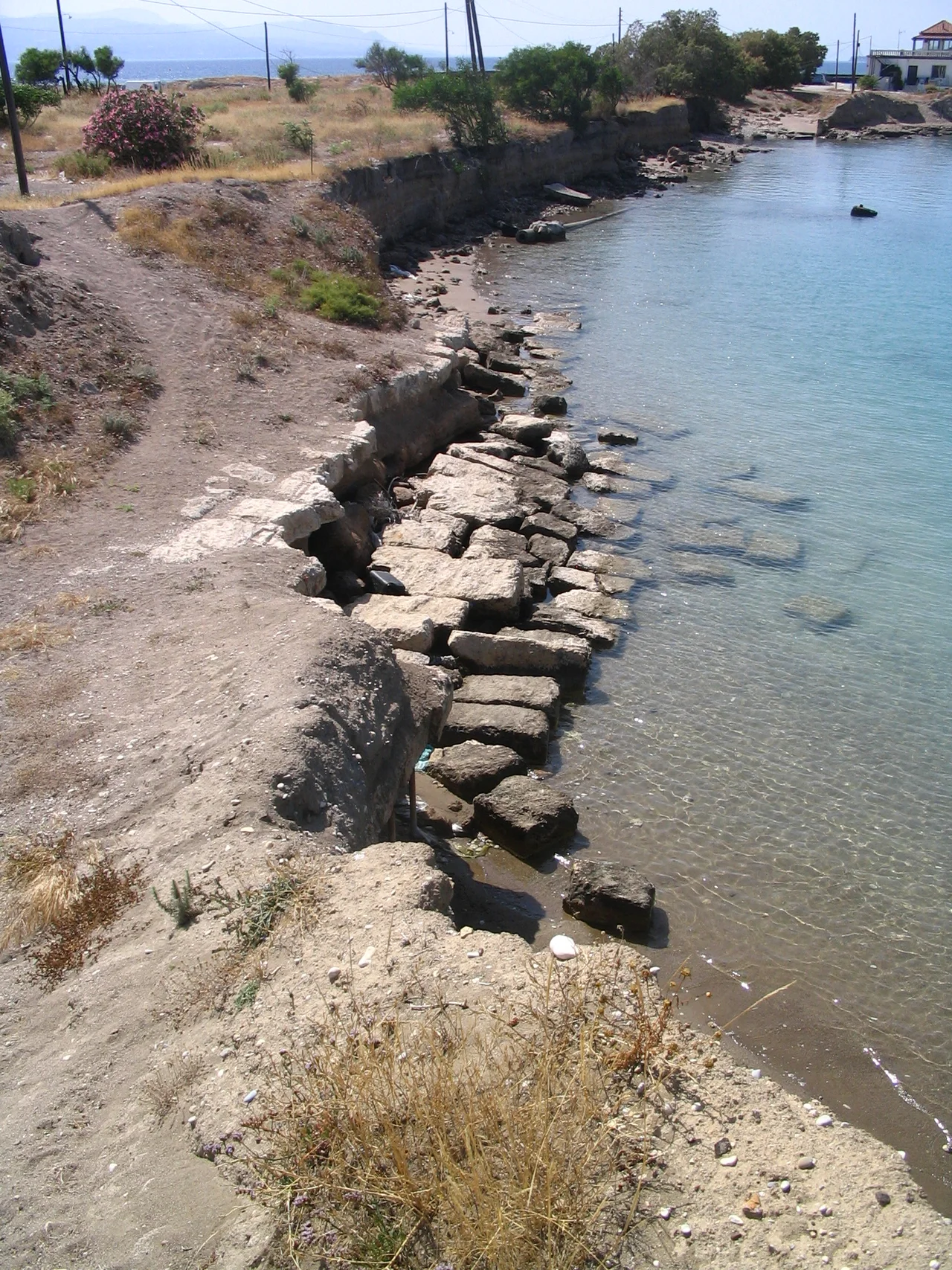

Diolkos
Aristophanes made it a punchline. The phrase "as fast as a Corinthian," the Athenian comic playwright wrote, was already a byword for speed — and what made Corinthians fast was the Diolkos, the paved trackway across the narrow neck of the Isthmus that let ships bypass the entire Peloponnese peninsula without going to sea. The idea seems almost absurd until you consider the alternative: sailing around Cape Malea, the treacherous southern tip of Greece, where storms and contrary winds claimed ships and cargoes alike. Against that, hauling a vessel overland on a limestone road — even a vessel weighing dozens of tons, pulled by teams of men and animals — made a certain hard Greek economic sense.
The Road That Moved Ships
The word Diolkos derives from the Greek: dia, meaning "across," and holkos, meaning "portage machine" or "hauling device." Built sometime around the end of the 7th or beginning of the 6th century BC — roughly when Periander was tyrant of Corinth — it was a purpose-built limestone road, 3.4 to 6 meters wide, paved in hard stone with grooves worn by the wheels of the trolleys that carried vessels across. The Isthmus at its narrowest is 6.4 kilometers wide, and the trackway crossed it at a point where the ridge rises to about 79 meters, with an average gradient of roughly 1.43% — gentle enough to be manageable with sufficient manpower. Its total length is estimated at somewhere between 6 and 8 kilometers, depending on how many bends the route took. About 1,100 meters of it has been archaeologically traced, mostly at the western end near the Gulf of Corinth.
How You Move a Warship Overland
Moving a ship across the Isthmus was not subtle work. A trireme — a Greek warship about 35 meters long, with a beam of 5 meters and a weight of around 25 tons dry — was presumably placed on a wheeled trolley and pulled by teams of men with ropes, tackles, and possibly capstans. To prevent the hull from sagging under its own weight, thick ropes called hypozomata ran from bow to stern, keeping the vessel stiff. Calculations suggest that hauling a water-soaked trireme and its trolley — perhaps 38 tons combined — up the ridge required between 112 and 180 men, exerting somewhere between 33 and 42 kilonewtons of force. At an estimated speed of 2 kilometers per hour over 6 kilometers, sea-to-sea transfer would have taken about three hours. Smaller vessels made the crossing more regularly; the trireme, for all its military utility, was probably at the edge of what was practical.
War and Commerce on the Trackway
The Diolkos served both peace and war. In peacetime it carried merchant ships, marble, monoliths, and timber between the two coasts, giving Corinth a cut of everything that crossed. In wartime it became a strategic shortcut that could tip the balance of entire campaigns. In 428 BC, Sparta planned to haul warships over the Isthmus to threaten Athens directly. In 411 BC, during the Peloponnesian War, a squadron was carted across for rapid operations at Chios. In 220 BC, Demetrius of Pharos dragged about fifty vessels across. Philip V of Macedon sent 38 ships the same way a few years later. Most dramatically, after his victory at the Battle of Actium in 31 BC, Octavian — soon to be Augustus — ordered part of his fleet of 260 Liburnian warships carried across the Isthmus in his haste to pursue Marc Antony. In 868 AD, the Byzantine admiral Niketas Oryphas hauled an entire fleet of one hundred warships across the neck of land in a single swift operation.
What Remains
The Diolkos remained in regular service until at least the mid-1st century AD, after which ancient sources fall silent. Nero's abortive canal-digging project in 67 AD may have disrupted or destroyed portions of it. For centuries it was forgotten, its stones buried under centuries of sediment. Remains were probably first identified by the German archaeologist Habbo Gerhard Lolling in the 1883 Baedeker travel guide. Serious excavation began in the 1950s, tracing a nearly continuous stretch of 800 meters and in total about 1,100 meters. Today, the western end of the Diolkos lies near the Corinth Canal — not the canal that ancient engineers dreamed of, but the one finally cut in the 1890s. Ship traffic on that canal has caused ongoing erosion to the ancient trackway. Restoration work in October 2024 shored up the canal bank and created a footpath alongside the exposed stone, which opened to visitors in 2025. Standing beside those worn limestone grooves, you can still see where wheels rolled and ropes pulled, where commerce and war moved, two seas at a time.
From the Air
The Diolkos lies at approximately 37.95°N, 22.96°E, at the western end of the Isthmus of Corinth near the modern Corinth Canal. From altitude, the canal is unmistakable — a perfectly straight cut through the narrowest part of the Isthmus, connecting the Gulf of Corinth (northwest) and the Saronic Gulf (southeast). The Diolkos trackway ran parallel to the canal's western approach. Recommended viewing altitude: 2,000–4,000 feet for the full isthmus geography; lower passes reveal the canal walls and the small section of exposed ancient trackway near the western end. Nearest major airport: LGAV (Athens International Eleftherios Venizelos), approximately 75 km east-northeast. The surrounding terrain is low and flat near the isthmus; the Acrocorinth rock is visible to the southwest on clear days.
Nearby Stories
- Stymfalia 3 km away
- Sanctuary of Asclepius, Epidaurus 4.6 km away
- German Submarine U-133 (1941) 5.9 km away
- Battle of the Trench (1821) 6.7 km away
- 1981 Gulf of Corinth Earthquakes 12 km away
- Aigeira 13 km away
- Agios Thomas, Boeotia 14 km away
- Agios Georgios (island) 36 km away