
Droop Mountain Battlefield State Park
John D. Sutton was a teenager carrying a rifle when he climbed Droop Mountain on November 6, 1863. Sixty-five years later, he was a member of the West Virginia House of Delegates, gray-haired and patient, lobbying his colleagues to preserve the ground where his regiment had fought. He got his wish. On the Fourth of July 1928, Droop Mountain Battlefield was dedicated as the first state park in West Virginia - a piece of land set aside because one old soldier refused to let his war fade into pasture and second-growth.
The Park's Origin
Sutton had served as a private in a West Virginia Union regiment that fought on this mountain in 1863. The battle was the largest fought entirely inside the borders of the new state, and the Union victory effectively ended Confederate efforts to retake the Greenbrier Valley. After the war Sutton went home, raised a family, and eventually went into politics. By the 1920s, when battlefield preservation was beginning to gather momentum nationally, he saw his chance. The state legislature agreed to acquire the mountaintop. The dedication ceremony drew what the Pocahontas Times described as a 'big crowd' on Independence Day 1928 - veterans of the battle, in their eighties now, walked the ground they had attacked or defended six and a half decades earlier.
The CCC Years
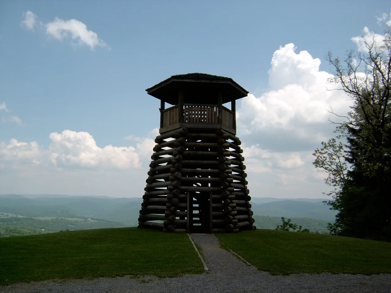
The newly dedicated park was a few signs and a fence until the Civilian Conservation Corps arrived during the Great Depression. CCC workers built the lookout tower, the picnic shelters, the museum building, and the trail system that visitors still use. The architecture is unmistakably CCC: peeled-log frames, stone foundations laid up dry, a kind of mountain rustic that the Roosevelt administration spread across thousands of parks in the 1930s. The work was done by young men who needed paychecks and meals more than they needed history lessons, but the result was the physical infrastructure that turned a battlefield into a place where ordinary families could come for a Sunday afternoon.
What You See
The summit lookout tower offers a panorama of the Greenbrier Valley, mountains folding into mountains all the way to the Virginia line. The Droop Mountain Museum holds battle artifacts - rifles, belt buckles, fragments of shell, a hand-drawn map or two. Confederate graves are marked along the original line. A reconstructed log cabin sits near the parking area. The earthworks the Virginians threw up on the morning of the battle are still visible if you know what to look for - low mossy ridges in the woods, where men crouched to fire and waited for the attack they could hear but not yet see. The West Virginia Reenactors Association stages public battle reenactments here in October of some even-numbered years, with reproduction muskets and uniforms that probably itch in November the way the originals did.
Getting There
Droop Mountain Battlefield sits on US-219 about 25 miles north of Lewisburg and 15 miles south of Marlinton. Two other state parks are nearby: Beartown, with its strange labyrinth of weathered sandstone passages, and Watoga, the largest state park in West Virginia. The combination makes this corner of Pocahontas County a natural three-day trip for visitors who want history, geology, and forest in roughly equal measure. The park is open year-round, but the road across the summit is one of those mountain roads that can close in winter when the snow gets serious. Check before you go in January.
Why It Matters
Most Civil War battlefields are preserved because of the importance of the battle. Droop Mountain is preserved because of the persistence of one veteran. The fight here was not Gettysburg or Antietam; it never appears in the standard surveys of the war except as a footnote. But that is precisely the point. There were hundreds of small battles in this war, fought in places like this mountain, by men whose names are not in any textbook. Most of those battlefields are now subdivisions or shopping centers. This one is a state park because John D. Sutton lived long enough to push for it, and because West Virginia, in 1928, decided that even a small piece of its history was worth keeping. The National Register agreed in 1970. The trees keep growing back. The breastworks are still there.
From the Air
Located at 38.11 degrees N, 80.27 degrees W in Pocahontas County, West Virginia. Droop Mountain rises to 3,100 feet MSL above the Greenbrier Valley. The park sits on US-219 about 25 nm north of Lewisburg. Greenbrier Valley Airport (KLWB) is the nearest tower-controlled field. Marlinton Airport (KMRT) is about 15 nm north. Recommended viewing altitude 5,500 to 7,500 feet MSL. Expect mountain wave activity with westerly winds; the long parallel ridges of the Allegheny Plateau dominate the view to the east and west.
Nearby Stories
- Warm Springs Pools 2.1 km away
- The Greenbrier 2.2 km away
- Appalachian String Band Music Festival 11 km away
- Battle of Camp Allegheny 19 km away
- Webster Sycamore 22 km away
- Clay, West Virginia 25 km away
- Botetourt County, Virginia 27 km away
- Beckley, West Virginia 29 km away