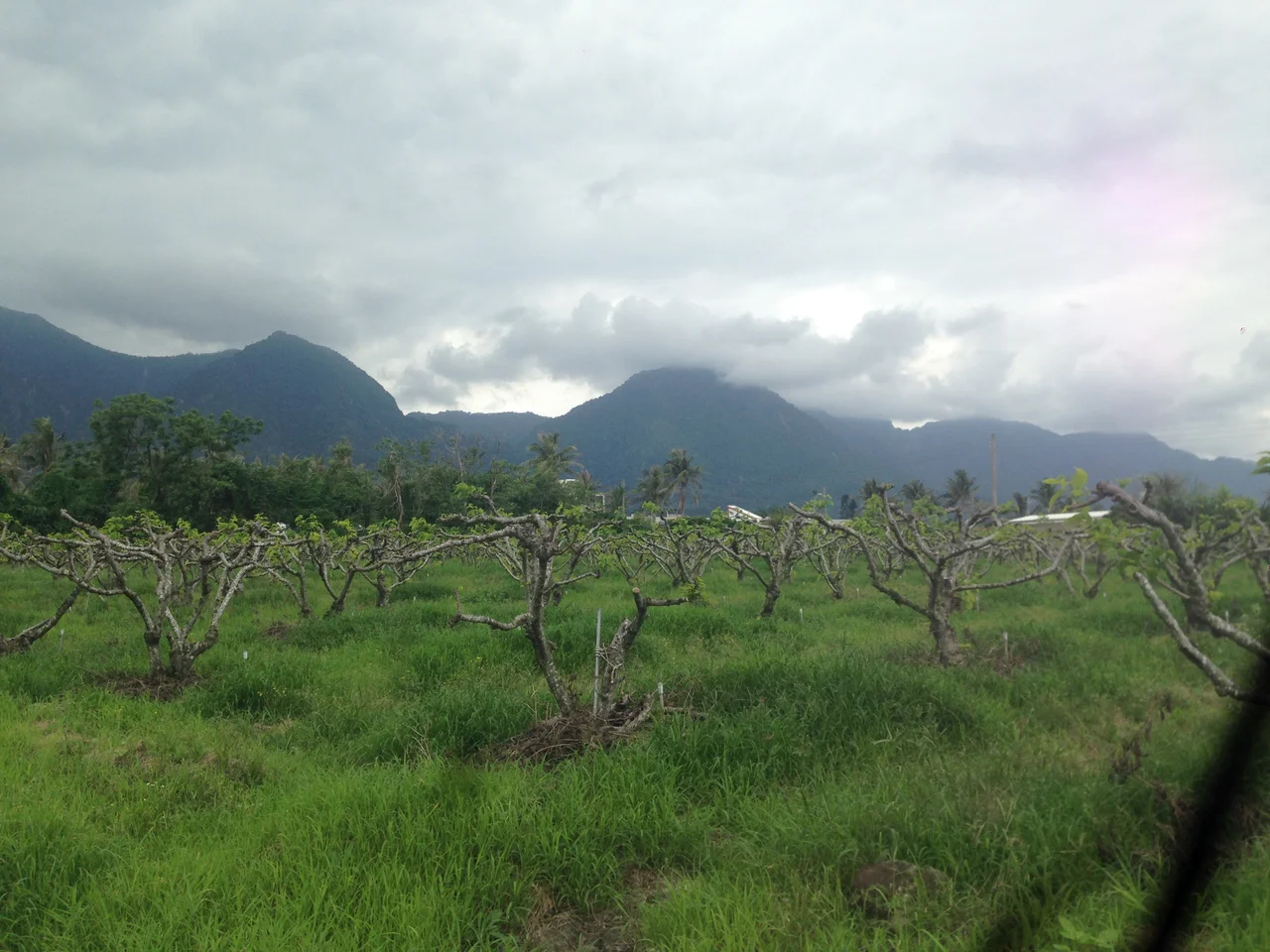

Dulan, Taiwan
The name has been carrying meaning for at least 3,500 years. Long before tourists arrived with surfboards, long before the sugar mill was built and later converted into an art venue, the Amis people knew this place as A'tolan — which translates as either "pile of stones" or "frequent earthquakes," depending on the telling. Both interpretations fit. The stones are here, in a 3,000-year-old archaeological site on the hillside. And the earth does shake, as it tends to do along Taiwan's active eastern coast. Dulan is one of those places where the present is merely the most recent layer of a very long story.
A'tolan: The Birthplace
Oral records and scholarly research together place the Amis people at Dulan — then called Gegalasan — as far back as 1500 BC. The village is considered the birthplace of the Amis, Taiwan's largest indigenous group, and the community has maintained its identity through every wave of outside influence. Japanese colonial administrators renamed the settlement "Tudor" during their rule over Taiwan, but the name Dulan was restored in 1937. The Amis who remained through these decades of renaming continued to practice their customs, their language, and their seasonal ceremonies. Today, even as Han Chinese residents have moved in alongside the growing tourist economy, the Dulan tribe actively preserves Amis traditions — the dances, the music, the relationship with the land and the sea that their ancestors carried down through those 3,500 years.
Between Mountain and Ocean
Squeeze a village between the Pacific and a forested mountain, and you get Dulan's geography: a narrow coastal strip where the surf rolls in from open water and the slopes of Dulan Mountain rise sharply behind the rooftops. The village sits within Dulan National Forest, giving it a lush green backdrop that deepens the sense of enclosure — a valley opening only to the sea. That opening to the Pacific is the reason surfers began finding their way here, drawn by consistent waves and a relaxed pace that the more developed resort towns of the coast had traded away. Dulan Bay and the rocky promontory of Dulan Nose are landmarks that anyone who has stood on the beach can pick out easily, framing the view that local Amis families have known since childhood.
Where the Sugar Mill Became a Stage
Sintung Sugar Factory Culture Park — a converted sugar mill on the edge of town — is the physical center of Dulan's art scene. The old machinery and industrial buildings have been repurposed as galleries, performance spaces, and workshop venues where artists working in indigenous traditions display their work alongside contemporary forms. Art fairs and live music nights happen regularly, and the park has become a meeting point between the Amis artistic tradition and the broader creative community that has settled in Dulan over the past two decades. The phrase the source article uses — "varied art forms of the First Taiwanese" — reflects a deliberate reclamation of visibility: Amis weavers, carvers, and musicians presenting their work on their own terms, in their own village.
Water Flowing Uphill and Other Wonders
Dulan has a quirky side too. One of the area's notable attractions is called Water Flowing Up — a roadside optical illusion where water in a shallow channel appears to run uphill, a trick of the surrounding terrain that has been fooling eyes for years. It is the kind of small delight that gives a place personality beyond its headline attractions. Dulan Bay offers swimming and snorkeling in calmer seasons, while the surf at the main beach draws a small but dedicated community of local and visiting riders. The Dulan archaeological site, just a short walk from the village center, lets you move from a three-thousand-year-old stone coffin to a bowl of Amis-style food in the space of an hour. This compression of timescales — ancient, colonial, contemporary — is what Dulan does particularly well.
Living With the Name
There is a footnote worth including. The Mandarin rendering of Dulan's name — 都蘭, pronounced Dōulán — is easily confused by outsiders with 都爛 (dōulàn), a colloquial slang term meaning "crappy." The village has learned to live with this. Local residents treat it as a small joke at the expense of anyone who mispronounces their home, and it has not slowed the steady arrival of visitors who come for the surf, the culture, and a pace of life that feels genuinely different from Taiwan's western corridor cities. The Amis name A'tolan carries no such ambiguity. In the language of the people who named this place, it describes exactly what is here: stones and earthquakes, and the community that has endured both.
From the Air
Dulan sits at approximately 22.874°N, 121.228°E on Taiwan's southeast coast, in Donghe Township, Taitung County. The village occupies a narrow coastal strip between the Pacific Ocean to the east and Dulan Mountain to the west. Taitung Airport (RCFN) lies about 28 kilometers to the southwest, accessible via Provincial Highway 11 along the coast. Flying northward from RCFN at 1,500 to 2,000 feet on a clear day, the coastal plain narrows dramatically as Dulan Mountain pushes toward the water — Dulan village is the settlement at that pinch point. Dulan Nose, a rocky headland, marks the southern limit of the village's beach; Dulan Bay curves northward from there.
Nearby Stories
- Liudui Hakka Cultural Park 3.3 km away
- 2025 Tainan–Chiayi Earthquake 3.4 km away
- Meinong Hakka Culture Museum 4.3 km away
- Chiaming Lake 13 km away
- Taimali 13 km away
- 1951 East Rift Valley Earthquakes 78 km away
- 2021 Hualien Train Derailment 142 km away
- Mavulis Island 176 km away