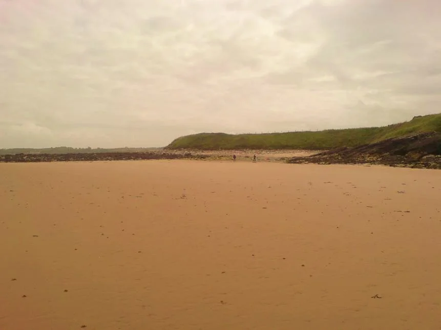

Dulas Bay
In 1821, a wealthy local man named James Hughes built a curious round stone tower with a cone-shaped roof on a small island a mile and a half off the east coast of Anglesey. Ynys Dulas - Seal Island, as the locals know it - had no fresh water, no shelter, and was too small for any permanent human use. Hughes' tower had only one purpose: to store food and provide shelter for shipwrecked sailors stranded by storms before help could arrive. The tower still stands. Seals still haul out on the rocks at its base. Two centuries on, ships still wreck themselves on the Anglesey coast occasionally - and Hughes' small Victorian act of kindness remains one of the most touching pieces of maritime architecture on the island.
Three Beaches, Three Names
Dulas Bay is small, and its geography is divided. The largest beach is Traeth Dulas, a sand-shingle-mud estuary where the Afon Goch - the Red River, named for the iron-rich water flowing down from Parys Mountain - meets the sea. Southeast of that, separated by a rocky outcrop called Craig y Sais ('Saxon Rock'), is the tiny Traeth Bach ('Small Beach'). Beyond that lies the sandy Traeth yr Ora, whose name translates roughly as 'Beach of the Fortified Landing Place' - a name that hints at much older defensive use of the coast. At low tide all three connect and you can walk between them; at high tide each is its own pocket. The estuary at the inland end has formed salt marshes that draw waders and wildfowl all year round.
Owain Gwynedd's Sea Battle
Welsh oral tradition holds that in 1134, three years before he became King of Gwynedd, Owain ap Gruffydd - Owain Gwynedd - defeated a combined force of Irish, Manx and Norse raiders near Llangwyllog in the centre of Anglesey. The Welsh fleet then turned on the raiders' ships, which had been left moored offshore, and captured every last one of them in and around Dulas Bay. It is a story that has been passed down for nine centuries, and like many oral histories from medieval Wales, sits somewhere between fact and folk memory. What is certainly true is that the bay has been used as a defensive landing for at least that long; the place-name Traeth yr Ora preserves the same idea in Welsh.
The Manor That Was, the Boat-Setters Who Came
Just inland is the village of Llysdulas - 'Dulas Court' - where the manor house Llys Dulas once stood. The land was held in antiquity by a Welsh family later called Llwyd, and passed through marriage to the Neave baronets and the Hughes family. When ownership passed to the Boston barony, the mansion was allowed to fall into disuse, and today only a few stone fragments of its chapel remain. The bay has a long history of wrecks - including, according to local tradition, the arrival around 1745 of the family that became Anglesey's famous Pen y Bryn 'bone setters,' a dynasty of orthopaedic healers whose skills, modern DNA studies suggest, may have come ashore as shipwreck survivors and stayed. The beach called Porto Bello on the bay's north side may itself be named after another wreck.
What the Air Sees
From above, Dulas Bay is a complex coastal handful: estuary, beach, offshore islands, manor ruins, salt marsh, all in a small space. About 1.5 km of shelf-like seabed less than 5 metres deep extends beyond Garreg Allan, the smallest offshore island, before dropping abruptly to deeper water - geology suggesting that Ynys Dulas may once have been part of a submerged headland or tombolo. A concrete observation post from the Second World War still sits on the cliffs above Traeth yr Ora, where lookouts watched for German aircraft and U-boats. Oil tankers idle offshore, waiting for the tide to enter the Mersey for discharge at Tranmere. Just south rises Mynydd Bodafon, the highest point on the Anglesey mainland at 178 metres - low by Welsh standards, but the highest viewpoint on an island whose horizons are otherwise mostly sea.
From the Air
Dulas Bay at 53.38°N, 4.27°W, on the northeast coast of Anglesey, between Llaneilian and Moelfre. From the air the bay is a small triangular estuary with three connected sandy beaches and three offshore islands (Ynys Dulas, Garreg Allan, Ynys y Carcharorion) lying 1-1.5 nm offshore. The Red River (Afon Goch) brings copper-tinted water down from Parys Mountain into the estuary, giving the inland mud-flats a distinctive rust colour. Nearest airports: Anglesey/Valley (EGOV) 18 nm west, Caernarfon (EGCK) 17 nm south-southwest. Mynydd Bodafon, the highest point on mainland Anglesey at 178m, rises 2.5 nm southwest of the bay.
Nearby Stories
- Llandudno Lifeboat Station 3.8 km away
- Glynllifon 6.1 km away
- German submarine U-1024 9.4 km away
- Irish Sea Bridge 11 km away
- Ysbyty Ifan 12 km away
- Irish Sea 18 km away
- Celtic Array 18 km away
- Birkdale Palace Hotel 56 km away