Eems Canal
In June 1879, the Swedish barque Israel slipped into Groningen's Oosterhaven, having sailed direct from South America. For a moment, the city's merchants could believe the dream they had been sold: that a freshly dug canal to the sea had restored Groningen to its old place among the trading ports of northern Europe. The shipping ledgers told a quieter story. Of the 165 foreign vessels that reached Groningen's harbor that year, most carried Baltic grain and Scandinavian timber - useful, profitable, but a long way from the global wholesale trade the canal's boosters had promised. Down at Delfzijl on the Ems estuary, the new sea lock saw nearly three times as many ships. The Eems Canal had worked. It just had not worked the way Groningen wanted.
Water Where There Should Not Be
Long before anyone dreamed of seagoing ships in Groningen, the canal solved a different problem: water that refused to leave. Through the early 1800s, peat cutters in eastern Groningen and northeast Drenthe stripped centuries-old bogs down to firmer ground. The drained peatlands could no longer hold winter rains the way the spongy peat once had. Excess water poured into the Reitdiep, a tidal channel that backed up at high water and had no locks to control it. Cancelled plans piled atop cancelled plans. By 1851, when the Provincial Council finally heard a serious proposal for a new sea port at Delfzijl linked by canal to Groningen, the argument was as much about hydraulics as commerce. The canal would carry barges, yes, but it would also flush the province's waterlogged interior into the Ems, on the schedule of engineers rather than tides.
A Decade in the Mud
Construction began with the lock, not the ditch. In July 1867, a ceremonial first stone went into the chamber being dug at Delfzijl - bridges and lock works had to exist before the long cut between them could fill with water. The contract for the canal itself did not go out for tender until June 1870. H. Schram de Jong of Sliedrecht won it with a bid of 1,148,500 guilders, slightly under the engineers' estimate. The estimate proved meaningless. Shipping technology was changing faster than the planners. Designs were revised upward to take larger vessels. The ground fought back. In late November 1874, Schram de Jong walked away, and the province had to finish the work itself. When the canal finally opened on 15 September 1876, the final bill came to 3,387,526 guilders and 80 cents - nearly triple the original tender, and the worst overrun of the entire 1856 waterway plan.
Fifteen Bridges, Fifteen Problems
What boats found when they reached the new canal was an obstacle course. Fifteen swing bridges, prosaically numbered Draaibrug No. 1 through 15, crossed the 26-kilometer cut. Each one was narrow enough that captains had to thread their hulls through with care. Collisions were frequent. The drainage function the canal had been built to perform created another hazard: when the sluices ran hard, currents in the canal grew strong enough that only steam tugboats could push upstream against them, and the water level at Delfzijl could drop noticeably while the province pumped its meadows dry. By 1899, when the Germans opened the rival Dortmund-Ems Canal to the south, the Groningen Chamber of Commerce commissioned a study of their own waterway and concluded what every coaster captain already knew. The Eems Canal was too small, too crowded with bridges, and too compromised by its second job.
The Coaster's Canal
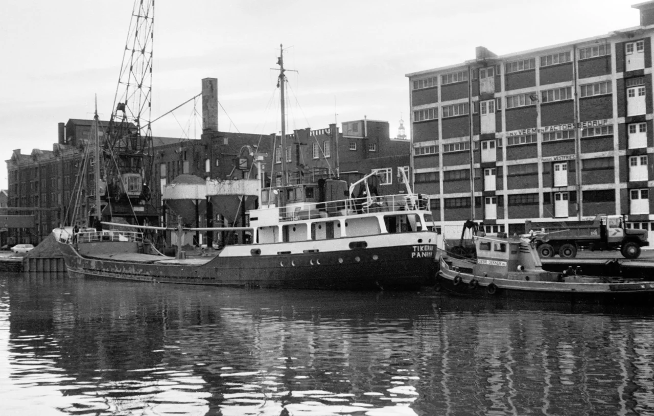
What saved the Eems Canal was a kind of ship that did not exist when it was dug. By 1938, the smoky steam vessels of the early 20th century had been almost entirely displaced by coasters - small, efficient motor ships designed for short-sea trade. They fit the canal almost perfectly. After the war, in 1953, the province approved a major upgrade aimed at the next size up: vessels of 1,500 gross register tons, with a new Farmsum Sea Lock at Delfzijl 16 meters wide. The lock opened in April 1959. The full canal upgrade, when the Minister of Infrastructure and Water Management Joop Bakker cut the ribbon on 27 June 1967, had cost 55 million guilders and reduced those fifteen swing bridges to just three. Among the most striking visitors on the rebuilt waterway were Russian Sormovskiy ships hauling cars straight from the Volga factory town of Tolyatti, a thread of Soviet industry tied to a Dutch provincial canal.
What Endures
By the late 1980s, the Eems Canal had lost most of what was left of its role as Groningen's gateway to the sea. The municipal port was privatized. Containerization came to inland shipping at the same moment that coasters were drifting away, and in 1995 a container terminal opened at Hunze Port to catch the new traffic. Today the canal forms a 26.4-kilometer link in the Lemmer-Delfzijl Waterway, the spine that connects Rotterdam and Amsterdam to Friesland, Groningen, and northern Germany. Ownership passed to the Dutch state in 2014. Inland barges glide between Groningen and the Ems. The shipyards of eastern Groningen still use the canal to launch new sea-going hulls toward salt water. On warm afternoons, kayakers and small pleasure craft work their way past the Borg Bridge near Ruischerwaard, where the polders open out and the water carries a different kind of cargo: people, time, and the long quiet of a Dutch summer.
From the Air
Located at 53.28 degrees North, 6.76 degrees East, the Eems Canal runs roughly east-northeast from Groningen city to the Ems estuary at Delfzijl - a 26.4-kilometer straight cut clearly visible from cruising altitude as a thin dark line through flat green polderland. Recommended viewing altitude 3,000 to 5,000 feet for landscape context, lower for following the canal itself. The nearest civil airport is Groningen Airport Eelde (ICAO EHGG), about 15 km south of the canal's western terminus. Bremen (EDDW) lies roughly 100 km east across the German border. Visibility is typically excellent over the North Sea coast, though sea fog can roll in over Delfzijl in spring and autumn. Look for the Farmsum Sea Lock on the Ems side and the cluster of harbor cranes at Hunze Port on the Groningen end.
Nearby Stories
- Zoutkamp 2.1 km away
- Papenburg 2.4 km away
- Sandwater 3.1 km away
- Dornum 4.7 km away
- Veenkoloniën 6.9 km away
- Schule am Meer 9.9 km away
- Gorredijk 20 km away
- Gemini Wind Farm 53 km away