Zoutkamp
Drive into Zoutkamp from the south and the village still looks like what it used to be: a fishing port at the edge of the world, cottages tight along the harbor, boats nodding at their moorings, a bench by the water carved with the local wisdom that 'a lie here, a lie there — don't say anything, it's all true.' The catch is that there is no longer any sea. In 1969, the Netherlands closed off the Lauwerszee with a dam, turning Zoutkamp's salt-water inlet into a freshwater lake overnight and stranding the village a few kilometers inland from the new working harbor at Lauwersoog. The fishermen could have given up. They didn't.
Salt and Sconce
The first written mention of Zoutkamp comes from 1418, as Soltcampum — literally 'salt field,' a hint that the earliest inhabitants may have been working a salt-production site on this raw stretch of Groningen coast. By the late 16th century, the place had a more aggressive purpose. The Dutch Revolt had split the northern Netherlands: the city of Groningen sided with Spain, while most of the surrounding Ommelanden countryside and the province of Friesland threw in with the Dutch Republic. In 1576, the Spanish built a sconce — a small earthwork fortification — at Zoutkamp to control the water route. Thirteen years later, in 1589, Republican forces under William Louis of Nassau took it back. The fortifications stayed in military use for nearly three centuries before being demolished in 1882, when Zoutkamp finally stopped being a strategic chokepoint and settled fully into life as a fishing village.
The Sea That Left
For most of the next century, Zoutkamp lived off the Lauwerszee, a tidal inlet of the Wadden Sea that opened the village directly onto productive fishing grounds. Then came 1969. After devastating floods in 1953 had killed nearly 2,000 Dutch citizens, the Netherlands committed to closing off vulnerable inlets along the northern coast. The Lauwerszee dam went in. The salt water became the freshwater Lauwersmeer. A new fishing harbor was built outside the dam at Lauwersoog, and the boats followed. The province wanted Zoutkamp's old harbor turned over to recreation — they were building the giant Eemshaven to the east as the region's commercial port. Zoutkamp and Friesland fought back. In January 1970 the dispute landed in the Dutch parliament. Lauwersoog won as the working harbor. But the fishermen made their own quiet protest that has held for half a century.
ZK, Not LO
Dutch fishing boats carry registration codes on their hulls that mark the port they come from. The boats that work out of Lauwersoog should, in any tidy bureaucratic reckoning, be marked LO. Many of them aren't. They still carry the letters ZK — Zoutkamp — even when they sail from a harbor that didn't exist before 1969. It's a small refusal, but in a fishing village it means everything. The men who go out from Lauwersoog every morning live in Zoutkamp. Their fathers fished from Zoutkamp. Their grandfathers fished from Zoutkamp. The dam moved the water, not the village. The economy here still runs on fish: the smokehouses, the small processors, the daily rhythm of the fleet. Until 2008, Zoutkamp also hosted a more secret kind of harbor — a ground station of the Dutch National SIGINT Organisatie, eavesdropping on satellite traffic from this quiet corner of Groningen until the operation was shut down.
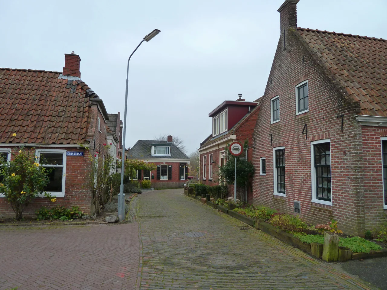
The Liars' Bench
Walk the Reitdiepskade today and you'll find the small things that make Zoutkamp feel different from a museum village. The old fishing houses on Vissersstraat still face the harbor at the angle they always did. The Alde Tsjerke, the old church, stands at the center of the village. There's an ice cream parlor for tourists in summer, and on the quay sits the Leugenbank — the liars' bench — where retired fishermen sat to swap stories that may or may not have been true. The bench's plaque settles the question with characteristic Groningen dryness: a lie here, a lie there, don't say anything, it's all true. Zoutkamp joined the new municipality of Het Hogeland in 2019. The fishing fleet still leaves before dawn. The village still has a lively center, still has shops worth walking to, still does not feel like it is on the way to anywhere else — which is exactly why people who find it tend to come back.
From the Air
Located at 53.34°N, 6.30°E in Het Hogeland municipality, Groningen province, at the southern edge of the Lauwersmeer. Recommended viewing altitude FL050-FL090 to take in the whole inlet system: Zoutkamp's old harbor, the Lauwersmeer freshwater lake (former Lauwerszee), and the working fishing port at Lauwersoog on the dam. Nearest airports: Groningen Eelde (EHGG) to the south-southeast. The Wadden Sea opens out beyond the dam to the north.
Nearby Stories
- Eems Canal 9.6 km away
- Gorredijk 11 km away
- Súdwest-Fryslân 11 km away
- Liauckamastate 17 km away
- Veenkoloniën 18 km away
- Schule am Meer 20 km away
- HVDC DolWin1 46 km away
- West Sole Gas Field 295 km away