_(27422902643).jpg)
Eightercua
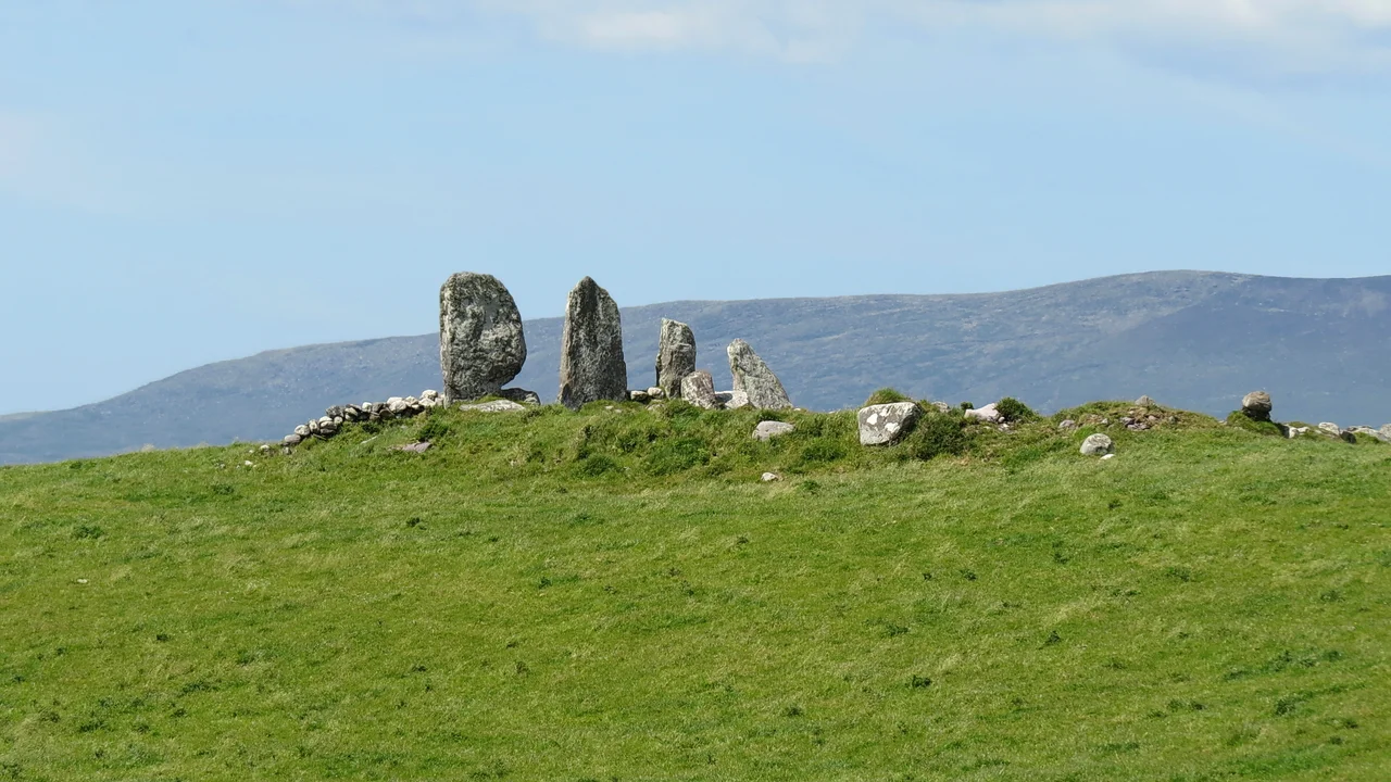
Four stones stand in a Kerry field, the tallest reaching ten feet, the row stretching twenty-five feet from one end to the other. They have stood here for roughly 3,700 years - longer than most of Europe's cathedrals have been ruins, longer than written Irish has existed as a language. The alignment runs east to west, which means whoever set these slabs in the ground was watching the sun. They were also, if you believe the tradition that has clung to this place for centuries, marking the grave of a woman who drowned before she could see the land her people had come to conquer.
Setting the Stones
Eightercua sits 1.5 kilometres south-south-east of Waterville, near the western edge of the Iveragh Peninsula where Ireland runs out of land. The four slabs rise from 1.8 to 3 metres, deliberately graded, deliberately aligned. From the southernmost stone a slab runs out at a right angle and disappears into a low oval cairn, about a metre high. Archaeologists think this might be the remains of a tomb chamber or cist - a stone box for the dead, buried under the cairn's heaped weight. Around the alignment are traces of an old enclosure and other fragmentary stones. Whatever this place was, it was not just four stones in a field. It was a complex, a destination, a stage set into the landscape.
The Queen Who Never Arrived
Irish tradition gives Eightercua a name: Scéine, wife of Amergin Glúingel, the poet and bard of the Milesians. The Milesians were the mythological people who, according to medieval Irish texts, sailed from Iberia to conquer the island and displace the Tuatha Dé Danann. Their landing point was Inbhear Scéine - the estuary of Scéine - which most scholars identify with the Kenmare River just south of here. Scéine herself drowned during the voyage. The tradition says her husband buried her at this spot above the bay, marking the place with stones that would outlast him by millennia. It is a story, not a fact, and the alignment is roughly a thousand years older than the Milesian myth would require. But tradition does not always care for chronology. The stones remain. So does the name.
What the Sun Knows
The east-west orientation is the most concrete clue Eightercua offers. Bronze Age people in Ireland built dozens of stone rows like this one, and they almost always picked an astronomical line - solstice sunrise, equinox sunset, lunar standstill. The exact target at Eightercua is still debated, but the principle is clear. Standing where the builders stood, watching the sun roll up out of the east on a particular morning of the year, would have given the alignment its meaning. Cattle grazed past it for thousands of years. Farmers worked around it. Modern cars now pass within a few hundred metres on the Ring of Kerry. The stones still mark their line.
The Field Today
Eightercua is not on most tourist itineraries. There is no visitor centre, no signage to speak of, just a farm track and a gate and a field with stones in it. Sheep work around them. The wind off Ballinskelligs Bay scours the grass and makes the lichens on the stones glow grey-green. From the alignment you can see Lough Currane to the north and the slow rise of the hills inland. It is the kind of monument that Ireland is generous with - the kind a country gets when its prehistoric people built in stone and its modern people, mostly, left them alone. You stand among the four slabs and feel the simple fact of their persistence.
From the Air
Eightercua sits at 51.815°N, 10.158°W, on a low rise between Waterville and Lough Currane. From the air the stones themselves are too small to spot, but the alignment lies in pastureland just inland from Ballinskelligs Bay, with the long finger of Lough Currane visible to the north. Approach altitude 1,500-2,500 ft AGL for terrain identification; the nearest aerodrome is Kerry Airport (EIKY) about 50 nm north-east, with Cork Airport (EICK) some 70 nm east. Weather along the Iveragh coast turns quickly - Atlantic systems push in from the west, so check Valentia Observatory's reports before low-level work in this area.
Nearby Stories
- Farranfore–Valentia Harbour line 3.3 km away
- Heir Island 4.1 km away
- Inishvickillane 4.4 km away
- Kealkill stone circle 8.7 km away
- Headford Ambush 10 km away
- Dunlough Castle 13 km away
- SM U-68 27 km away
- Sao Miguel 1923 km away