
Elizabeth Fort
In 1603, the people of Cork demolished their own fort. They had watched George Carew's soldiers build it two years earlier, naming it for Queen Elizabeth I and aiming its cannons inward at the city as much as outward at any besieger. When the Queen died and the throne passed to James I, the city seized its moment and pulled the walls down with their own hands. The triumph was short. Lord Mountjoy retook Cork within months, and the fort was rebuilt on the same hill. It has been a Tudor garrison, a Cromwellian stronghold, a women's prison, an artillery base, an emergency air-raid shelter, and a Garda station. As of 2014, for the first time in over four hundred years, it is simply a place anyone can walk into.
Why the hill mattered
Cork in 1601 was already old - a walled medieval merchant town crammed onto a marshy island in the River Lee. For centuries the city's defences had been built on the assumption that attackers would come from the river. Shandon Castle and the city walls were enough against arrows and ladders. But artillery changed the geometry of war. A cannon dragged onto one of the hills overlooking Cork could lob shot down into the streets, and no medieval wall would stop it. Sir George Carew, Lord President of Munster during the bitter end of the Nine Years' War, understood the problem. He chose the hill south of the city, above what is now Barrack Street, and ordered a star fort built there - the polygonal, angled, geometrically modern fortification that European engineers had developed to absorb and deflect cannon fire. The hill no longer threatened Cork. It now defended it - or controlled it, depending on which side of the walls you stood.
What the fort became
After the 1690 siege of Cork - the same bombardment that smashed the medieval St Fin Barre's church and shot a 24-pound cannonball through its walls - the city's defensive value declined and the fort drifted into other uses. By 1719 it was a barracks. In 1817 the army moved out and a prison moved in. From 1822 the population was almost entirely female: women awaiting transportation to Australia were held inside the star-shaped walls until 1837. The convict depot closed. The Cork City Artillery took over later in the nineteenth century. A fire gutted the interior at some point and was rebuilt in the 1920s. Then the Garda Siochana - the police of the new Irish state - moved in and stayed until 2013. For 412 years, civilians could not freely walk through the gates. Generations of Corkonians grew up looking at the embankment from below and never seeing the inside.
The handover
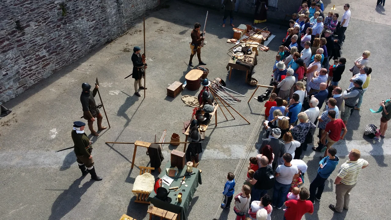
When the Garda station closed in 2013 the buildings passed to Cork City Council, which spent a year preparing the site for public access. In September 2014 the walls opened, six days a week, free of charge. About 36,000 visitors came in the first year. The grounds now host the Cork Midsummer Festival, Heritage Open Day, Culture Night, and the Saint Patrick's and Fin Barre's festivals. Reenactors in seventeenth-century uniforms drill on the parade ground where prisoners once exercised. Plans for an interpretive centre have moved slowly - funding was diverted to the Shandon area in 2016 - but the simple act of being allowed inside has been transformative. A site that was off-limits during the lives of every Corkonian now living has become an outdoor room of the city.
A church beneath the bastions
Long before Carew's engineers laid out their bastions, this ground was sacred. The early construction of 1601 cut into an existing medieval church - dating, by the documentary record, to at least 1199 when it appears in the records as St Mary del Nard, and again in 1311 as Holy Cross del Nard. John Speed's beautiful 1610 map of Cork labels it Holy Roe. The Hiberno-Norman parish church is gone now, its stones presumably scavenged for the fort's interior buildings. What remains is the layering: an early medieval Christian site overlaid with a Tudor military complex, overlaid with a Georgian barracks, overlaid with a Victorian artillery station, overlaid with a twentieth-century police station, overlaid with a twenty-first-century park. Stand on the rampart at sunset and look out over the spires of St Fin Barre's directly to the north. The two structures have been arguing across the marsh for the entire history of modern Cork.
From the Air
Elizabeth Fort sits at 51.8945 N, 8.4780 W on a rise immediately south of the River Lee's south channel, about 400 m south of the city centre and 500 m east of St Fin Barre's Cathedral. The star-shaped earthwork is best identified from the air by its angular bastions, an unusual geometric silhouette in the otherwise organic street grid. Cork Airport (EICK) is 6 km south; the airport's primary 17/35 runway brings traffic on final approach almost directly over central Cork at lower altitudes. Recommended viewing 1,500-3,000 ft AGL. The fort, the cathedral spires, and the bend of the Lee form one of the most photogenic urban combinations in southern Ireland.
Nearby Stories
- Ballyvourney 1.6 km away
- Castlemartyr 3.9 km away
- Ballybeg Priory 4.1 km away
- Kilbrittain 5.2 km away
- Shanbally Castle 10 km away
- Skibbereen 17 km away
- Castleisland 22 km away
- SM U-27 118 km away