Eritrea-Sudan Border
The border does not look like much from the ground. Near Teseney it is a dirt road, a customs shack, a white-painted stone. Farther north it is pure desert, an imaginary line between two empty landscapes. Yet 686 kilometers of boundary between Eritrea and Sudan have shaped the lives of millions of people - wartime invaders, independence fighters, refugees, and the nomadic pastoralists who never cared about lines at all. The border tells the whole 20th-century story of the Horn of Africa in one thin seam.
Drawn by the Scramble
Europeans drew this line. The Berlin Conference of 1884 laid the ground rules for the Scramble for Africa, and in the decades that followed, Italy and Britain mapped the boundaries of their colonial holdings in the Red Sea region. Italy purchased Assab Bay through a shipping company in 1869, took Massawa in 1885, and pushed inland until it proclaimed the Colony of Eritrea in 1890. Britain meanwhile consolidated Anglo-Egyptian Sudan. The line between them ran from the Red Sea at Ras Kasar in the north, through the town of Kerora where buildings now straddle two countries, down through hilly terrain to a tripoint with Ethiopia on the Tekeze River near Humera. Italian Eritrea's eastern border with Sudan would matter because Sudan was the Nile, and the Nile was Egypt, and Egypt was Suez, and Suez was the shortest route to India.
The Kassala Invasion
On 4 July 1940, with France newly fallen and Britain reeling, Italian forces streamed west across the Eritrean-Sudanese border and attacked the railway junction at Kassala. The British garrison - Sudan Defence Force troops and local police, vastly outnumbered - withdrew after taking significant casualties. For months, Italian East Africa threatened to expand all the way to the Nile. Then in 1941, Allied forces launched an invasion in the opposite direction. British and Commonwealth troops, many of them Indian and African soldiers, pushed east from Sudan into Eritrea, through the mountain passes of Keren, and kept going until Italian East Africa collapsed. The border had been crossed twice in less than a year, in opposite directions, by two different empires. The people who lived along it carried on.
A Thirty-Year Independence War
When Eritrea was federated with Ethiopia in 1952 and then annexed outright in 1962, the border with Sudan became a lifeline for the Eritrean independence movement. The Eritrean Liberation Front was founded in 1961, the Eritrean People's Liberation Front split from it in 1970, and for three decades fighters moved back and forth across Sudanese territory. Refugees came the other way: hundreds of thousands of Eritrean civilians fleeing Ethiopian bombing and famine settled in camps around Kassala and farther south. Between 1961 and 1991, this border was less a boundary and more a breathing membrane - porous, dangerous, essential. In 1991, the Eritrean People's Liberation Front defeated Ethiopian forces and declared independence. A 1993 referendum confirmed the choice with 98.5 percent approval. Ethiopia became landlocked. Eritrea became Africa's newest nation, until South Sudan claimed that title in 2011.
Closed, Reopened, Closed Again
The post-independence period has been anything but calm. Eritrea broke relations with Sudan in 1994 and supported the Sudan People's Liberation Army. In January 2018, Sudan closed the border after a surge of illegal crossings and human trafficking - a crisis that had been building for years as Eritreans fled forced military service and dictatorship. Sudan reopened crossings in 2019 after its own political upheaval. Then came the Tigray War. Between 2020 and 2022, more than 114,000 refugees crossed into eastern Sudan, most of them settling in Kassala and Gedaref states. By 2023, Sudan hosted nearly 130,000 Eritreans. On 7 May 2023, The Guardian reported that the Eritrean government had forcibly deported over 3,500 Eritreans and Sudanese-Eritreans from Kassala back across the border; more than 100 were detained on arrival. The reasons people fled had not changed, so they fled again.
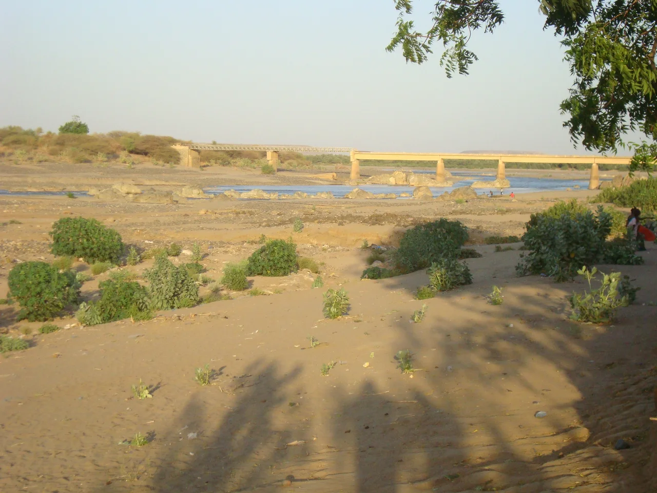
Rivers, Dust, and Mangroves
Follow the border today and the landscape speaks first. From the Red Sea coast at Ras Kasar, the line heads inland across desert where rainfall is rare and temperatures in summer approach 45 degrees Celsius. Around Teseney, the land greens briefly each rainy season. The Tekeze River - called Setit in Eritrea and Atbara in Sudan - marks part of the Ethiopian frontier near Humera, a small town where three countries meet. Administratively, the border separates Eritrea's Anseba, Gash-Barka, and Semenawi-Keyih-Bahri regions from Sudan's Kassala and Red Sea states. The maritime extension runs out into the Red Sea until it meets Saudi Arabia's waters. For most people who live along it, the line has always been negotiable. Nomadic Beja herders cross for water. Traders cross for market prices. Refugees cross for their lives. The line endures; the reasons to cross keep changing.
From the Air
The Eritrea-Sudan border runs roughly from 18.05°N, 38.60°E at Ras Kasar on the Red Sea south to 14.26°N, 36.56°E at the tripoint with Ethiopia. Nearest airports: Asmara International (ICAO: HHAS) for Eritrea and Kassala Airport (ICAO: HSKA) for Sudan. From cruising altitude, the northern section appears as featureless sand-and-gravel desert; the southern section shows the green thread of the Tekeze/Setit/Atbara river and the darker agricultural patchwork around Teseney. The Gash River delta is visible during rainy seasons. Expect heavy haboob dust July through September; clear visibility November through March.
Nearby Stories
- Western Zone, Tigray 36 km away
- El-Gadarif 52 km away
- Welkait 78 km away
- Kassala 96 km away
- Gash-Barka Region 97 km away
- Al Qadarif State 113 km away
- Northern front, East Africa, 1940 132 km away
- Abushneib 309 km away