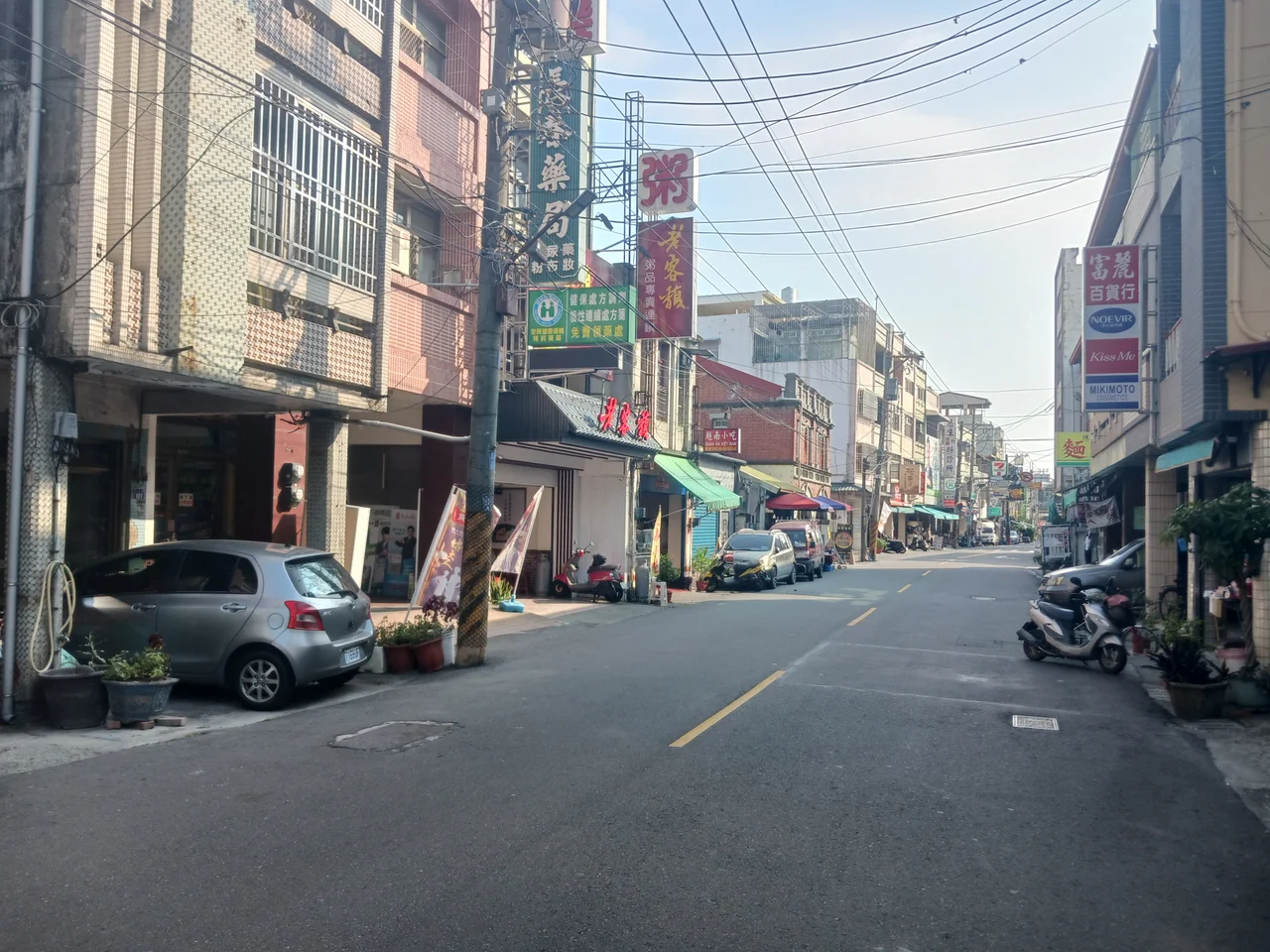

Ershui
The name says everything about what mattered here: Ershui, "Two Waters." The two Babao canals that give the township its name were not engineering footnotes — they were the reason anyone settled in this corner of Changhua County in the first place. Drawn from the Zhuoshui River and directed in a fan-shaped network across the Changhua Plain, the canals turned dry foothills into farmland. People called them the "Mother Rivers of Changhua." That reputation for water-fed abundance has defined Ershui since the first settlers came up from the coast in the seventeenth century, and it still shapes the landscape today: flat, green, crossed by irrigation channels, and tucked against the foot of the Bagua Mountain Range.
Written in Water
The first documented inhabitants arrived at Ershui in 1621, during the Ming dynasty — migrants from Fujian province who came ashore at Lukang, then pushed inland to the Bagua foothills. They were a small group, roughly 300 people, and they farmed using spring water drawn from the mountains above. The real transformation came when the Babao canals were built during the Qing dynasty period. Canal Number 1 opened the territory dramatically. The population jumped to around 1,700 people, some 300 households, and farms spread outward along both banks. Where water went, settlement followed. The canals fanned out through the county in a pattern still visible from above — an agricultural delta without a river, sustained entirely by engineered channels that the people of Changhua have tended for generations. Ershui sits at the point where that system begins.
From Frontier to Station Town
Japanese administration, which began in 1895, renamed the township Nisui Village. In 1918, the formal railway station opened — TRA Nisui Station — and the line connecting the coastal plain to the interior suddenly made Ershui a commercial node. Businesses lined the kilometer of street leading from the station entrance. The transformation accelerated in 1932 when a pineapple canning plant was established, turning what had been primarily a farming township into an industrial one. At its peak, Nisui was described as the most prosperous town in the Zhuoshui River region. Taiwan's return to the Republic of China in 1945 brought another renaming: the Japanese-era Nisui became Ershui Township, reclaiming the original reference to the two canals. The station, still running on Taiwan Railway's Western Line, remains the gravitational center of the community — most of the township's 14,000 residents live near the plaza in front of it.
Mountain Edges and Open Trails
The Bagua Mountain Range defines Ershui's eastern horizon. These aren't dramatic peaks — the Bagua plateau is a gentle ridge rather than an alpine wall — but it gives the township a clear boundary between the flat agricultural plain and the forested interior. Ershui is known for the biking and hiking trails that climb into the Bagua range, and visitors who come by train find themselves immediately at the edge of two landscapes: the orderly farmland spreading west toward the coast, and the quieter paths leading east into the hills. The Zhuoshui River, which feeds the canals, runs along the county line to the south. On a clear morning, before agricultural haze builds over the plain, the combination of green fields, canal glints, and the forested ridge behind gives Ershui a particular tranquility that its modest size would not otherwise suggest.
People of the Place
Ershui produced two notable figures who found their way to the highest levels of Taiwanese government. Hsieh Tung-min served as Vice President of the Republic of China from 1978 to 1984. Timothy Yang served as Secretary-General of the Presidential Office from 2012 to 2015. That a township of 14,000 people generated two figures of national prominence across very different political eras is not something Ershui makes great ceremony of — it sits quietly in the agricultural lowlands, tending its canals and its pineapple fields, a place whose significance in Taiwan's water history far exceeds what its size implies. The population has held relatively steady in recent decades, a sign of an community that has found its equilibrium between the railway, the mountains, and the two old rivers that gave it a name.
From the Air
Ershui Township sits at 23.817°N, 120.617°E at the southeastern edge of Changhua County, where the Changhua Plain meets the foot of the Bagua Mountain Range. From the air, the township is identifiable by the flat agricultural grid of the plain giving way to the forested ridgeline of Bagua to the east, with the Zhuoshui River visible along the southern boundary. Nearest major airport: RCMQ (Taichung International Airport), approximately 30 km to the north. Approaching from the northwest at low altitude, the irrigation canal network fans visibly across the green plain below — a useful geographic reference. Recommend viewing altitude 800–1,200 meters. The Ershui railway station is visible as a small cluster of buildings at the plain's edge. Afternoon visibility can be reduced by agricultural haze over the Changhua Plain.
Nearby Stories
- Alishan 5.8 km away
- Cultural Heritage Park 10 km away
- Taroko National Park 10 km away
- Ruisui Tropic of Cancer Marker 12 km away
- Taixi, Yunlin 14 km away
- Lintianshan Forestry Culture Park 16 km away
- High-Heel Wedding Church 22 km away
- Taiwan Strait 87 km away