
Fan Lau Fort
In 1729, a century and twelve years before the British planted their flag on Hong Kong, an imperial Chinese garrison was already standing watch at the southwestern tip of Lantau Island. They built their fort on a cliff 116 metres above the sea, at the exact point where the Pearl River's outflow collides with the open South China Sea. The soldiers called it Tai Yu Shan Fort, after the old Chinese name for Lantau itself — and from those ramparts, every vessel threading the narrow Lantau Channel passed under their gaze.
Eight Cannons at the Edge of the Empire
Fan Lau Fort was completed in 1729 under the supervision of Yeung Lin, Governor of Guangdong and Guangxi provinces, during the seventh year of the Yongzheng Emperor's reign. Its construction was recorded in the Macau Gazetteer, which noted it as one of two forts raised on Lantau Island that year. The Qing dynasty, unlike the naval powers of Europe at the time, did not maintain a large blue-water fleet — so it relied on fixed coastal fortifications to police its southern waters. The fort was a practical answer to a persistent problem: pirates operating along the South China coast regularly preyed on merchant shipping moving through the Pearl River estuary.
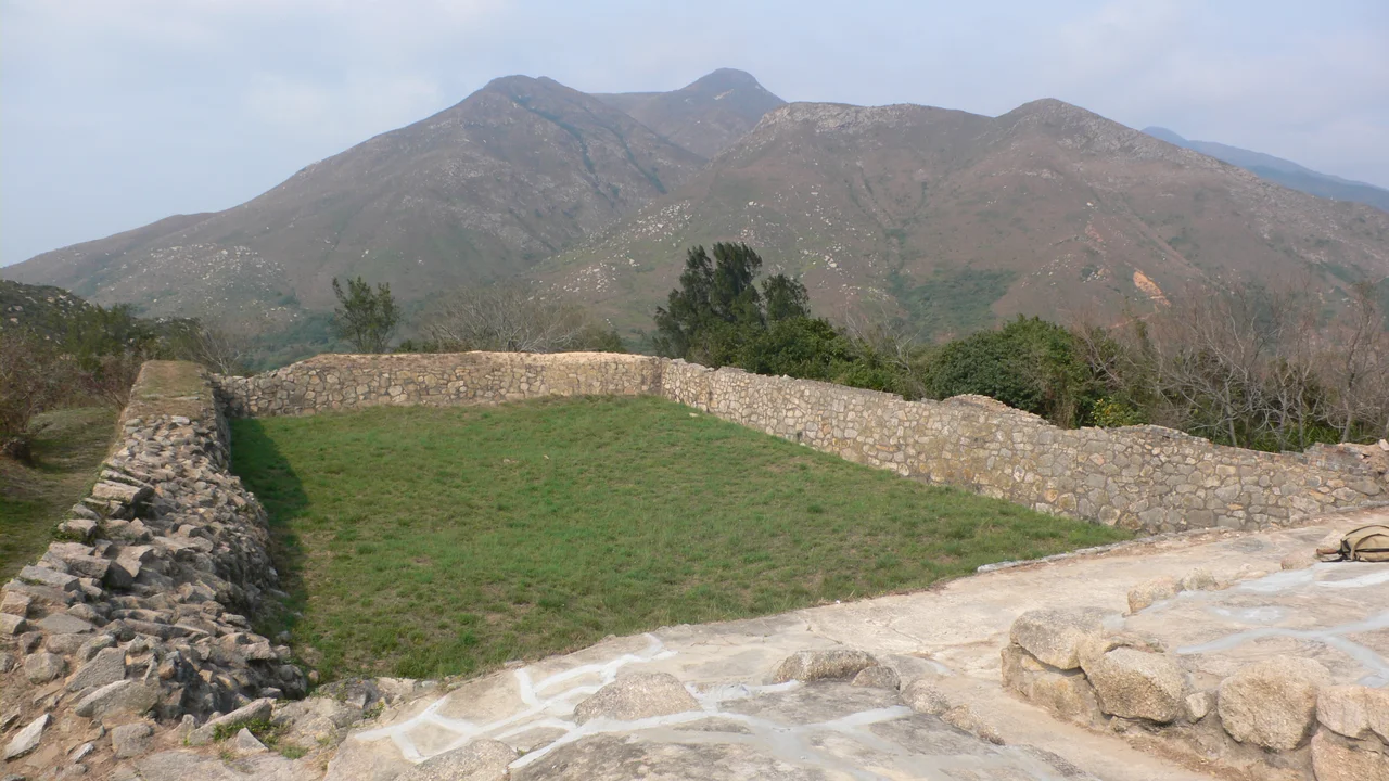
The fort was rectangular, measuring 46 metres by 21 metres, with exterior walls of semi-dressed stone and green brick rising five metres. Its single entrance faced east. When fully garrisoned, thirty soldiers stood watch here, backed by eight cannons trained on the water below.
Taken by the Enemy It Was Built to Stop
The fort's history carries an irony that its Qing architects could not have foreseen. At some point, the very pirates the garrison was stationed to repel managed to seize the fortification itself. The source records are sparse on the details of how it fell, but by 1810 the government had recovered it: the pirates surrendered to imperial soldiers and the fort returned to official hands.
Over the course of the nineteenth century the fort's name was changed again — from Tai Yu Shan Fort to Kai Yik Fort — as it passed through the middle and later eras of Qing rule. By 1898, with the British having consolidated their hold on Hong Kong and the strategic calculus of the Pearl River estuary transformed beyond recognition, the garrison was withdrawn and the fort abandoned. It had stood watch for nearly 170 years.
What the Jungle Gave Back
Abandoned and exposed to the subtropical climate of the South China coast, the fort surrendered slowly to encroaching vegetation. By the late twentieth century, foliage had largely engulfed the ruins. Preliminary restoration works were carried out in 1985, and a more extensive effort followed in 1990, when workers cleared the dense growth and stabilised the remaining walls.
Today Fan Lau Fort is one of only two historic military fortifications on Lantau Island to have survived into the present day — the other being Tung Chung Fort on the island's north coast. Hong Kong declared it a monument in 1981, recognising its place as one of the oldest intact defensive structures in the territory. The walls still stand at something close to their original height, and the eight cannon emplacements look out over the same passage the Qing dynasty garrison watched for more than a century.
A Cliff Chosen for Its Clarity
The site was not chosen at random. Standing on that cliff, the logic of the location is immediately apparent: the land falls away sharply to the water on three sides, and the approaches to the Lantau Channel stretch clear to the horizon. Any ship attempting to pass without permission would have been visible long before it reached effective range. In clear conditions the coasts of Macau and the Pearl River mouth are both in sight from the fort's walls.
The peninsula below is Fan Lau itself — the name meaning 'separating water flows' in Cantonese, describing precisely what happens here where the Pearl River current meets the South China Sea. Reaching the fort today requires following the Lantau Trail or the Fan Lau Country Trail through Lantau South Country Park, a walk that makes plain just how remote and strategically exposed this southwestern corner of the island has always been.
From the Air
Fan Lau Fort sits at approximately 22.198°N, 113.851°E, on the southwestern tip of Lantau Island, Hong Kong. Approach from the east along the southern Lantau coastline at 1,500 to 2,500 feet for the best view of the cliff-top ruins and the narrow Lantau Channel below. The fort is a small rectangular structure visible as a light-coloured ruin on the headland. Hong Kong International Airport (VHHH) lies roughly 12 km to the northeast on Chek Lap Kok Island. The channel between Fan Lau and the Macau peninsula is a busy shipping corridor — expect traffic below at all altitudes.
Nearby Stories
- Tai Tau Chau (Southern District) 0.7 km away
- Lai Chi Wo 3 km away
- Wanshan Archipelago Campaign 3.2 km away
- Pearl River Delta 3.7 km away
- Battle of Yamen 13 km away
- Jiangmen 15 km away
- Hong Kong 12 32 km away
- Battle of Nanpeng Island 114 km away