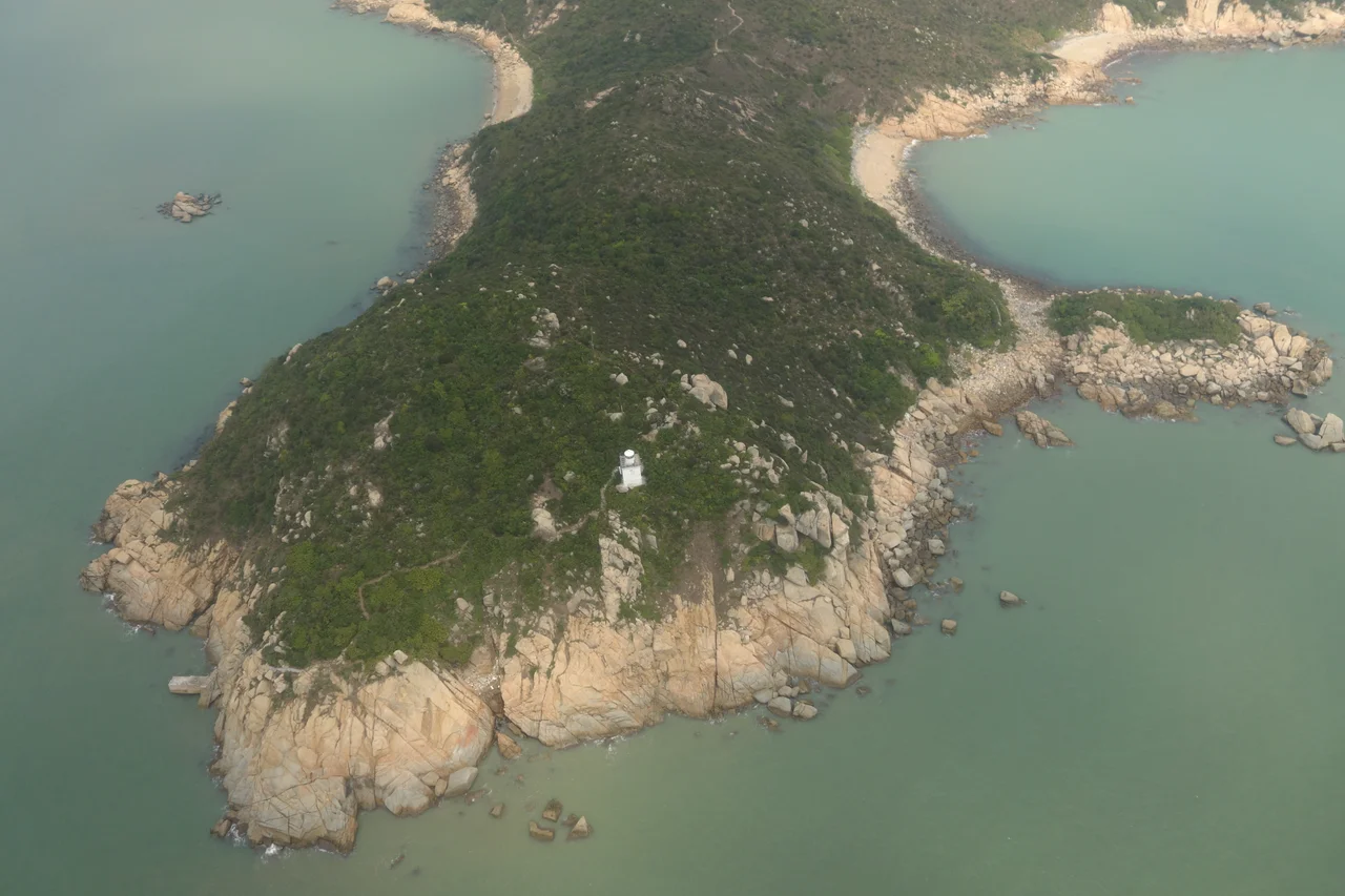

Fan Lau
Fan Lau means 'separating water flows,' and the name is exactly right. Stand at Fan Lau Kok — the very tip of the peninsula — and you can watch the silty brown outflow of the Pearl River meet the deep blue of the South China Sea in a visible seam. Lantau Channel runs below, one of the Pearl River Delta's busiest shipping passages, and the southwestern corner of Hong Kong's territory extends to this narrow point. Behind the headland, the land opens into sheltered coves — Fan Lau Tung Wan to the east, Fan Lau Sai Wan and Fan Lau Miu Wan to the west — each one calmer than the exposed tip they shelter.
Stone Circles Before History Had a Name
Long before the Qing dynasty sent soldiers to this peninsula, people were already here. Somewhere on the headland — the exact location known to archaeologists but not widely publicised — a stone circle survives from the Neolithic and Bronze Age. Its purpose has never been determined with certainty. The stones are arranged with evident intention, and their age places them among the oldest human traces in Hong Kong, but whatever ceremonies or calculations the circle once served have not come down to us. The Hong Kong government has declared it a monument alongside Fan Lau Fort, recognising that whatever these people meant by their arrangement, they meant it deliberately.
The Fort on the Cliff
The most visible legacy of Fan Lau's strategic importance is the Qing dynasty fort completed in 1729, sitting on a cliff 116 metres above sea level at the eastern edge of the peninsula. It was built because Lantau Channel could not be left unwatched: pirate fleets regularly worked the Pearl River approaches, and the empire's southern coast needed fixed defences where its navy was thin. The fort's garrison could see every vessel attempting the passage below, and eight cannons stood ready at the walls.
The fort was abandoned in 1898 after the British consolidated their hold on the region, and was declared a monument in 1981. It shares that status with the stone circle — which means Fan Lau holds two declared monuments on the same small peninsula, separated by several thousand years of human history.
A Village Nearly Empty
Fan Lau Tsuen, the village that grew up on the flat ground between the peninsula and the main body of Lantau Island, once had a Cantonese name that says something about the landscape: Shek Sun Village, meaning 'Village of Stone Shoots.' At its most populous the settlement numbered fewer than 200 people, mostly fishing families, and it was always a place that the currents of modern Hong Kong only lightly touched.
By January 1997, three people were still living there. The rest had moved, mostly to Tai O and Pui O elsewhere on Lantau. The village is officially recognised under Hong Kong's New Territories Small House Policy, meaning indigenous residents retain certain land rights — but the practical reality of the place is near-abandonment. Walking through it today you pass small houses slowly returning to the hillside.
Saved from the Power Company
In the late 1980s, China Light and Power — one of Hong Kong's two major electricity companies — was looking for a site to build a new generating plant. Fan Lau was on the shortlist. CLP's proposal envisaged a coal-fired station covering 60 hectares of the peninsula, complete with chimneys, ash lagoons, transmission pylons, and new access roads. Environmental groups mobilised fiercely against it.
In 1990 the Hong Kong government rejected the Fan Lau site on two grounds: unprecedented conflict with the Country Parks Ordinance, and air pollution. The power station was eventually built at Black Point in Tuen Mun instead. Fan Lau became part of Lantau South Country Park, which it remains today — accessible by the Lantau Trail's seventh stage and the Fan Lau Country Trail, with a lighthouse at Fan Lau Kok still guiding shipping through the channel the Qing garrison once watched.
From the Air
Fan Lau peninsula lies at approximately 22.211°N, 113.855°E at the southwestern tip of Lantau Island, Hong Kong. The point where Pearl River outflow meets the South China Sea is clearly visible from altitude as a colour boundary in the water. Approach from the northeast along the southern Lantau coastline; the peninsula juts distinctly southward from the main island mass. Lantau South Country Park covers the surrounding hills. Hong Kong International Airport (VHHH) is approximately 13 km to the northeast. The lighthouse at Fan Lau Kok is a small structure at the very tip. Lantau Channel carries heavy commercial shipping traffic directly south of the headland.
Nearby Stories
- Tai Tau Chau (Southern District) 0.7 km away
- Lai Chi Wo 3 km away
- Wanshan Archipelago Campaign 3.2 km away
- Pearl River Delta 3.7 km away
- Battle of Yamen 13 km away
- Jiangmen 15 km away
- Hong Kong 12 32 km away
- Battle of Nanpeng Island 114 km away