
Fishguard and Goodwick
Richard Burton and Elizabeth Taylor came here in 1971 to film Dylan Thomas's Under Milk Wood, and they found the location already half built for them. Lower Town Fishguard is one of those harbours that looks like it was sketched into existence by someone who needed a backdrop for ships and quayside cottages and a tide that comes right up to the front door. Above the quay, the cliffs flare with 460-million-year-old pillow lava from the Ordovician. Beneath the ground, in a neat line on the hill above the ferry terminal, four Neolithic burial chambers wait where they have waited for the last five thousand years.
Two Towns, One Bay
Fishguard and Goodwick spent the first eight hundred years of their adjacent existence not really speaking. Fishguard sat up on its medieval bluff above the old harbour, prosperous from fishing and coastal trade by the seventeenth century, with the Norman castle long gone but the market square still busy. Goodwick stayed a small fishing village at the head of the bay, its name probably an echo of the Vikings who raided this coast in the late tenth century: Old Norse godr for good and vik for bay, though some locals insist it actually comes from the Welsh goedwig, meaning forest. Goodwick stayed sleepy until 1887, when work began on a railway and a harbour, and the village transformed itself into a port town almost overnight. The two only merged administratively in 1934, fifty-five years before the urban district itself was abolished.
The Geology Below
The cliffs that frame Fishguard Lower Town's harbour are protected as a Site of Special Scientific Interest because of what they preserve. From Saddle Point on the western side around to Castle Point on the east, the rocks here demonstrate the Llanvirn series of the Ordovician period, formed when volcanic eruptions in the early Palaeozoic pumped lava and ash into a shallow sea. The lava cooled into pillow formations on the seabed, where they sat for 460 million years before being heaved up into Welsh sunlight by the same plate tectonics that built Snowdonia and the Brecon Beacons. The pillows look exactly like what they are: solidified bubbles of molten rock. You can walk down to the quay and see them at low tide.
Ancient Marks on the Land
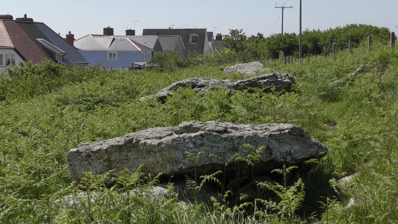
Long before the Vikings or the Normans, Neolithic farmers built four chambered tombs along a single line on the hillside above what is now the ferry terminal. The Garn Wen burial chambers cluster a footpath away from a modern housing estate, and Pen-Rhiw Cromlech sits with its massive capstone in a quiet field north of Pen-rhiw farm. These are the houses of the dead from a community that fished, foraged, and farmed this coast five thousand years ago. Up on Castle Point above the upper town, the Old Fort stands more recently: built in the 1780s when fears of a French invasion were running high. Those fears, as it turned out, were not unfounded. In February 1797 the French actually came.
Under Milk Wood Quayside
When Andrew Sinclair filmed Dylan Thomas's verse drama in 1971, he needed a Welsh harbour that could double as the fictional Llareggub. He used Lower Town Fishguard, and the wedge of houses and cottages curling around the old quay barely needed dressing. Burton played the Voice of the Author and Taylor played Rosie Probert. The picturesque value the film makers exploited is now formally protected: Lower Town is one of three conservation areas in the community, and the heritage list includes 161 grade II buildings clustered along Market Square, the High Street, and the quayside cottages of Bridge Street and Quay Street. Plas Glyn-y-Mel, built in 1797 to 1799 for the Pembrokeshire historian Richard Fenton, stands as grade II*; so does Hermon Baptist Church on the High Street, the earliest Welsh example of a wide arch breaking into an open pediment, a design that would dominate Welsh chapel facades through the nineteenth century.
Edwardian Goodwick
Goodwick's heyday came later, with the 1906 arrival of the Great Western Railway and the dream of trans-Atlantic liners docking at Fishguard Harbour. The dream collapsed when silting prevented the larger ships, but for a brief Edwardian moment Goodwick was fashionable, and you can still read it in the Victorian shopfronts and red-brick terraces in the conservation area along the hillside above the railway. The ferry terminal handles two daily sailings to Rosslare in Ireland on the MS Stena Nordica, the A40 trunk road from London ends its 257-mile run at the same gate, and the Goodwick Moor nature reserve quietly shelters otters and water voles in fifteen hectares of reed-bed within sight of the breakwaters. The first successful flight from Britain to Ireland departed from Goodwick's Harbour Village in April 1912, taking one hour and forty minutes in a Bleriot XI.
From the Air
The twin towns sit at 51.99 degrees north, 4.97 degrees west on the north Pembrokeshire coast. From altitude the bay reads as a sharp arc with the long arms of two breakwaters reaching into it; the ferry terminal is unmistakable on the northwest side, with the railway tracks running along the shore. Lower Town's old harbour shows as a smaller inlet at the southeast corner. Haverfordwest (EGFE) lies fifteen miles south; Swansea (EGFH) about fifty miles east. The Pembrokeshire Coast National Park surrounds the community on three sides but excludes the towns themselves.
Nearby Stories
- RAF Angle 0.9 km away
- Cardigan Bay Special Area of Conservation 5.4 km away
- Abercych 11 km away
- Cantre'r Gwaelod 12 km away
- Burry Port Lifeboat Station 22 km away
- Johnstown Castle 61 km away
- Hook Lighthouse 92 km away
- 1979 Fastnet Race 157 km away