
Flamborough Head
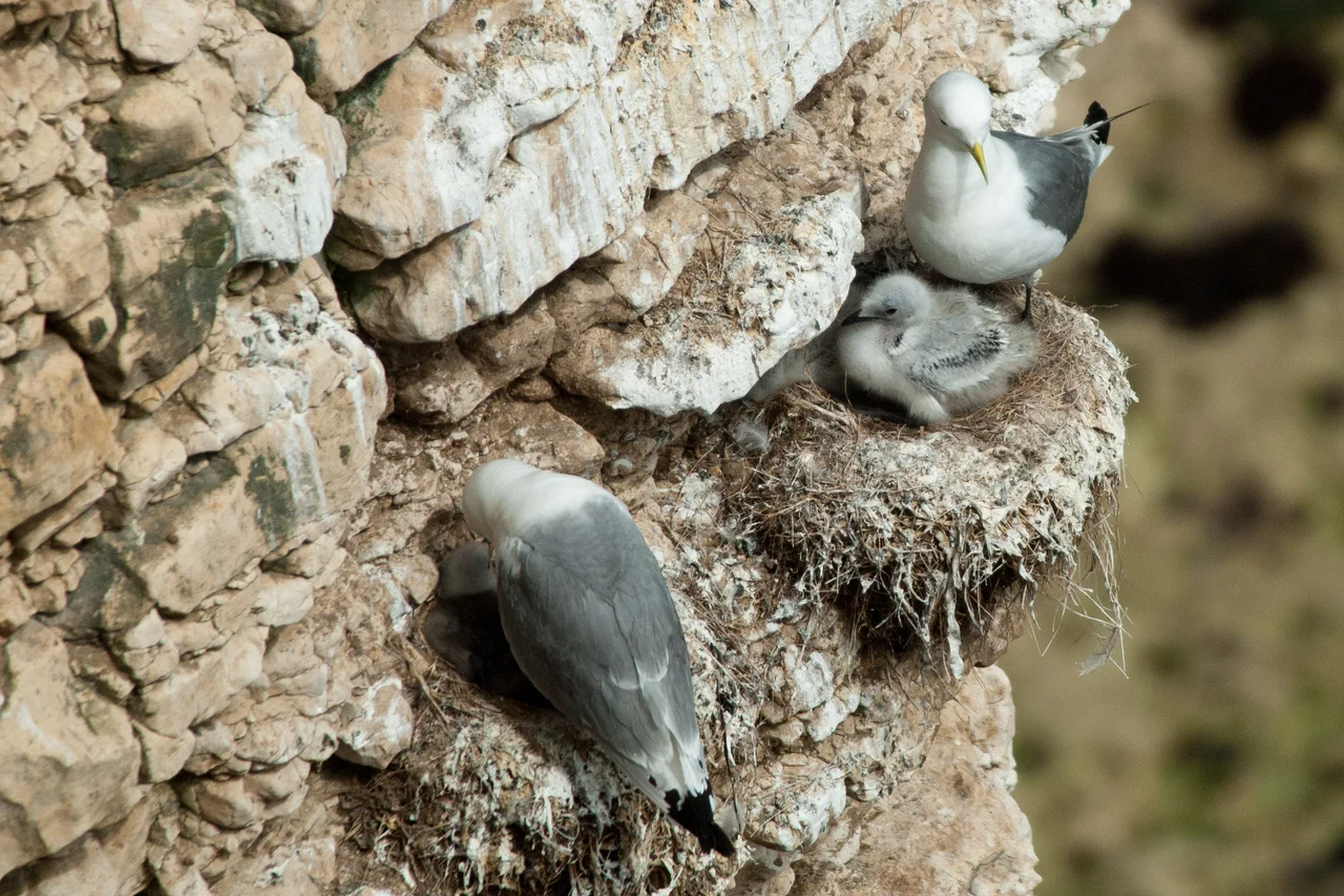
On the night of 23 August 2006, a lightning bolt hit a buttress on the cliffs at Flamborough Head and dropped a hundred tonnes of chalk into the North Sea. That kind of event sounds dramatic, and it is, but the headland was already used to losing pieces of itself. The chalk runs from a hundred million years ago to seventy, deposited in a shallow sea, lifted, undercut by storm, and worked into stacks, blowholes, arches, and caves. The largest sea caves here extend more than fifty metres back from their entrances, more numerous and varied than anywhere else on the British chalk coast. What stands above is white, sheer, and surprisingly alive: an estimated two hundred thousand nesting seabirds, one of only two mainland British gannetries, packed onto the ledges in spring.
The Battle of Flamborough Head, 1779
On 23 September 1779, during the American War of Independence, a Franco-American squadron under Captain John Paul Jones engaged two Royal Navy frigates off Flamborough Head. Jones's ship USS Bonhomme Richard, with the French frigate Pallas, took on HMS Serapis and HMS Countess of Scarborough in one of the most famous single-ship actions in naval history. Bonhomme Richard was an old converted East Indiaman, outgunned and outclassed. She locked alongside Serapis, the two ships smashing each other to pieces at point-blank range. When the British captain called for surrender, Jones is said to have shouted back that he had not yet begun to fight. Bonhomme Richard was sinking when Serapis struck her colours. Jones transferred his crew, watched his own ship go down, and sailed Serapis away. A toposcope at the lighthouse commemorates the 180th anniversary of the battle, raised in 1959.
Chalk, Caves, Gannets
Flamborough Head is the only chalk sea cliff in the north of England. The SSSI designation, first applied in 1952, runs from Sewerby around the headland to Reighton Sands and covers a complete sequence of Chalk Group strata. Four different chalks are named here, Ferriby, Welton, Burnham, and Flamborough. The cliffs host the only mainland British gannet colony alongside Bempton, several miles north along the coast. In autumn, when the wind swings east, birders gather below the lighthouse to watch passing seabirds, or scour the hedges for landbird migrants blown across the North Sea. The headland has its own bird observatory, dedicated to the patient business of counting and ringing what passes through.
The First Law for Birds
In the nineteenth century, Flamborough's seabird colonies were under intense pressure. Boatmen were taking a hundred birds a day to sell to taxidermists, and party shooters travelled to the cliffs for sport. In 1868 Professor Alfred Newton condemned the practice in his speech to the British Association for the Advancement of Science. The local MP, Christopher Sykes, took up the cause, and the Sea Birds Preservation Act 1869 became the first Act to protect wild birds in the United Kingdom. It was a piece of Victorian conservation legislation born directly from what was happening on these chalk cliffs. Shooting continued for a while in defiance of the law, but the principle had been set, and the descendants of those nineteenth-century colonies are the gannets and guillemots still nesting on the ledges today.
Danes Dyke and Thornwick Bay
A two-mile defensive ditch called Danes Dyke runs north to south across the headland, isolating five square miles of land that is naturally defended by the cliffs on three sides. The name suggests Viking origins, but excavation by Pitt-Rivers in 1879 turned up Bronze Age arrowheads, and the dyke is now understood as prehistoric. Two boat-launching beaches, North Landing and South Landing, sit within the enclosed land, and the 2016 Dad's Army film used North Landing as a location. On the north side of the headland lies Thornwick Bay, where a plaque remembers Robert Redhead, bowman of the Bridlington lifeboat, who died in 1952 trying to rescue two young girls, Joan Ellis and Gillian Fox, from drowning. The chalk towers above them where the lightning would later strike.
From the Air
Flamborough Head juts into the North Sea at 54.12 degrees north, 0.08 degrees west, the eastern extremity of the Yorkshire Wolds. From 1,500 to 3,000 feet the eight-mile promontory shows white against the dark sea, with both lighthouses visible at the tip and the gentler curves of Filey Bay to the north and Bridlington Bay to the south. Danes Dyke shows as a long shallow line crossing the headland. Humberside Airport (EGNJ) is roughly 38 nautical miles south-southwest. The headland generates orographic effects in onshore winds, and summer haar can roll in from the sea with little warning. Maintain altitude above 500 feet near the cliffs to respect the seabird colonies.
Nearby Stories
- SM UC-47 2.1 km away
- 2025 North Sea Ship Collision 6.5 km away
- North York Moors 8 km away
- Wilberforce House 11 km away
- Howden 12 km away
- Kirkham Priory 12 km away
- Robin Hood's Bay 27 km away
- Breagh Gas Field 44 km away