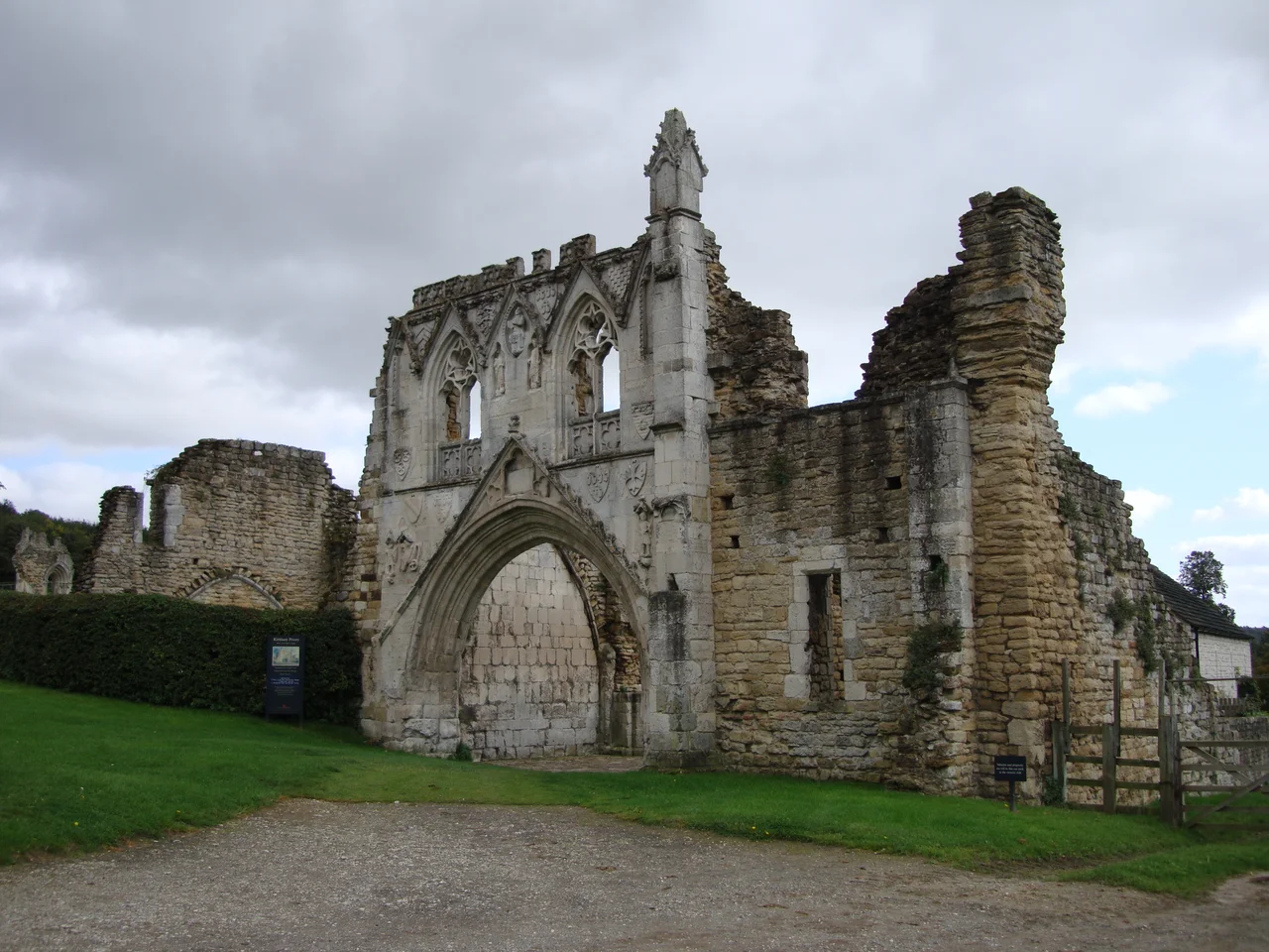

Kirkham Priory
A horse spooked by a wild boar threw its rider, and a father's grief built a priory. That is the legend Augustinian canons told about Walter l'Espec, lord of Helmsley, whose only son died near the banks of the River Derwent in the 1120s. The stones l'Espec raised in memory of that boy still stand at Kirkham, a roofless skeleton of grey arches above the water meadows. Four centuries later, Henry VIII's commissioners would close the priory. Four centuries after that, Churchill himself would walk these same cloisters in secret, watching tanks splash through the river that gave the canons their daily fish.
A Boar in the Forest
The story comes down through the centuries with the patina of legend, but the priory it explains is unmistakably real. Walter l'Espec was one of the most powerful Norman lords in the north, a man who would later command English forces against the Scots at the Battle of the Standard in 1138. Around 1122, he founded Kirkham Priory for Augustinian canons, and within two decades, he and his wife had founded Rievaulx Abbey nearby as well. The pattern of paired foundations suggests deep grief and deeper piety. The Augustinians at Kirkham followed a less austere rule than the Cistercians at Rievaulx, allowing them to serve as priests in surrounding parishes while still living a communal religious life. For four centuries they kept this place, until Prior John Kyldwyck handed the keys to Henry VIII's commissioners on 8 December 1538.
The Gatehouse Bestiary
The most spectacular survivor is the gatehouse, an explosion of carved stone built around the 1290s. A wide arch sweeps up under continuous mouldings to a crocketed gable, framing one of the finest sculpture programmes of any English priory. St George spears the dragon on the left. David swings his sling at Goliath on the right. Christ presides from a pointed niche above, flanked by St Bartholomew and St Philip. Below them runs a parade of armorial shields, the coats of arms of the families who paid for prayers and burial space here: de Ros, Scrope, de Forz, Vaux, FitzRalph, and l'Espec himself, whose arms show three cart-wheels with six spokes apiece. Only Butley Priory in Suffolk preserves anything comparable. To stand under this gateway is to read the social register of medieval Yorkshire carved in stone.
Tanks in the Cloister
In the spring of 1944, the canons would have been astonished. The British 11th Armoured Division arrived at Kirkham with tanks, jeeps, and waterproofing compounds, turning the priory grounds into a laboratory for the largest seaborne invasion in history. The shallows of the River Derwent stood in for the beaches of Normandy. Drivers practised submerged crossings while engineers tested seals against the Channel's salt water. Troops scrambled up and down the high western cloister wall with cargo nets, rehearsing the descent from troopship to landing craft they would soon make under German fire. Then, on a day kept off the official calendars, Prime Minister Winston Churchill and King George VI walked these ruins together, watching the preparations. The medieval stones that had once heard plainsong now echoed with diesel engines bound for Sword Beach.
What Remains
The de Ros family lies buried here, generations of barons whose arms are carved on the gatehouse they helped pay for. So does Ralph Greystoke, 5th Baron Greystoke, his bones somewhere beneath the rough grass. The lavatorium where canons washed before meals still shows its trough and its Norman arcading. The cloister walks have vanished, but their outlines mark the lawn. English Heritage now cares for the site as a Grade I listed scheduled monument. On a still summer evening, when the Derwent runs slow and the swallows hunt low over the water, it is easy to feel the weight of nine centuries pressing down: the boar, the boy, the canons, the king.
From the Air
Located at 54.08 degrees N, 0.88 degrees W in the Derwent Valley of North Yorkshire, about 5 miles southwest of Malton. From cruise altitude the priory ruins appear as a small grey footprint on the south bank of the River Derwent. Nearest airports: Leeds Bradford (EGNM) about 45 nautical miles southwest, Humberside (EGNJ) about 35 nautical miles south. The York Plain spreads westward; the Yorkshire Wolds rise to the east. Best viewed at low altitude in morning light when the eastern facade catches the sun.
Nearby Stories
- Burton Agnes Hall 2.3 km away
- Temple Newsam 3.5 km away
- Wressle Castle 3.6 km away
- Rosedale Abbey 3.7 km away
- Hull History Centre 4.7 km away
- Battle of the Standard 6.3 km away
- Knaresborough Castle 6.5 km away
- Breagh Gas Field 67 km away