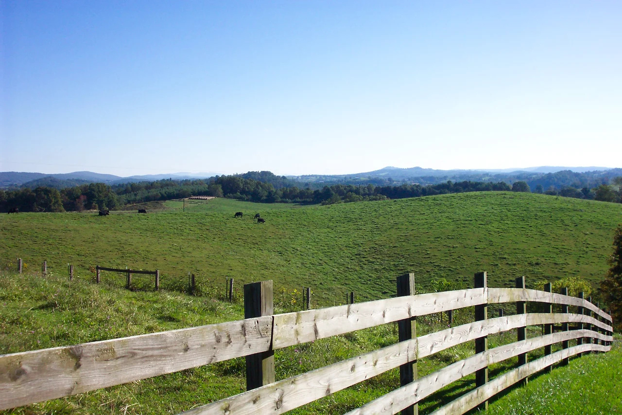

Floyd County, Virginia
No water flows into Floyd County. It is one of the more startling facts in Virginia geography - a high plateau perched atop the Blue Ridge, divided so cleanly along the eastern continental divide that every drop of rain falling here drains out, never in. The Little River carries most of it westward to the New River, then to the Kanawha, then to the Ohio, then to the Mississippi, and finally to the Gulf of Mexico. From a courthouse step in the town of Floyd, then, the rain you stand under is bound for Louisiana.
The Plateau in the Sky
Floyd County sits on a 381-square-mile shelf in the Blue Ridge Mountains of southwestern Virginia, with Buffalo Mountain - at 3,971 feet, the highest point in the county - anchoring its southern edge. The town of Floyd, the county seat, is forty miles southwest of Roanoke along US 221. From here, the land falls away in every direction, so streams begin and never end, draining the county in three directions like a leaky pitcher. The 2020 census counted 15,476 residents, a modest population for a county this size. The Appalachian Regional Commission counts Floyd among its 423 service counties, and the cultural historian Colin Woodard puts it squarely in what he calls Greater Appalachia.
Established 1831, Named for a Governor
The General Assembly of Virginia carved Floyd County out of Montgomery County on January 15, 1831, and named it for John Floyd, then the sitting governor of Virginia. Settlement had begun nearly a century earlier - James Patton received a 100,000-acre grant on the New River and the westward-flowing waters in 1745, and the Royal Company of Virginia got its own grant in 1749, setting the two in competition. The county seat was initially called Jacksonville after Andrew Jackson, the seventh president. Locals renamed it Floyd in 1896. The first Commonwealth's Attorney was William Ballard Preston, John Floyd's nephew, who would later serve as U.S. Secretary of the Navy. He was followed in the role, eventually, by Jubal Early, who left to become a Confederate general.
Deserters Who Stayed Republican
Floyd is an oddity in Virginia politics. While the rest of the state was deep in the Democratic Solid South after Reconstruction, Floyd County stayed Republican - and not just slightly. The reason runs back to the Civil War, when much of the county's white population deserted the Confederate army. After the war, Floyd became one of very few areas in the antebellum slave states to embrace Radical Reconstruction. The party loyalty calcified over generations. Floyd was the only Virginia county to vote for Herbert Hoover against Franklin Roosevelt in 1932. The last Democrat to carry it in a presidential election was Winfield Scott Hancock - in 1880. That is not a typo.
The Friday Night Jamboree
In the 1960s and 1970s, Floyd County became a magnet for people looking to live closer to nature - back-to-the-land settlers, artists, musicians, and the occasional millennialist commune. The Rivendell community formed here in the late 1990s. The county's music scene runs deeper than the counterculture though. The Floyd Country Store hosts a Friday Night Jamboree where old-time string bands, bluegrass musicians, and flatfoot dancers fill the wooden floor every week. Both the Country Store and County Sales, the legendary roots-music record shop, sit on Virginia's Crooked Road heritage music trail. FloydFest, the world music festival that runs each summer just off the Blue Ridge Parkway, has hosted everyone from The Lumineers to Brandi Carlile to Matisyahu. The Alum Ridge Boys and Ashlee, a local old-time string band, took first prize at the Galax Old Fiddlers' Convention in 2021.
Wineries, Shooting Creek, and the Parkway
The Blue Ridge Parkway runs through Floyd County, threading past Rocky Knob Recreation Area and Buffalo Mountain Natural Area Preserve on its way south. Chateau Morrisette and Villa Appalaccia, both established in the 1980s, anchor the county's small wine industry just off the parkway. Shooting Creek - named for the speed of its waters over the rocks - once supplied the lawless moonshine trade that turned the Virginia mountains into a Prohibition-era headache for federal agents. The roads up here twist and climb, the air thins, and the county pulls back into the kind of quiet that only happens when the rain you stand under is on its way to somewhere far downstream.
From the Air
Floyd County occupies a high Blue Ridge plateau centered roughly at 36.94 N, 80.36 W, with Buffalo Mountain at 3,971 feet marking the high point. The Blue Ridge Parkway threads the county's eastern edge. Look for the high tableland sloping westward into the New River drainage, with the town of Floyd at the crossroads of US 221 and SR 8. Nearest commercial field is Roanoke-Blacksburg Regional (KROA) about 30 nm north-northeast. Smaller fields: New River Valley (KPSK) about 25 nm northwest near Dublin; Mountain Empire (KMKJ) southwest near Marion. Mountain wave and rapid weather changes possible along the parkway crest.
Nearby Stories
- Patrick County, Virginia 7.5 km away
- Galax, Virginia 9.8 km away
- Murders of Alison Parker and Adam Ward 20 km away
- Wytheville, Virginia 21 km away
- Concord University 22 km away
- Salem, Virginia 25 km away
- National D-Day Memorial 25 km away
- 2014 Dan River Coal Ash Spill 29 km away