The Lake That Swallowed a Gold Rush Town
During the drought years, the water drops low enough to reveal foundations, artifacts, and the outline of streets. Mormon Island reappears -- a Gold Rush settlement that once held 2,500 people, built on a 300-foot sandbar where members of the Mormon Battalion found gold in the American River. By the 1940s, fire, depleted claims, and a new railroad had emptied the town. In 1953, the government bought the land, and Folsom Lake swallowed what remained. Two million visitors come to Folsom Lake State Recreation Area each year. Most of them have no idea they are boating over the bones of a town that gold built and water erased.
Digging Ditches, Building Fortunes
Before the lake existed, water was already the currency of power here. In 1851, local miners formed the Natoma Water Company and spent $175,000 constructing a 20-mile ditch from the Salmon Falls Bridge down to Granite City -- the settlement that would become the city of Folsom. The Natomas Ditch supplied water to hydraulic mining operations that were reshaping the Sierra foothills one pressurized blast at a time. By 1912, the company had lined 13,000 feet of the ditch with concrete, a measure of how essential the infrastructure had become. Miners from England, Scotland, Wales, New York, Virginia, Kentucky, Hawaii, and China camped beside their claims along the American River's forks. Their temporary camps became small towns with names that told their own stories: Rattlesnake Bar, Oregon Bar, Manhattan Bar. When the government arrived in 1953 to build Folsom Lake, many of these settlements vanished beneath the rising water.
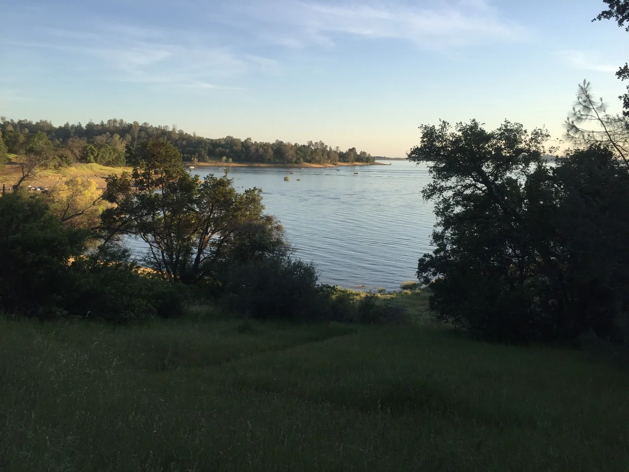
A Dam Creates a Playground
Folsom Dam was completed in 1955, and the state recreation area was established the following year. The park sprawls across 19,564 acres, wrapping around California's ninth-largest reservoir. The lake consists of two bodies of water: Folsom Lake proper, whose shoreline extends 15 miles up the forks of the American River, and smaller Lake Natoma downstream behind Nimbus Dam, with about 500 surface acres. Water levels fluctuate dramatically with the seasons -- from around 460 feet in early spring to below 400 feet by late summer as Sierra snowmelt tapers off and Sacramento's thirst intensifies. Ninety-five miles of trail wind through the recreation area, including a stretch of the Western States/Pioneer Express Trail connecting Sacramento to Carson City. A 32-mile paved bicycle path links the lake to Old Sacramento, threading through Sacramento County parks along the way.
Where Black Miners Made History
One of the park's campgrounds carries a name that connects directly to the Gold Rush's lesser-known participants. Black Miners Bar -- originally known by a now-outdated name that was temporarily changed in 2022 while a permanent decision is made -- marks one of the earliest recorded locations mined by African American gold miners during the 1849 rush. The original site was a large sandbar on the south bank of the lower American River, in what is now the city of Folsom. Most of the African American miners had moved on to more productive claims by 1852, but the name endured as a reminder that the Gold Rush drew people from every background and circumstance. Today the campground sits on the opposite bank of the American River from the original sandbar, offering group sites along Lake Natoma.
Hatchery and Habitat
Before the Folsom-Nimbus project was completed in 1958, the American River provided approximately 100 miles of stream where salmon and steelhead could spawn. The dams cut off most of that habitat in a single stroke. Nimbus Hatchery was built as mitigation, raising about four million Chinook salmon and 430,000 steelhead for release into the American River each year. The hatchery sits at Nimbus Dam, where the Bureau of Reclamation pays the California Department of Fish and Wildlife to operate the facility. It is an engineered answer to an engineered problem -- human intervention replacing what human intervention destroyed. Beyond the hatchery, the recreation area supports a rich natural community: blue oaks and foothill pines on the hillsides, wildflowers like Indian paintbrush and lupine in the spring meadows, and a bird population that includes nesting egrets, ospreys, and bald eagles riding thermals above the water.
Seasons on the Lake
Summer transforms Folsom Lake into one of Sacramento's essential escapes. Temperatures push into the 90s and 100s, and the lake fills with boats, kayaks, and swimmers. Peninsula Campground, at the end of an 11-mile road from Highway 49, occupies the finger of land between the North and South Forks and offers a remoteness unusual for a park this close to a major city. Beals Point, on the west shore near the dam, provides beach access and a snack bar for day-trippers. The Sacramento State Aquatic Center operates on Lake Natoma, offering equipment rentals for paddling, rowing, sailing, and wakeboarding. But perhaps the most remarkable feature of Folsom Lake is its memory. Each drought year peels back another layer of the landscape that existed before the reservoir -- stone foundations, old roads, the ghost geography of Mormon Island surfacing like a whisper from the 1850s before the rains return and the water covers it again.
From the Air
Located at 38.73N, 121.13W, Folsom Lake is a prominent water feature visible from high altitude as a branching reservoir in the Sierra Nevada foothills, approximately 25nm east of Sacramento. The two forks of the American River create a distinctive Y-shape. Folsom Dam is visible at the western end, with the smaller Lake Natoma extending downstream. The recreation area's 19,564 acres surround the lake on all sides. Sacramento Mather Airport (KMHR) lies 15nm southwest; Sacramento Executive (KSAC) is 22nm west. Lake levels vary significantly by season -- spring shows maximum water with green surrounding hills; late summer reveals exposed shoreline and lower water.
Nearby Stories
- Sutter National Wildlife Refuge 12 km away
- Griffith Mansion 15 km away
- Never Come, Never Go: The Railroad That Hauled $200 Million in Gold 16 km away
- Rancho Seco Recreational Park 18 km away
- The Roadside Stand That Fed a Queen 31 km away
- New Melones Dam 61 km away
- Donner Pass 66 km away