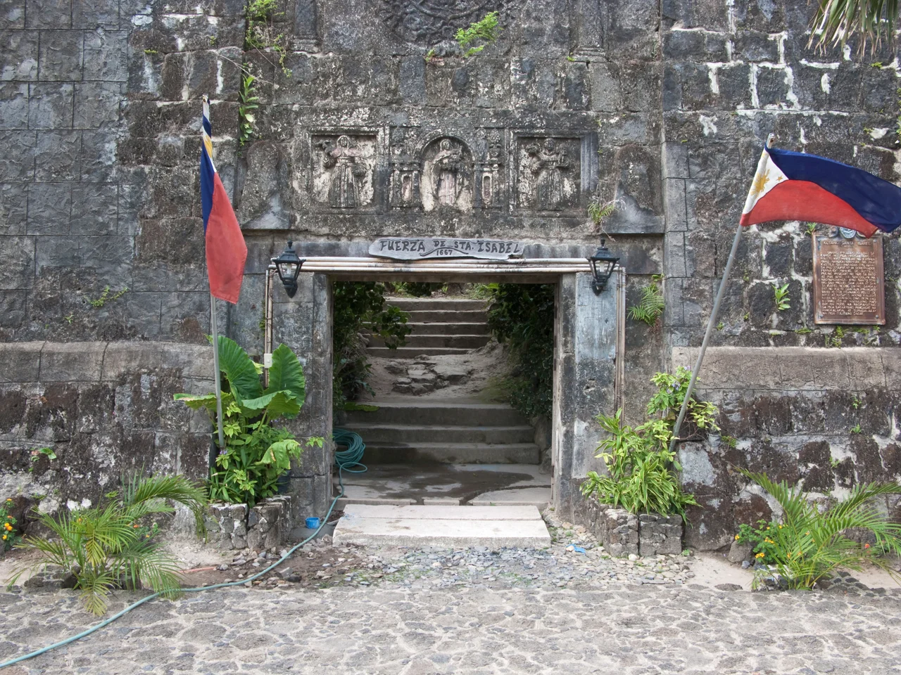
Fort Santa Isabel
The cannons at Fort Santa Isabel point outward across the water, aimed at threats that no longer come by sail. Perched on the coast of Taytay in northern Palawan, this coral limestone fortification has stood watch since 1738, when it replaced an earlier wooden palisade that the Augustinian Recollect priests had erected in 1667. For nearly four centuries, the fort has been a sentinel, a ruin, and -- most recently -- a restoration project. Its walls carry the layered history of Spanish colonial ambition in the Philippines, from the missionaries who planted the first posts to the governor-general who ordered them replaced with stone.
A Princess and a Palisade
The original fort was built in 1667 under the direction of the Augustinian Recollect priests, one of the religious orders that played a central role in Spanish colonization of the Philippines. It was a wooden palisade -- functional but impermanent, the kind of structure that could be raised quickly in a remote outpost where labor and materials were limited. The fort was named in honor of Isabella II of Spain, connecting this far-flung Pacific outpost to the Bourbon monarchy thousands of miles away. Taytay at that time was an important settlement on Palawan's northern coast, a Spanish administrative center in a province that stretched across hundreds of islands. The wooden walls served their purpose for seven decades before the decision was made to build something more durable.
Coral and Limestone Against Raiders
In 1738, through the efforts of Governor-General Fernando Manuel de Bustillo, the wooden palisade was replaced by a fortification built from coral limestone -- a material sourced from the reefs and coastal formations that surrounded Palawan. The new structure was designed primarily as a defensive work against Muslim raiders, who had long threatened Spanish settlements along the archipelago's western seaboard. These were not sporadic attacks but sustained campaigns by Moro warriors from the Sulu Archipelago and Mindanao, who raided coastal towns for captives and goods. Fort Santa Isabel gave the Spanish garrison in Taytay a hardened position from which to defend the town and project authority over the surrounding waters. The coral limestone walls, thick enough to absorb cannon fire, also weathered tropical storms and monsoons, outlasting by centuries the wooden structure they replaced.
Estrella del Norte
By the 21st century, Fort Santa Isabel had survived Spanish colonialism, the American period, Japanese occupation, and decades of tropical weather. What it could not entirely survive was neglect. The fort deteriorated over the years, its walls crumbling in places, vegetation reclaiming the stonework. In 2018, the municipal government of Taytay, with support from the National Historical Commission, launched the Estrella del Norte Heritage Development Project -- "Star of the North," a name that acknowledged both the fort's geographic position and its symbolic importance to northern Palawan. Heritage architect Joel Rico led the renovation, which was set for completion by May 1, 2019. The restoration aimed to preserve the fort's original coral limestone construction while making the site accessible to visitors. Today, Fort Santa Isabel stands as one of the best-preserved Spanish colonial fortifications in Palawan, its cannons still angled toward the sea, its walls thick with the compressed remains of creatures that built reefs long before anyone built forts on top of them.
From the Air
Located at 10.83°N, 119.52°E on the coast of Taytay in northern Palawan. Best viewed from 3,000-8,000 feet. The fort sits directly on the waterfront and is visible as a stone fortification near the town center. The surrounding coastline features islands and bays typical of northern Palawan. Nearest major airport: Puerto Princesa International Airport (RPVP), approximately 180 km to the south. San Vicente Airport (RPNS) is closer, about 50 km to the southwest.
Nearby Stories
- San Vicente, Palawan 11 km away
- El Nido, Palawan 12 km away
- Puerto Princesa 90 km away
- Coron, Palawan 109 km away
- Iwahig Prison and Penal Farm 120 km away
- Fort Cuyo 123 km away
- 2019 Reed Bank Incident 225 km away
- Guimaras Oil Spill 289 km away