
Fortifications of Plymouth
In August 1403 a French raiding party landed at Plymouth and burned what they could reach. King Henry IV's response was swift: he ordered the prior of Plympton and the abbot of Tavistock to fortify the town with walls and towers. The result was a castle of four towers overlooking the harbour, funded largely by Plymouth's own townspeople and run by the mayor and aldermen rather than the Crown. Only a fragment of that medieval castle survives today, in Lambhay Street at the head of the stairs down to the Mayflower Steps. But it set a pattern. For the next six centuries Plymouth would build, rebuild, and abandon defences in successive waves, each generation answering the threats of its own time.
Tudor Blockhouses and a Chain Across the Harbour
By 1540, charts show six small artillery blockhouses placed around Plymouth Sound, each commanding the strip of water in front of it. Fisher's Nose Blockhouse on the headland at the eastern end of Plymouth Hoe is now a café. The Mount Edgcumbe Blockhouse, built by the Edgcumbe family around 1545 to protect their estates at the entrance to the Hamoaze, can still be visited. Firestone Bay Blockhouse, also possibly Edgcumbe work, is a restaurant. Devil's Point Blockhouse can be viewed from outside. A fortified jetty at the mouth of Sutton Harbour gave its name to the Barbican district, and from it a chain could be drawn across the harbour entrance 'when the need requireth.' In 1602 the Italian military engineer Federigo Giambelli was brought in to upgrade the works.
The Siege
When the English Civil War came in 1642, Plymouth declared for Parliament while most of Devon and Cornwall stood with the King. Royalist forces besieged the town from 1643 to 1646. The existing fortifications protected only the seaward approaches, so a ditch and earthen rampart were thrown up around the landward sides, with a further line of triangular redoubts on the high ground to the north, running from Lipson across North Hill to Stonehouse. The Royalists built their own redoubts facing them. They lacked the heavy guns to break through. They did succeed in placing a battery on the headland later called Mount Batten, which effectively shut Sutton Pool to shipping and forced Plymouth's people to use Millbay harbour instead. The town held out, almost alone in a Royalist West Country.
The Royal Citadel and the New Dockyard
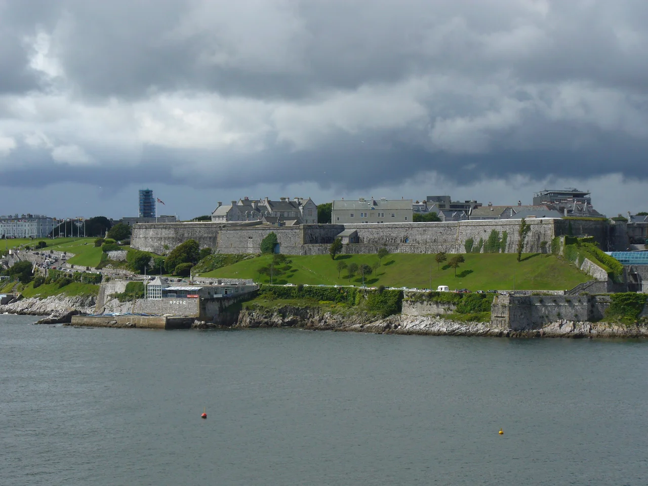
When the monarchy was restored, the Crown built the Royal Citadel from 1665 to designs by Sir Bernard de Gomme, on the eastern end of the Hoe over the site of Drake's Fort. It is a bastion fort, and it is still in military use today as the base of 29 Commando Regiment of the Royal Artillery, with guided tours offered in summer. In 1690, work began on a new Royal Dockyard on the Hamoaze, initially called Plymouth Dock and later renamed Devonport. New batteries went in at Devil's Point, Drake's Island, and Cawsand Bay to protect the dockyard from the sea. When the Seven Years' War brought renewed conflict with France and Spain, a 2,000-yard ditch and rampart with four bastions, the Devonport Lines, went up to protect the dockyard from landward assault. They would be rebuilt in stone between 1810 and 1816 and then progressively abandoned as the city expanded over them in the second half of the 19th century.
Palmerston's Ring
The greatest of Plymouth's defensive efforts came in response to Napoleon III. Lord Palmerston's Royal Commission of 1859 recommended a massive programme of new forts to defend the country's dockyards. Around Plymouth the recommendations took shape as two lines of coastal artillery forts guarding the seaward approaches, with a semi-circle of overland forts shielding Devonport from any French army landing on the south coast. Fort Bovisand, Breakwater Fort, Picklecombe Fort, and Cawsand Fort formed the outer sea line. Drake's Island Battery and Garden Battery at Mount Edgcumbe formed the inner line. On the Cornish western flank stood Fort Tregantle and Fort Scraesdon. To the north-east of Plymouth a chain of forts and batteries, Ernesettle, Agaton, Knowles, Woodlands, Crownhill, Bowden, Egg Buckland Keep, Forder, Austin, Efford, and Laira, watched the inland approaches. The Staddon Position to the south-east closed the eastern flank. The French never came, but the ring stayed in military use through both world wars.
What Remains
Some of the Palmerston forts have become museums, like Crownhill, restored by the Landmark Trust as the best-preserved of the type. Some have become wedding venues or holiday rentals. Some, like Staddon Fort, are now Royal Navy communications centres. Many simply sit in suburban Plymouth as ivy-covered earthworks, recognisable to those who know what to look for and invisible to those who don't. The 1652 Mount Batten Tower, thirty feet high and circular, still dominates the Cattewater opposite Fisher's Nose. Later batteries from 1888 through 1909, Frobisher, Hawkins, Penlee, Raleigh, Whitsand Bay, and Lord Howard's, add a final Edwardian layer to the palimpsest. Walk the Hoe today and you can stand on six centuries of stone, each layer placed by people who believed their generation's fortifications would hold.
From the Air
The Plymouth fortifications cluster around 50.36 degrees north, 4.14 degrees west, ringing Plymouth Sound and its approaches. From the air the system is best appreciated at altitude: the Sound with its breakwater, the Royal Citadel on the Hoe, Drake's Island in the centre, and the polygon shapes of the Palmerston ring on the high ground inland. Plymouth (EGHD) is at the centre of the system; Exeter (EGTE) lies 35 nm to the north-east. Best viewed at 3,000-5,000 feet on clear days, when the geometric patterns of the Victorian forts can be picked out against suburban Plymouth and the western shore of Cornwall.
Nearby Stories
- Davidstow Circuit 3.7 km away
- Golden Hind 3.9 km away
- Powderham Castle 4.4 km away
- Fowey Lifeboat Station 5.1 km away
- Okehampton Castle 12 km away
- Battle of Plymouth (1652) 19 km away
- Goonhilly Satellite Earth Station 44 km away
- German Submarine U-672 73 km away