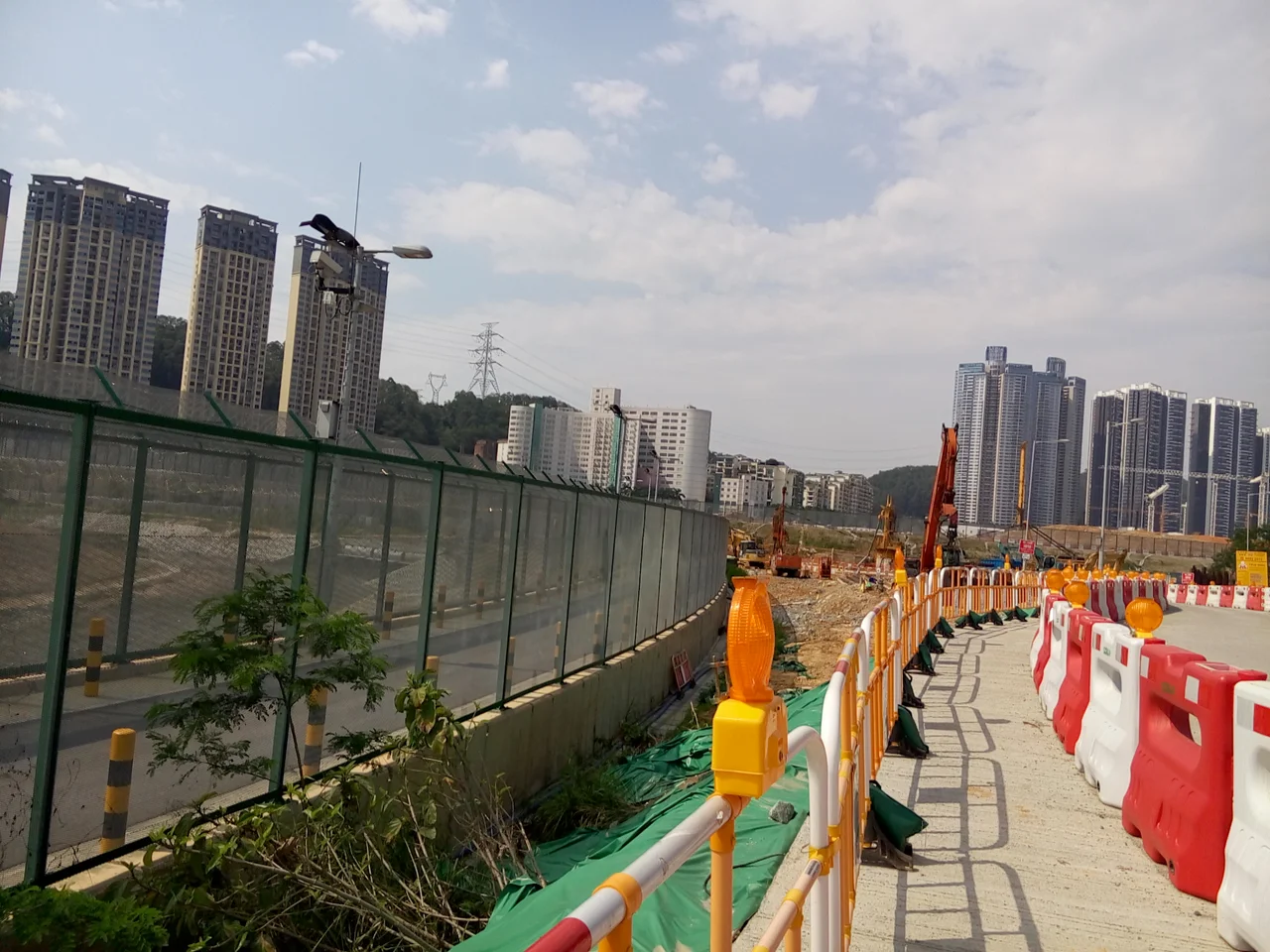

Frontier Closed Area
The fence went up in June 1951, and in a way it never really came down. Hong Kong Governor Alexander Grantham established the Frontier Closed Area under emergency powers, drawing a line of wire and patrol roads along the territory's northern boundary with mainland China. The original purpose was control — stopping illegal migration, gun smuggling during the Korean War, the clandestine crossings that Cold War geography made inevitable. What nobody fully anticipated was what happens to land when you keep people off it for seventy years.
A Line Drawn in 1951
The Cold War came to Hong Kong in the form of a fence. Governor Grantham's 1951 order created a regulated buffer strip running the full length of Hong Kong's land border, backed by checkpoints, police patrols, and a curfew for the villages caught inside. By 1952, with the Korean War at its height, a nighttime curfew confined residents to their homes from midnight to 4:00 a.m. unless they carried a special permit. The British Army held patrol duties until October 1992, when responsibility transferred to the Hong Kong Police's Field Patrol Detachment. The curfew itself was not lifted until August 1994, more than four decades after it began — a measure so routine by then that its end barely made headlines.
The Waves of 1962
If any single year defined the closed area's purpose, it was 1962. Thousands of people were attempting to cross into Hong Kong every day — not armed smugglers, but men, women, and families fleeing famine and upheaval on the mainland. The colonial government's response was a second, more robust fence of concertina wire, erected south of the original barrier in May of that year. Soldiers and police intercepted people in the hills, in the rivers, on the mudflats of Deep Bay. Most were turned back. The closed area's perimeter was the last obstacle before Hong Kong proper, and it was designed to hold. The human reality behind those statistics — the exhaustion, the fear, the reasons people walked through mountains at night to reach a fence — is part of the landscape too, even if it left no physical trace.
Unintended Wilderness
Restrict human settlement tightly enough, for long enough, and nature fills the space. The Frontier Closed Area, running from Mai Po Nature Reserve in the west across Starling Inlet to Sha Tau Kok in the east, became one of Hong Kong's most ecologically significant zones precisely because development was forbidden. The Mai Po Marshes — internationally recognized wetlands that host migratory waterbirds along the East Asian–Australasian Flyway — owe much of their survival to the closed area's cordon. Egrets, herons, and rare migratory species wintered in the reed beds and fishponds for decades while the rest of Hong Kong built upward. When proposals emerged to reduce the closed area's extent, environmentalists and WWF raised urgent concerns about the ecological cost. They were not wrong to worry.
Border Road and What Remains
Border Road — the northernmost road in Hong Kong, running along the south bank of the Sham Chun River — captures what the closed area has become in its reduced modern form. Since January 2016, it is one of the last stretches still subject to full restriction, open only to patrol vehicles and closed absolutely to the public. The road begins at Mai Po and traces the river east, keeping one eye on Shenzhen's glittering skyline across the water. The contrast is striking even from the air: on the Hong Kong side, green hillsides and wetland; on the Shenzhen side, one of the most vertical city skylines in Asia. A Closed Area Permit remains required for anyone wishing to enter the remaining restricted zones. The permit exists; the area persists. Some borders, it turns out, are harder to dissolve than the politics that created them.
From the Air
The Frontier Closed Area lies at approximately 22.53°N, 114.10°E along Hong Kong's northern boundary. From the air at 4,000–6,000 feet, the zone is identifiable by the conspicuous green buffer strip running between the urban density of Shenzhen to the north and the New Territories settlements to the south. The Sham Chun River (Shenzhen River) marks the international boundary and is visible as a narrow waterway dividing the two territories. Mai Po Marshes appear as an intricate wetland pattern at the western end. The nearest major airport is VHHH (Hong Kong International), approximately 30 kilometers to the southwest. ZGSZ (Shenzhen Bao'an International) lies roughly 40 kilometers west-northwest, across the bay.
Nearby Stories
- Hong Kong Disneyland 4.1 km away
- Mount Guanyin (Dongguan) 7 km away
- 2024 Lixinsha Bridge Collapse 7.4 km away
- Portas do Cerco 12 km away
- Lotus Hill 15 km away
- Nanxiong Formation 78 km away
- Heyuan 130 km away
- Checheng Fu'an Temple 629 km away