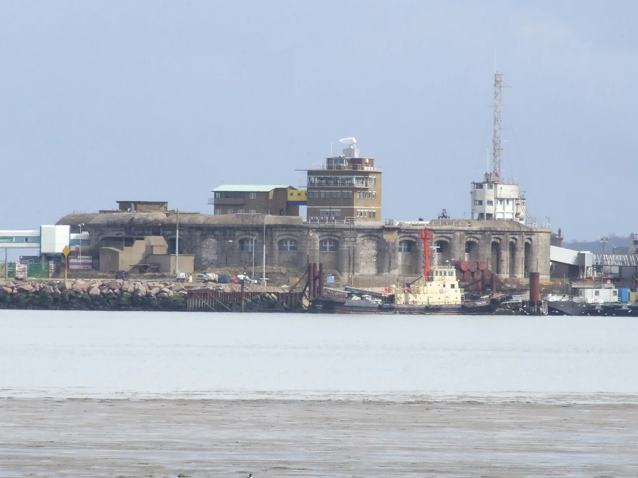

Garrison Point Fort
Thirty-six heavy guns once aimed from this peninsula across the wide grey water where the Medway joins the Thames. The breech of each one rested in a granite casemate four metres deep, sealed behind two thousand tons of wrought iron armour. The Royal Commission of 1860 had been clear: if a French fleet was ever to steam up the Thames toward London, this was where it had to be stopped. The fort the commissioners ordered was finished in 1872, by which time relations with Napoleon III's France had warmed considerably and the dreaded invasion never came. The guns waited a hundred years and never fired in anger.
The Long Habit of Fortification
Garrison Point has been fortified since at least 1547, when Henry VIII's coastal defences included a square stone blockhouse at the tip of Sheppey. The blockhouse stood for a hundred and twenty years until the most humiliating day in Royal Navy history: 12 June 1667, when Dutch admiral Michiel de Ruyter sailed his fleet through these defences in the Raid on the Medway and burned three of England's largest warships at their moorings. The blockhouse was destroyed in the same action. In 1669 the Crown commissioned a new bastion fort here from Bernard de Gomme, the Dutch-born military engineer who had also designed Tilbury Fort upriver. Two more batteries - Half Moon and Cavalier - were added later. By the 1850s, however, the rifled artillery and ironclad warships of a new industrial age made all of it obsolete in a single decade.
Palmerston's Folly
Lord Palmerston, Prime Minister in 1859, was convinced that Napoleon III's France posed an existential threat. The Royal Commission on the Defence of the United Kingdom, appointed at his urging, recommended that some seventy forts and batteries be built around the coast - the largest peacetime fortification programme in British history. Critics called them Palmerston's Follies because they were never tested in war and were obsolete almost the moment they were finished. Garrison Point was one of two semi-circular casemated forts in the programme - the other being Picklecombe in Cornwall. Construction began in February 1861 and the final iron shielding went up in June 1872. Seventeen casemates on each of two floors faced the river, all of them armoured. The walls and piers were four point four metres thick. The magazines were tucked into the basement below the waterline.
Designed for an Invasion That Never Came
The arc of fire from Garrison Point overlapped with Grain Fort and Grain Tower on the opposite bank of the Medway and with Grain Wing Battery and Dummy Battery further north - a coordinated kill zone that any attacking fleet would have had to cross under sustained gunnery. Two more turrets were planned for the roof but never built; budgets ran short, and by the 1880s the threat from France was clearly receding. Behind the casemates, a row of defensible buildings in Kentish ragstone closed off the rear of the fort with loopholes for close defence. Inside that crescent of stone and iron lay an open parade ground where soldiers drilled and the day-to-day administration of the garrison played out. A Brennan Torpedo station was installed late in the century - one of the earliest guided weapon systems anywhere, using two trailing wires to steer a torpedo toward an attacking ship.
The Ferry and the Decay
The fort was decommissioned in 1956 and the army moved out. Twelve years later, Sheerness Docks was reopened as a commercial port. The fort, sitting at the eastern entrance of the harbour, was awkward to demolish and so was kept and adapted. In the 1980s it briefly served as a ferry terminal: passengers walked through one of the original armoured casemates to board ships bound for Vlissingen and Zeebrugge. The ferries are gone now. The fort was Grade II listed in 1977 and forms part of a scheduled monument that includes the wider Sheerness defences, but it sits inside the operational area of the port and is not open to the public. English Heritage describes it as in "slow decay" and lists it on the Heritage at Risk Register. Many original fittings have been stripped, but the Brennan Torpedo launching rails are still in place, corroding inside their crumbling chamber.
What the Cranes See
Visit the seafront at Sheerness today and you can see Garrison Point from the public promenade - a low curve of weathered brick and iron lying behind the dock cranes, with the wide grey estuary stretching away beyond. To the south the Sheerness Dockyard buildings, dating from before the fort, are still in commercial use as a roll-on roll-off port handling cars and forest products. On the far side of the Medway, Grain Fort and Grain Tower stand among the gas terminals and refineries of the Isle of Grain. The estuary is one of the busiest stretches of water in northwestern Europe, lined with the relics of every era of British coastal defence - and not one of them ever stopped what it was built to stop. Sometimes that counts as a kind of success. The fleets that didn't come can't say they were not deterred.
From the Air
Garrison Point Fort sits at 51.45°N, 0.74°E at the north-western tip of the Isle of Sheppey in Kent, where the Medway empties into the Thames Estuary. Recommended viewing altitude is 2,000-3,000 feet. The semicircular fort is just visible behind the line of dock cranes; look for the long curved breakwater extending from the peninsula, and the matching Grain Fort directly opposite across the channel. Nearby airfields: London Southend (EGMC) about 7 nm north across the estuary, Rochester Airport (EGTO) 12 nm southwest. The site lies under busy approach paths and within the London TMA - coordinate with ATC.
Nearby Stories
- Royal Tunbridge Wells 6.6 km away
- Broadstairs 6.8 km away
- Belmont Castle 8 km away
- White House Farm murders 10 km away
- Port Lympne Mansion 12 km away
- North Weald Airfield 14 km away
- Battle of the Narrow Seas 17 km away
- Maunsell Forts 25 km away