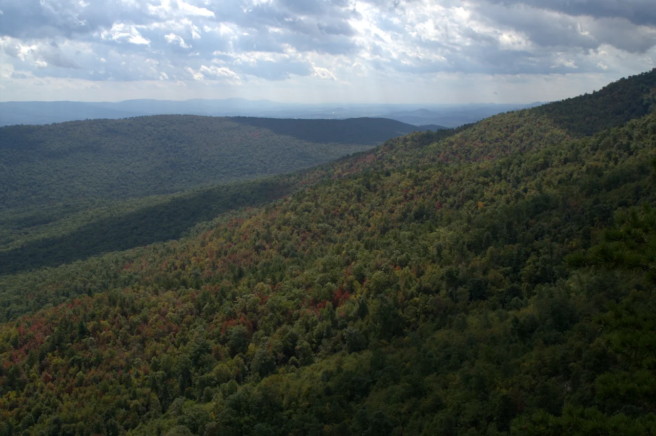

George Washington and Jefferson National Forests
On April 17, 1933, the first 200 young men of the Civilian Conservation Corps arrived at a camp near Luray, Virginia, in what was then the George Washington National Forest. The camp was designated NF-1 and named Camp Roosevelt, for the president whose first hundred days had just put it there. It was the first of more than 4,500 CCC camps that would eventually employ over three million unemployed young Americans during the Great Depression. They planted trees, cut firebreaks, built roads, fought fires, and earned $30 a month - most of which they sent home to their families. The forest where it all started is now part of a 1.8-million-acre national forest stretching from the Pennsylvania line south through Virginia and into Kentucky.
Two Forests, One Administration
The George Washington National Forest, established in 1918, covers the northern Allegheny and Blue Ridge ranges in Virginia and West Virginia. The Jefferson National Forest, established in 1936, covers the southern Virginia mountains and extends into Kentucky. In 1995, the Forest Service merged the two units administratively into the George Washington and Jefferson National Forests, with a single supervisor's office in Roanoke. The forests together cover approximately 1.8 million acres - a vast contiguous tract of Appalachian highland that crosses three states. Most of what was once virgin hardwood and hemlock was logged in the late 19th and early 20th centuries; what stands today is mostly recovered second-growth, mature now but still younger than the trees that once shaded the same ridges.
Wilderness Within the Forest
The forest contains 139,461 acres of designated wilderness across multiple individual areas, including Ramsey's Draft, the Mount Rogers area, and dozens of smaller tracts. In 2012, the New River Group of the Sierra Club commissioned a study of roadless areas in the forest and grouped them into eleven clusters - Glenwood, Craig Creek, Barbours Creek-Shawvers Run, Sinking Creek Valley, Mountain Lake Wilderness, Angels Rest, Walker Mountain, Kimberling Creek, Garden Mountain, Mount Rogers, and the Clinch Ranger District. Some have since received formal wilderness designation. Others remain unprotected, dependent on Forest Service management plans that can change with each administration. The forest is one of the largest contiguous tracts of public land east of the Mississippi, and many of the central Appalachians' remaining old-growth stands survive within it.
Pipelines and Protest
In 2018 and 2019, the Mountain Valley Pipeline became one of the most contested infrastructure projects in the Eastern United States. The 303-mile natural-gas pipeline would cross the Jefferson National Forest and the Appalachian Trail near Peters Mountain. Protesters set up tree-sits to delay construction. A Virginia Tech professor, Pamela Krish, locked herself to pipeline construction equipment. The U.S. Forest Service issued arrest warrants. The pipeline was completed in 2024 after multiple court battles and federal legislation that effectively overrode some environmental review requirements. The episode showed how a national forest, in theory set aside for conservation and public use, can be repurposed for industrial easements when the legal and political tides shift.
Camp Roosevelt and the Long Memory
Camp Roosevelt, where CCC NF-1 was established in 1933, is now the Camp Roosevelt Recreation Area near Luray. Picnic tables and interpretive signs occupy the spot where young men once lived in barracks and learned forestry. The CCC reforested millions of acres of degraded land, built infrastructure that the Forest Service still uses, and gave a generation of young men - many of them from cities, many from immigrant families - their first contact with the Appalachian forests. The work they did is visible all over the George Washington and Jefferson today: the stone retaining walls, the picnic shelters with peeled-log roofs, the trail networks. In 2023, a small plane carrying four people strayed into restricted Washington airspace, was intercepted by F-16s, and crashed in the national forest after the pilot lost consciousness. There were no survivors. The accident is a reminder that even a forest this large remains, somehow, tied to the broader geography of American life.
From the Air
Located across an area centered near 38.5N, 79.0W, the George Washington and Jefferson National Forests cover roughly 1.8 million acres across Virginia, West Virginia, and Kentucky. The forests stretch from the Pennsylvania line south to the Tennessee line. Recommended viewing altitude is 6,500 to 9,500 feet for broad views of the long parallel ridges and intervening valleys. Many small airports serve the area; Shenandoah Valley Regional (KSHD) and Roanoke (KROA) are among the most prominent. Watch for ridge-induced turbulence, rapid weather changes in the highlands, and reduced visibility in summer haze.
Nearby Stories
- Lighthorse Harry Lee Cabin 5.2 km away
- Grand Caverns 10 km away
- Allegheny Mountains 17 km away
- Belle Grove Plantation 21 km away
- Sinks of Gandy 22 km away
- Montpelier 23 km away
- Bath County Pumped Storage Station 33 km away