
Grand Caverns
A seventeen-year-old distillery manager named Bernard Weyer crawled into a hole on the Amend family's land in 1804, looking for a trap he had set for a small animal. He never found the trap. He did find a cavern that stretched for miles beneath the Shenandoah Valley, decorated with rare shield formations and rooms tall enough to hold a cathedral. Two years later, Matthias Amend opened it as a commercial show cave. It has been open ever since - longer than any other show cave in the United States. Stand inside Cathedral Hall today and you are looking at limestone first marketed to paying visitors when Thomas Jefferson was still in the White House.
America's First Show Cave
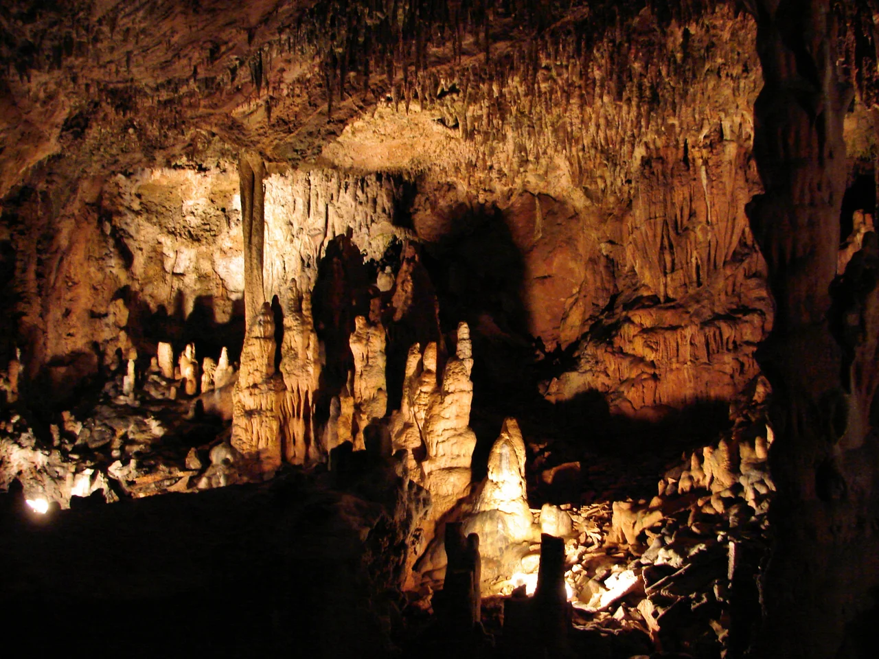
Grand Caverns - originally Weyer's Cave, before that Amend's Cave - opened to the public in 1806. The early operators advertised in Richmond and Washington newspapers, and 19th-century travel diaries record gentlemen and ladies arriving by coach to descend the wooden stairs Amend installed. The big rooms drew the biggest crowds. Cathedral Hall, the most spectacular of them, runs 280 feet long and stands more than 70 feet high - among the largest cave rooms in the eastern United States. Other named features, given Victorian flourish, include Bridal Veil, the Tapestry Room, Stonewall Jackson's Horse, and Dante's Inferno. The lithograph artists who came in the 1850s exaggerated little; the formations are genuinely dramatic.
Soldiers in the Dark
During the Civil War, both Union and Confederate soldiers visited Grand Caverns. Stonewall Jackson camped near Port Republic during his 1862 Valley Campaign and allowed his troops to tour the cave; later, Union soldiers came through during their own campaigns. Over 230 of these soldiers signed their names on the cave walls, most in pencil, some in soot. The signatures survive because the cave's stable temperature and humidity preserve almost everything left in it. One reads W.W. Miles, dated September 26, 1864. To stand in front of these signatures is to face a strange democracy of war - young men from opposite sides of the conflict, all spending an off-duty afternoon doing what tourists do anywhere, scratching their names where they hoped someone would later see them. Many of them did not survive the war.
Shields and Speleothems
The cave forms in Cambrian limestone and dolomite half a billion years old. Grand Caverns is best known among cavers for its shield formations - rare paired discs of calcite that grow outward from cave walls like dinner plates seen edge-on. The mechanism by which shields form is still debated; nowhere else in the eastern U.S. has them in such abundance. The National Park Service designated Grand Caverns a National Natural Landmark in 1973 explicitly for the shields. The cave also boasts the full repertoire of speleothems: stalactites hanging from the ceiling, stalagmites rising from the floor, the slender connecting columns that form where they meet, and translucent draperies that ripple along the walls.
A Cave That Keeps Growing
In 2004, cavers from the National Speleological Society resurveyed the cave for the first time since the 1930s. After mapping the original 2,651 meters of commercial passage, they squeezed through a 20-centimeter gap and discovered another 3,432 meters of unexplored cave beyond. The new passages are extraordinary - a dry northern section so brilliantly white the surveyors named it New Mexico, and a southern section of huge breakdown rooms, the largest of which (Kentucky) measures over 100 by 40 meters. The new sections remain closed to the public to protect their formations. The total surveyed length now stands at over six kilometers, making Grand Caverns the 215th longest surveyed cave in the United States. After more than two centuries of tours, much of what lies beneath the Shenandoah Valley is still being mapped.
From the Air
Located at 38.2603N, 78.8353W in Grottoes, Virginia, in the central Shenandoah Valley. Recommended viewing altitude is 4,500 to 6,500 feet for views of the cave's surrounding park and the surrounding karst landscape - look for the karst topography of small sinkholes scattered through the valley floor. The Blue Ridge rises to the east; Massanutten Mountain runs through the valley to the north. Nearest airport is Shenandoah Valley Regional (KSHD) about 12 nm northwest; Charlottesville-Albemarle (KCHO) is 30 nm east across the Blue Ridge.
Nearby Stories
- Rockingham County 4.8 km away
- Shenandoah: The Skyline Drive Through America's Oldest Mountains 5.6 km away
- 2023 Virginia Cessna Citation Crash 16 km away
- Highland County, Virginia 16 km away
- Montpelier 20 km away
- Fork Union Military Academy 26 km away
- Battle of Greenbrier River 28 km away
- Alleghany County, Virginia 53 km away