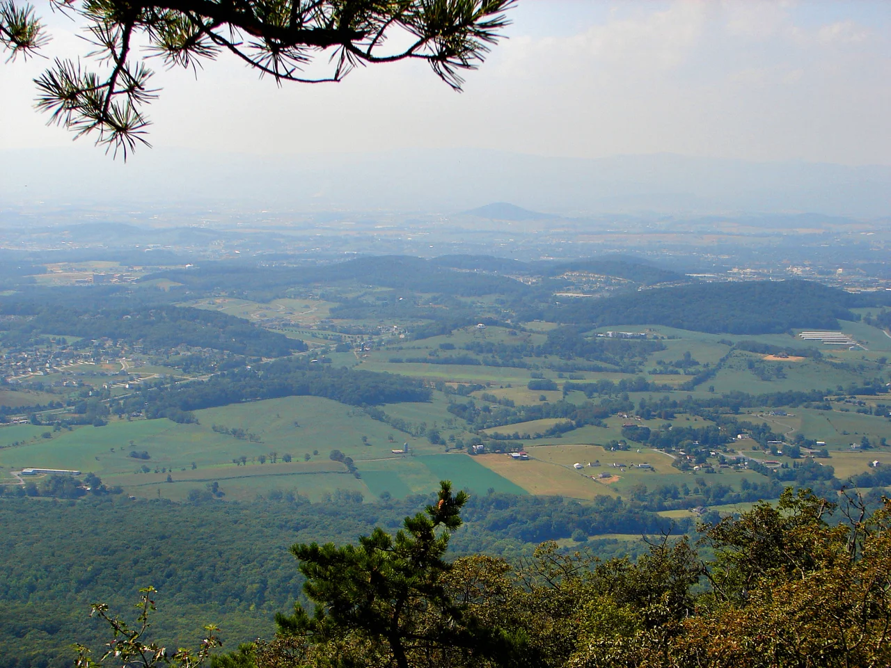

Rockingham County
In 1727, a German-born settler named Adam Miller staked a claim on the South Fork of the Shenandoah River, becoming the first known European to settle what is now Rockingham County. He had come south from Lancaster County, Pennsylvania, drawn by reports about a lush valley west of the Blue Ridge that he'd heard during a trip through eastern Virginia. In 1741 he bought 820 acres including a large lithia spring near Elkton, and he lived there until he died. The migration he initiated would, over the following decades, populate the central Shenandoah Valley with German Lutherans, Scots-Irish Presbyterians, Swiss Mennonites, and English Quakers - a cultural mix that still defines Rockingham County today.
Named for a Friend of America
When the Virginia legislature carved Rockingham County out of larger Augusta County in 1778, they named it for Charles Watson-Wentworth, the 2nd Marquess of Rockingham. He was an unusual honoree for the Revolutionary moment - a British statesman, not an American patriot - but the choice was deliberate. Rockingham had served as British prime minister twice and had vocally supported American constitutional rights. He brought about the repeal of the Stamp Act of 1765, reducing the tax burden on the colonies that had so inflamed Boston and elsewhere. In his second term, in 1782, he backed independence for the Thirteen Colonies and began the process of ending British involvement in the war. He died after only fourteen weeks in office. Virginia, in the same year the county was created, was simultaneously renaming Dunmore County - which had honored the deeply unpopular royal governor John Murray - to Shenandoah County. Rockingham got to stay. Three other American counties and a North Carolina city are also named for him.
Geography Between Two Mountain Ranges
Rockingham covers 853 square miles - the third-largest county in Virginia by land area. It stretches east-west across the entire width of the Shenandoah Valley, from the easternmost Allegheny Mountains on the West Virginia border to the crest of the Blue Ridge along the Greene County line. Massanutten Mountain bisects the valley through the county's center - a long parallel ridge that separates the German River and North Fork Shenandoah River on its west from the South Fork on its east. Large portions of Rockingham are protected: Shenandoah National Park on the eastern Blue Ridge, the George Washington National Forest on the western Alleghenies. Reddish Knob, on the West Virginia line, is in Rockingham at 4,397 feet. So is the volcanic remnant of Mole Hill. The county's 83,757 residents are distributed across a landscape where farmland alternates with national forest and mountain peaks visible from almost every road.
Lincoln's Father, Mennonite Farms
Thomas Lincoln - Abraham Lincoln's father - was born in Rockingham County in 1778, the same year the county was established. The Lincoln Homestead and family cemetery near Broadway remain. So does the broader Mennonite, Brethren, and Anabaptist presence that made Rockingham one of the densest concentrations of peace churches in the South. Bridgewater College (1880) and Eastern Mennonite University (1917) - both Anabaptist-affiliated - sit within county lines, alongside the state's massive James Madison University in Harrisonburg. The interplay between conservative pacifist farmers, secular state universities, immigrant poultry workers, and student populations gives the county a complex political identity. It votes reliably Republican in most elections - Lyndon Johnson in 1964 was the last Democratic presidential nominee to carry the county - and has pockets of progressive politics in and around the campuses.
Poultry, Roads, and Trains
Rockingham County is one of the country's largest poultry-producing regions. The processing plants in Dayton and elsewhere drew waves of Latino and refugee workers in the late 20th and early 21st centuries; the 2018 strikes at the Dayton Cargill plant marked a moment when those workers organized publicly. Interstate 81 runs the entire length of the county north-south, paralleling U.S. Route 11 - which itself follows an old Native American trail later known as the Valley Turnpike. U.S. Route 33 crosses the county east-west, climbing the Blue Ridge to Swift Run Gap at 2,365 feet where it meets Skyline Drive and the Appalachian Trail. Norfolk Southern's main north-south corridor passes through the county along the same route. From an aircraft, the county looks like a geography textbook: parallel ridges, a wide central valley, a single bisecting mountain, and a road grid that has been laid down along these features for three hundred years.
From the Air
Located at approximately 38.52N, 78.88W in the central Shenandoah Valley. The county stretches east-west from the Allegheny crest to the Blue Ridge crest, with Massanutten Mountain bisecting the valley through the middle. Recommended viewing altitude is 5,500 to 7,500 feet for views of the multi-ridge structure of the central Valley. The Skyline Drive runs along the Blue Ridge to the east; the George Washington National Forest extends west. Nearest commercial airport is Shenandoah Valley Regional (KSHD) in adjacent Augusta County. Watch for valley haze in summer and the distinct topography of Massanutten dividing the Valley floor.
Nearby Stories
- Lighthorse Harry Lee Cabin 5.2 km away
- Grand Caverns 10 km away
- Allegheny Mountains 17 km away
- Belle Grove Plantation 21 km away
- Sinks of Gandy 22 km away
- Montpelier 23 km away
- Bath County Pumped Storage Station 33 km away