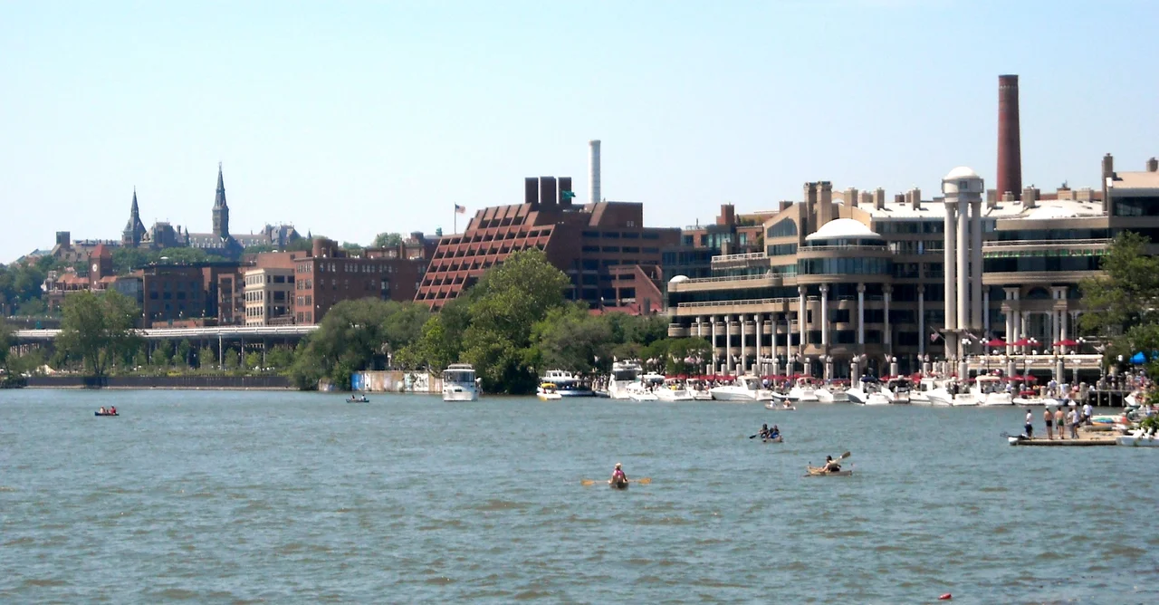

Georgetown (Washington, D.C.)
George Washington negotiated for the federal district from a tavern in Georgetown. Suter's Tavern stood near present-day Wisconsin Avenue and the canal, and Washington met repeatedly with the local landowners in its taproom in the spring of 1791 to assemble the land that would become the District of Columbia. The town the negotiations happened in was already forty years old at that point. Georgetown had been founded as a tobacco port in 1751 at the head of navigation on the Potomac, the farthest upstream that ocean-going vessels could reach. It was a working town when Washington bought it the land around it. It is now one of the wealthiest neighborhoods in the country, with the highest-priced rowhouses outside Manhattan and the deepest history in the District. Most of the rowhouses Washington walked past on his way to Suter's Tavern are still there.
Before the Federal City
In 1632 the English fur trader Henry Fleet documented an Algonquian village called Tohoga on the bluffs above the Potomac, home to the Nacotchtank people who had traded along the river for generations. The Maryland legislature authorized the establishment of a town here in 1751 to serve as a tobacco inspection point, buying sixty acres from George Gordon and George Beall for 280 pounds. The town may have been named after King George II, or after its two founders both named George. Robert Peter, an early merchant, served as the first mayor in 1790. The Old Stone House at 3051 M Street, built in 1765, is the oldest still-standing structure in Washington, D.C., and one of very few surviving pre-Revolutionary buildings in the federal district. Stephen Bloomer Balch founded a Presbyterian church in 1784. Trinity Catholic Church opened in 1795. The city's commercial life ran on tobacco, flour milling, and the river.
Absorbed by Washington
When the federal capital moved from Philadelphia to Washington in 1800, Georgetown became an independent municipality inside the new District of Columbia, one of three (along with Washington City and Alexandria). The town kept its own mayor, charter, and street names until 1871, when the District of Columbia Organic Act dissolved all three municipalities and combined them into a single territorial government. Georgetown's separate identity persisted in practice for another quarter century. In 1895 a second congressional act repealed all remaining Georgetown ordinances and renamed Georgetown's streets to match those of the rest of Washington. High Street became Wisconsin Avenue. Bridge Street became M Street. The change was bitterly resented at the time. Georgetown had been older than Washington and had not asked to be absorbed.
Slavery, Free Communities, and the Mount Zion Church
The 1800 census showed Georgetown with 5,120 people, of whom 1,449 were enslaved and 227 were free Black residents. Slave trading was active in the town: John Beattie ran a business on O Street starting in 1760, and other slave dealers operated near M Street and Wisconsin Avenue. The trade was banned in the District as part of the Compromise of 1850, and Congress abolished slavery itself in the District on April 16, 1862, eight months before the Emancipation Proclamation. Mount Zion United Methodist Church, founded in 1816 and the oldest Black congregation in Washington, started because Black members of Dumbarton Methodist Church were forced to sit in a hot, overcrowded balcony. The original Mount Zion meetinghouse burned in the 1880s and was rebuilt at its present site on 29th Street. The Mount Zion Cemetery, on what was called Herring Hill in eastern Georgetown, offered free burials for the District's earliest Black families and survives today as one of the most important Black historical sites in the city.
Decline and Preservation
The Chesapeake and Ohio Canal, begun on July 4, 1828, was meant to revive Georgetown's port economy after the river silted up below the falls. The canal reached Cumberland in 1850, eight years after the Baltimore and Ohio Railroad got there, and was never profitable. Flour milling and other industries declined through the late nineteenth century. The waterfront became increasingly industrial. By the early twentieth century Georgetown was one of the poorer neighborhoods in Washington, with rowhouses that had been split into rental units and large numbers of African American residents who had moved in after the Civil War. The Olmstead Plan and the New Deal redirected federal attention here in the 1930s. The Old Georgetown Act of 1950 created a historic district and a permanent design review process. White professional families began buying and restoring the old rowhouses in large numbers in the late 1940s and 1950s, displacing many of the Black families that had lived in them for generations. The neighborhood that emerged is preserved, beautiful, and almost entirely white.
Twenty-First Century Georgetown
Today Georgetown is one of the most expensive residential neighborhoods in the United States. The commercial core at M Street and Wisconsin Avenue holds high-end retail (the Georgetown Park mall has been redeveloped into a more boutique format), bars, and restaurants. The waterfront at Washington Harbour has been reclaimed for restaurants and offices. Georgetown University occupies a 104-acre campus on the western edge of the neighborhood with Healy Hall's clock tower visible across the Potomac. Embassies of Cameroon, France, Iceland, Liechtenstein, Mongolia, Sweden, Thailand, Ukraine, and Venezuela occupy historic houses scattered through the residential blocks. The Old Stone House is open to the public. The C&O Canal towpath begins here. The cherry trees along the Tidal Basin owe their existence in part to William Howard Taft's first lady Helen, who had lived briefly in Georgetown. The 27,000 residents who live here today walk past a town that George Washington negotiated in two hundred and thirty-five years ago.
From the Air
Georgetown sits at 38.9076 degrees north, 77.0623 degrees west, in northwest Washington on the bluff above the Potomac at the western end of the District. Best viewed at 1,500 to 2,500 feet AGL with the Key Bridge and Theodore Roosevelt Island clearly visible. Reagan National (KDCA) is four nautical miles south. The site sits inside the P-56 prohibited area; viewing is from authorized riverside approaches.
Nearby Stories
- Gunston Hall 1.1 km away
- 2023 Baltimore Shooting 4.9 km away
- Battle of Middleburg 6.6 km away
- Crownsville Hospital Center 10 km away
- Battle of Loudoun Heights 13 km away
- First Battle of Rappahannock Station 20 km away
- Howard County, Maryland 21 km away
- Harriet Tubman Underground Railroad 50 km away