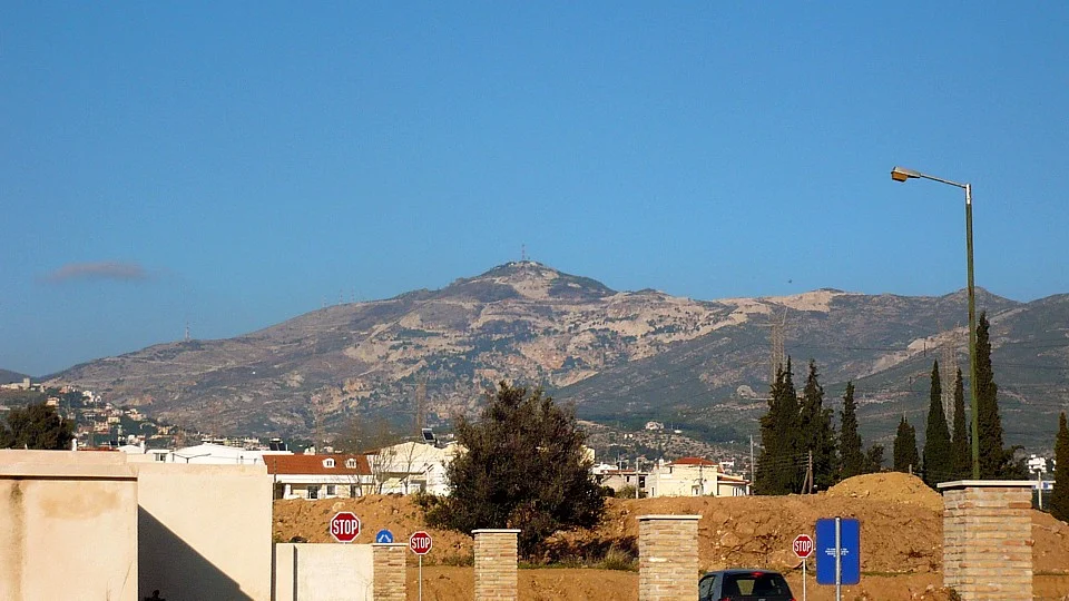

Gerakas
In 1967, a handful of settlers near an old railway station petitioned the prefecture to recognize their patch of Attic farmland as a proper community. They were turned down. They tried again in 1974, and again the request stalled. Not until 1980 did the East Attica Prefecture finally grant approval and let the new commune choose its name. The residents held an informal vote among three candidates, Gerakas, Stavros, and Gargittos, and picked Gerakas. Within a generation that hard-won village of farmhouses would explode into one of the fastest-growing suburbs in all of Athens.
The Hawk's Name
The name Gerakas means hawk, and it comes from a man, not a bird. In the sixteenth century a grand logothete named Ierakas, a senior church official, owned large tracts of land here that were caught in a dispute between Saint Timotheos and Saint Philothei. To resolve the quarrel he surrendered his titles, and in gratitude the region took his name. Ierakas derives from ierax, the ancient Greek word for hawk, which became geraki in modern Greek. But the land had older names still. To the ancients it was Gargettos, a deme set in the heart of the Mesogeia, the inland plain of Attica named because it sits farthest from the sea, at the very center of the land.
Epicurus's People
Gargettos has a famous son, though he was born somewhere else. The philosopher Epicurus, who taught that pleasure rightly understood is the absence of pain and built his school in a garden, was Athenian by descent through this very deme. His parents, the schoolteacher Neocles and his wife Chairestrate, came from Gargettos before settling as colonists on the island of Samos, where Epicurus was born around 341 BC. By Athenian custom a citizen belonged to his father's deme, so Epicurus carried Gargettos with him, the ancestral home of one of the most influential thinkers the ancient world produced. The man who taught Athens to seek tranquility traced his roots to this quiet corner of the Mesogeia.
Theseus and the Ambush
The plain around Gerakas saw older drama than any zoning dispute. In myth, when the hero Theseus returned to claim Athens, his rivals the Pallantides, the fifty sons of Pallas, plotted to seize the throne. They split their forces, setting an ambush at the northeastern gate of Hymettus at Gargettos to catch Theseus if he marched against them. The trap failed. Warned by a herald named Leo, Theseus struck first and scattered his enemies at Gargettos, securing his rule over Athens. Centuries later the plain saw real history too: in 546 BC the tyrant Peisistratos defeated his opponents near here at Pallini, then buried his fallen soldiers beneath grave monuments scattered across the fields of Gargettos and Pallini.
Shepherds, Mercenaries, and Monks
For most of its long history, Gargettos was a place people passed through or grazed across. Arvanite mercenaries from Epirus were sent into the Mesogeia around 1205 to guard the Frankish Duchy of Athens, and they stayed, bringing their language and place names. Sarakatsani shepherds drove their flocks down from the marble-rich slopes of Penteli to winter in the milder lowlands. Monks from the Penteli Monastery, founded by Saint Timotheos in 1578, used the old Saint Nikolaos church at Gargettos as a place of quiet asceticism. The famous marble of Penteli, the same stone that built the Parthenon, was worked in quarries on the heights above, and islanders from the Aegean came to labor in its workshops.
The City That Arrived Overnight
Then everything changed at once. The 2004 Athens Olympics poured infrastructure into northeastern Attica: the Attiki Odos motorway, the Hymettus ring road, and Metro and suburban rail stations at Doukissis Plakentias and Pallini. Marathonos Avenue was widened, farmland was carved into building lots, and Athenians fleeing the crowded center streamed in. By 2021 Gerakas held 33,856 residents packed at more than 5,000 people per square kilometer, set on a small plain that climbs from around 190 meters to 374 meters against the foothills of Penteli to the north and Hymettus to the south. Land that sold by the square meter for a few hundred euros in the early 2000s soared past two thousand. In two decades a village of scattered farmhouses became a dense modern suburb, the eastern gate into the Athens basin, growing almost faster than its streets and sewers could follow.
From the Air
Gerakas lies at approximately 38.023 N, 23.858 E, about 12 km northeast of central Athens and 2 km west of Pallini, in the Mesogeia plain of East Attica. It sits in a saddle between two mountains: Penteli to the north and Hymettus to the south, climbing from roughly 190 to 374 meters in elevation. The Attiki Odos motorway is a clear linear landmark cutting through the area, and the dense modern street grid distinguishes the suburb from the open plain to the east. The nearest airport is Athens International (Eleftherios Venizelos), ICAO LGAV, about 15 km to the east-southeast, an easy reference point on approach. Clear Attic skies make the contrast between the built-up suburb and the surrounding mountain slopes easy to read from the air.
Nearby Stories
- Great Sand Beach 5 km away
- Battle of Delium 7.7 km away
- Tower of Aliartos 9 km away
- HMHS Britannic 10 km away
- Saronic Gulf 15 km away
- Sousaki Volcano 17 km away
- Sanctuary of Apollo Maleatas 24 km away
- Skyros 66 km away