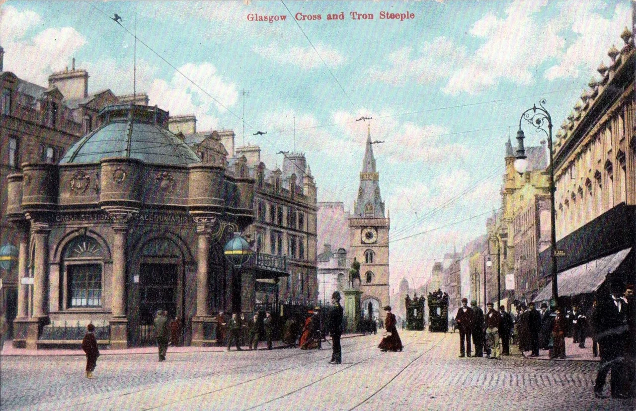

Glasgow Cross
Five streets meet at Glasgow Cross, the way they have for the better part of a thousand years. North runs the High Street, climbing toward the cathedral and the Necropolis hill. East goes the Gallowgate, opening out toward the city's East End. South drops the Saltmarket down to Glasgow Green and the river. West, Trongate becomes Argyle Street and threads through the modern city centre. At the centre of the crossroads stands a single survivor: the Tolbooth Steeple, all that is left of the 17th-century Glasgow Tolbooth, isolated now on a traffic island, still telling everyone who passes it where the old burgh used to begin.
The Heart of the Old Burgh
Glasgow Cross marks the notional boundary between the modern city centre and the East End, and it sits close to where the city first crossed the River Clyde. Before the bridge there was a ford, and before that a settlement that grew up around the cathedral on the hill, with the High Street running down from St Mungo's church to the river crossing. The Cross was, for centuries, the city's commercial heart. Merchants traded here. Trials and punishments were held here. Public proclamations were read here, often from the steps of the mercat cross, the symbol of the burgh's right to hold a market. When that medieval cross was lost, William George Black commissioned a replica in 1929, designed by the Scottish architect Edith Hughes — the first woman to practise architecture professionally in Britain. It still stands at the junction today, an old form rebuilt in modern stone.
The Surviving Steeple
The Tolbooth Steeple is the most recognisable thing here, a tall crow-stepped tower rising seven storeys above the traffic. It was once attached to a larger Tolbooth building that served as the city's jail, council chamber, and customs house all at once. The rest of the Tolbooth was demolished in the early 19th century when the city outgrew it and council business moved south to the Saltmarket. The steeple stayed. It stands alone now, a stone fragment from a vanished building, with the streets curving around its base. Photographs of Glasgow Cross from the 19th century — including a striking 1868 image by the Glasgow photographer Thomas Annan — show the steeple already isolated, already a survivor. It has been a survivor ever since.
The Tontine and the King
Next to the Tolbooth once stood the Tontine Hotel and its Assembly Rooms, designed from 1737 by the architect Allan Dreghorn and adapted in 1781 by William Hamilton of St Andrew's Square. The Tontine was the city's exchange centre: where merchants did deals, where political meetings were held, where the social life of the old burgh played out under candlelight. In front of it stood an equestrian statue of King William III, erected in 1735, now resited up the hill at Cathedral Square. Walk a short distance west along Trongate and you reach another quiet survivor: the Tron Theatre, built in 1794 as the Tron Kirk and now a working theatre and bar. After the Tolbooth Steeple, it is among the oldest buildings standing in the city centre.
A Junction Still
Beneath the junction, almost forgotten, sits the disused Glasgow Cross railway station, closed in 1964 and now sealed behind hoardings. Above ground, traffic still moves through the crossing in five directions, but the rhythm of the place has shifted. The wealth that once funnelled through here has moved west, toward Buchanan Street and the Merchant City. What is left at Glasgow Cross is the structure of the old burgh: the steeple, the mercat cross, the converging streets, and the sense that this is the point from which the city was measured. Stand under the steeple for a few minutes and you can pick out the geography of medieval Glasgow in the way the streets run. It is the kind of place that does not announce itself, but it is impossible to understand the city without it.
From the Air
Located at 55.857 N, 4.244 W where five streets converge at the foot of the High Street, just north of the River Clyde. From altitude Glasgow Cross reads as a small irregular junction with the Tolbooth Steeple as a distinctive vertical landmark. Glasgow Cathedral and the Necropolis sit roughly a kilometre to the north on rising ground; Glasgow Green opens south of the Cross toward the river. Glasgow Airport (EGPF) lies 9 nautical miles to the west. A low overflight at 1,500 to 2,500 feet on a clear day gives a clear view of how the radial streets fan out from this point — the underlying medieval geometry of the city is still visible from above.
Nearby Stories
- Mauchline 3.6 km away
- Shotts 4.2 km away
- HMS Ulysses (1917) 7.7 km away
- Rothesay Castle 8.8 km away
- Inchcailloch 10 km away
- Strachur 14 km away
- Battle of Dollar 16 km away
- Crawford Castle 16 km away