
Inchcailloch
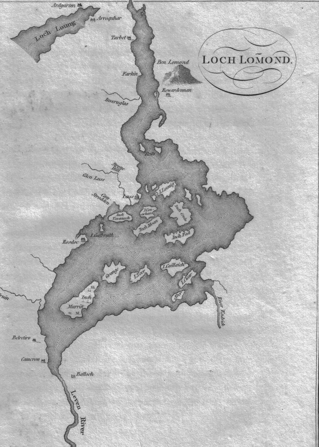
The name comes first. Inchcailloch - innis-na-cailliche in older Gaelic - means 'island of the cowled woman' or, more plainly, 'island of the old woman'. The woman in question was Saint Kentigerna, an Irish princess turned hermit, who left her homeland in the eighth century to preach Christianity in Scotland and is said to have settled, prayed, and died here on this small wooded island in Loch Lomond. The ruins of an old chapel and a burial ground in her name once stood somewhere on the island, though no certain trace of either survives. What does survive is the name, attached to an 85-metre-high oak-covered ridge that rises out of the loch's southern basin near the village of Balmaha.
Sitting on the Fault Line
Inchcailloch is geologically theatrical. The island sits directly on the Highland Boundary Fault - the great geological seam where the lowland sandstones of central Scotland meet the metamorphic schists and quartzites of the Highlands proper. Stand on the island's ridge and you are walking on a slice of the fault itself, conglomerate rock that erupted along the line when the two terranes ground against each other hundreds of millions of years ago. Three other islands in the same string - Inchmurrin, Creinch, and Torrinch - form a kind of stepping-stone trail across the fault as it crosses Loch Lomond. To the southeast lie the gentler lowlands; to the northwest, the Highlands rise abruptly. The island is a punctuation mark in the geology of Scotland.
Robert the Bruce's Hunting Forest
The island's recorded human use goes back at least to the early fourteenth century, when it was used as a hunting forest during the reign of Robert the Bruce. The crossing from Balmaha to the island is shallow enough that deer can ford it, and red deer still swim across to graze on the island today. White deer - rare colour-morphs - were seen on the island as recently as 2003. The island was farmed until the early nineteenth century; agricultural records from 1800 describe it as producing good wheat and oats, and the ruins of the old farm can still be found among the trees. For around 130 years after farming ceased, Inchcailloch was managed as an oak plantation, the timber harvested and processed at Balmaha (on the site of what is now the Highland Way Inn) for the production of wood vinegar (pyroligneous acid), wood tar, and dye for the textile mills.
Clan MacGregor's Sacred Ground
For Clan MacGregor - the broken, persecuted clan whose surname was for a century made illegal under Scottish law - Inchcailloch was sacred ground. The travel writer H.V. Morton visited in the 1930s and recorded the tradition: 'The isle is sacred to the MacGregors, and in the tangled branches and amongst the green trees is their ancient burial ground. It was on the halidom of him who sleeps beneath the grey stone of Inchcailloch that members of this vigorous clan used to take their oaths.' To swear by the bones of an ancestor buried here was the most binding oath a MacGregor could make. The grey stone Morton mentions is still on the island. So is the burial ground. The clan still gathers occasionally on the island, generations after the proscription of their name was lifted in 1774.
The Lady of the Lake
Walter Scott put Inchcailloch into national literature. In his long narrative poem The Lady of the Lake, published in 1810, the island appears under its older Gaelic spelling as the place where the yew trees grow whose wood is used to make a slender crosslet - the fiery cross summoning Clan Alpine (a poetic stand-in for the MacGregors) to arms. 'Whose parents in Inch Cailliach wave / Their shadows o'er Clan Alpine's grave, / And, answering Lomond's breezes deep, / Soothe many a chieftain's endless sleep.' Scott's poem swept Britain in 1810, inventing the modern tourist industry of the Trossachs almost single-handed. Suddenly Loch Lomond and its islands were a national pilgrimage site for romantic-minded Victorians. Inchcailloch acquired a reputation it has been carrying ever since.
A Reserve in the Reserve
Today Inchcailloch is part of the Loch Lomond National Nature Reserve. Visitors can take a small ferry from Balmaha across the shallow strait, walk the nature trail that loops around the wooded ridge, and visit the old burial ground. The oak woodland is one of the surviving fragments of the Atlantic oakwood that once cloaked much of western Scotland - the so-called Celtic rainforest, characterised by mossy ground, lichens, and ferns growing on every surface. From the summit on a clear day you can see Ben Lomond rising directly to the north, and the chain of smaller islands stretching south across the broad lower basin of the loch. Saint Kentigerna died here, somewhere around 734. The island has kept her name for thirteen centuries. The oaks have been here only a few human lifetimes. Some islands wear their history lightly. This one has it folded into the moss.
From the Air
Inchcailloch lies in the southern basin of Loch Lomond near 56.08N, 4.56W, just off the village of Balmaha on the eastern shore. The island appears from altitude as an oblong wooded ridge surrounded by water, with a low forested profile rising to 85 m at the summit. Best viewed at 2,000-4,000 ft AGL. The Highland Boundary Fault runs across the loch at this point - the line of small islands (Inchmurrin, Creinch, Torrinch, Inchcailloch) traces the fault visually from southwest to northeast. Ben Lomond rises directly to the north. Glasgow International (EGPF) is ~18 nm south-southeast; Cumbernauld (EGPG) ~16 nm east-southeast. Watch for low cloud over the loch and rapidly shifting visibility when fronts arrive from the west.
Nearby Stories
- HMS Repulse (1916) 0.6 km away
- Killin 6.5 km away
- Strachur 9 km away
- Shotts 9.3 km away
- Rothesay Castle 11 km away
- Tullibardine Distillery 12 km away
- Bonawe Iron Furnace 19 km away
- Dunkeld Cathedral 23 km away