
Glenbeigh
Diarmuid and Gráinne, the lovers of Irish myth, are supposed to have hidden in a cave in this valley while fleeing the wrath of the warrior Fionn. A few miles away, at Rossbeigh strand, Oisín and Niamh rode a white horse into the surf and disappeared into Tír na nÓg, the land of the young. Glenbeigh sits at the foot of the valley where both stories begin, a small village on the Ring of Kerry between the Behy River and the Atlantic. Its Irish name, Gleann Beithe, means valley of the birch tree, and the village is the kind of place where myth, archaeology, and weekend tourism all stand in the same intersection.
Rock Art on the Hills
The hills around Glenbeigh hold one of the highest concentrations of prehistoric open-air rock art in Ireland. The carvings belong to the Atlantic tradition: simple cup marks pecked into bedrock, sometimes surrounded by concentric rings, sometimes joined by radial grooves running outward like the spokes of a wheel. Most date to the late Neolithic or early Bronze Age, between roughly 2300 and 1500 BC. There is an especially dense cluster near Coomasahran Lake. Nobody knows for certain what the carvings meant. They mark territory, perhaps; they map something, perhaps; they belong to a system of belief that no longer leaves any other trace. The stones sit in pasture today, half hidden in heather, and most walkers pass over them without noticing. Four thousand years ago, someone climbed up here with a stone hammer and a stone chisel and spent hours making them. The hammer is gone. The marks are still there.
Wynne's Folly
Near the village stands the ruin of Glenbeigh Towers, also known as Wynne's Folly. It was built in the nineteenth century by the local landlord, the Wynne family of Glenbeigh, and it is one of those grand Victorian piles whose name now sums up its fate. The Record of Protected Structures lists six buildings in the parish, including the tower, both the Church of Ireland and the St James Catholic Church, the Towers Hotel, the Glenbeigh Hotel, and a single cottage. The Towers Hotel still trades on the family name. The folly itself has lost its roof and most of its dignity, but the shell of it, with the Reeks visible behind, is the kind of ruin that gives Kerry valleys part of their character: a half-empty stage where someone once tried to live like the gentry of a wetter, colder England.
Rossbeigh and the Land of the Young
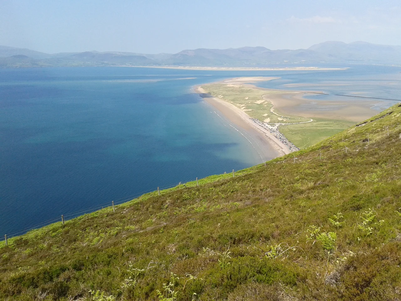
Rossbeigh strand stretches out into the bay just below the village, a Blue Flag beach with a sandy spit running northeast almost to the Inch peninsula on the far side. At low tide the mudflats expand. Across the bay you can see Seefin Mountain on the Dingle side. The Behy River runs down the western edge of the village to meet the sea at Rossbeigh Creek; to the north it links to Lake Caragh, and to the south the smaller lakes of Coomaglaslan and Coomasaharn fill steep glacial hollows. The whole valley sits inside two candidate Special Areas of Conservation, which means the conservation regulations are tight. The mythology is even older. Niamh of the Golden Hair, daughter of the king of Tír na nÓg, is said to have taken Oisín, son of Fionn, away from this very strand on a white horse, riding west across the surf to the land of the young. Three hundred years later Oisín returned to find Ireland Christianised and his old companions long dead. The story is old enough to have outlasted the language it was first told in.
A Stop on the Ring of Kerry
Practically speaking, Glenbeigh is what local-area plans call a service centre, with a Garda station, a community centre, a church, two hotels, and the kind of small high street that empties out at six on a Tuesday and fills up at eleven on a Saturday. It sits where the N70, the Ring of Kerry road, meets the village, and it is one of the natural overnight stops for the touring circuit that brings buses around the Iveragh Peninsula. The Kerry Way, a long-distance walking trail, runs through the village as well, and walkers come down off the hills in the evenings looking for dinner. Outside the season, when the buses thin out, Glenbeigh becomes its winter self: a small valley village under birch trees, a few lights against the dark of the mountain, the bay sighing somewhere on the other side of the dunes.
From the Air
Glenbeigh sits at 52.058 N, 9.938 W, on the N70 Ring of Kerry road at the head of the valley of the Behy River. From the air the village is a small cluster of slate roofs in green pasture, with Rossbeigh Strand reaching north into Dingle Bay and Coomasaharn Lake set in a steep amphitheatre to the south. Nearest airport is Kerry (EIKY) about 25 km north-east; Shannon (EINN) lies about 95 km north. Best viewing altitude is 1,500 to 4,000 ft, ideally on a westerly approach that sweeps along Rossbeigh strand toward Inch on the far side. Expect strong onshore breezes and rapidly building cloud over the Reeks just inland.
Nearby Stories
- Inishtooskert 2.5 km away
- Staigue stone fort 5.6 km away
- Listowel 7.1 km away
- Castleisland 13 km away
- Ballyheigue Castle 13 km away
- Kealkill stone circle 15 km away
- RMS Carinthia (1925) 93 km away
- Sao Miguel 1951 km away