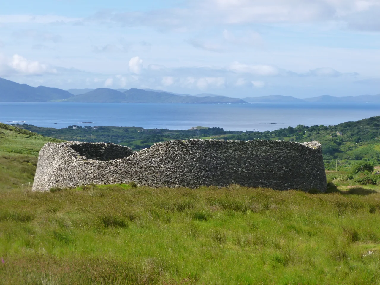

Staigue stone fort
Imagine a building eighteen feet high, ninety feet across, with walls thirteen feet thick at the base. Now imagine it was built without mortar, by people who did not yet know how to write down what they were doing, somewhere between 300 and 400 AD. And imagine that it is still standing, almost intact, in a green Kerry valley above the sea. Staigue stone fort is what survives when you build something properly and then nobody bothers to take it apart. It is one of the largest and finest preserved ringforts in Ireland. It looks, when you first see it from the road, like a low circular mountain. It is a building, and people lived in it.
The Geometry of Defence
Staigue sits at the head of a valley that opens south to the sea, eighteen kilometres west of Sneem. The fort is a perfect circle, 27.4 metres - ninety feet - in diameter, surrounded by a ditch over eight metres wide and presently 1.8 metres deep. The walls rise to 5.5 metres - eighteen feet - at their highest, and they are four metres - thirteen feet - thick at the bottom, tapering as they rise. The only way in is through a single passage 1.8 metres long, roofed with massive stone lintels laid across the gap, and closed by a tapered doorway just wide enough for a person at a time. Inside the wall, the builders cut an elaborate network of stairways that climb to terraces high up on the inside face of the rampart, with small corbelled cells - little stone rooms - tucked into the thickness of the masonry. It is not a wall. It is a building with a wall around its interior.
How You Build Without Mortar
Drystone construction relies entirely on the careful fitting of one stone against another. There is no cement, no clay, no anything between the stones except their own weight pressing them together. The builders of Staigue used undressed local sandstone - rough quarried blocks, more or less rectangular but not finely cut. They graded the sizes carefully, used the largest stones at the base where the weight was greatest, and worked upward with progressively smaller stones. Vertical joints visible in the wall today show that the builders left temporary gaps as the wall went up, presumably to bring materials and people through, and then filled the gaps in once the structure was higher. The result has stood for roughly 1,700 years with only modest collapse at the top. Modern engineers who study Staigue come away impressed.
What It Was For
Archaeologists generally interpret Staigue as a high-status ringfort - a defended residence for a local lord or king and his immediate household. There is evidence that copper was excavated in the surrounding area, suggesting the wealth that paid for the construction came partly from metal production and trade. But the fort is too elaborate to be only a house. The corbelled cells in the wall, the terraces, the careful proportions all suggest some ceremonial function too. Suggestions over the years have included a place of worship, an astronomical observatory, a gathering site for tribal assemblies. Probably it was several things at once. Pre-Christian Ireland did not separate the political, the religious and the practical the way later cultures would.
The Valley and the View
Walking up to Staigue from the road, you cross a small wooden bridge and a stile, then climb a stretch of grazing land that rises gently toward the fort. The valley opens behind you, and you can see the white wash of waves on the distant coast where the bay reaches the sea. The fort itself, when you arrive at the base of its walls, is bigger than it looks from anywhere else. The stones are dark grey-green with lichen, and the surface of the wall is rougher than you expect - this is not a polished monument. Inside, the interior is bare and grassy and surprisingly intimate, like standing in a circular roofless room. The terraces and stairways are still climbable. The corbelled cells are still there in the thickness of the masonry. You can put your hand on a stone that was put in this place when the Roman Empire still ruled most of Western Europe.
What Outlasts Everything
Most Iron Age structures in Ireland are gone. The wooden palisades rotted. The thatched roofs burned or fell in. The unmortared low walls were taken apart by later generations for field boundaries and farm buildings. Staigue was too big and too useless for that. You cannot easily dismantle a wall thirteen feet thick using only hand tools. So it stood, mostly ignored, while the medieval kingdoms came and went, while the Normans built their square keeps, while the English took the land and lost it again. The fort outlasted all of them. The Ring of Kerry now passes the turnoff to Staigue, and a few thousand tourists a year find their way up the side road and through the fields. They look at the fort. The fort, after seventeen centuries, gives no sign of looking back.
From the Air
Staigue stone fort sits at 51.805°N, 10.016°W, about 18 km west of Sneem in a small valley that opens south toward the sea on the Iveragh Peninsula. From the air the fort appears as a small green circle in pastureland just inland from the coast - look for a turnoff from the N70 (Ring of Kerry) leading inland, then a single track up the valley. Best viewing altitude 1,500-2,500 ft AGL for clear identification of the circular wall. Nearest airfields: Kerry (EIKY) about 35 nm north-east, Cork (EICK) about 65 nm east. The terrain rises steeply north of the fort - keep altitude in mind on northbound approaches.
Nearby Stories
- Farranfore–Valentia Harbour line 3.3 km away
- Heir Island 4.1 km away
- Inishvickillane 4.4 km away
- Kealkill stone circle 8.7 km away
- Headford Ambush 10 km away
- Dunlough Castle 13 km away
- SM U-68 27 km away
- Sao Miguel 1923 km away