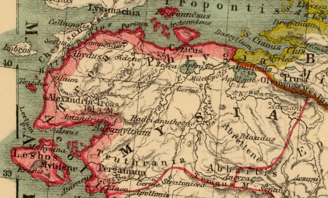

Hadrianotherae
Most Roman cities were founded for reasons of military strategy, trade, or administrative efficiency. Hadrianotherae was founded because an emperor killed a bear and was pleased about it. The name makes the reason explicit: in Greek, 'therae' refers to hunting or the quarry of a hunt, and the 'Hadrian-' prefix is self-explanatory. Sometime in the 2nd century AD — most likely during Hadrian's travels through Asia Minor, which he conducted with unusual personal engagement — the emperor hunted successfully in the region near present-day Balıkesir, commemorated the occasion by founding a city, and the city took his name and his hobby as its own identity. It is an origin story that says something about both the man and the era.
The Emperor Who Traveled
Hadrian ruled from 117 to 138 AD and spent more time traveling his empire than almost any other Roman emperor. He visited Britain, where he ordered the famous wall built; he toured Egypt, Greece, and Asia Minor; he hunted extensively, and hunting in antiquity was not a casual sport but a demonstration of courage, fitness, and imperial virtue. The bear was the most dangerous quarry available in Mysia's forested hills, and a successful bear hunt was worth commemorating. Hadrian did so in the most permanent way available to an emperor: he founded a city. The site he chose lay on the road between Ergasteria and Miletopolis in ancient Mysia, the region of northwest Anatolia that today constitutes Balıkesir Province. A hunting lodge became a settlement, and a settlement was granted urban status.
Coins That Tell the Story
We know Hadrianotherae existed and had pretensions to civic dignity largely because of its coins. Ancient cities issued coins as a form of civic identity — they bore the city's name, its patron gods, its symbols. Coins from Hadrianotherae survive from Hadrian's reign onward, which gives us a rough founding date and confirms the city persisted for centuries. More unusually, its coins mention a senate — a civic body that gave the town a degree of formal self-governance. That is not trivial: not every settlement in Roman Mysia achieved the status of a city with a functioning council. The coins provide a material thread connecting this otherwise almost-vanished place to the wider Roman world.
A Bishop's Seat
As the Roman Empire became Christian, Hadrianotherae accumulated a new layer of significance: it became the seat of a bishop. Episcopal sees in late antiquity were assigned to settlements of a certain size and importance — they needed a congregation large enough to sustain a church hierarchy and a bishop's household. Hadrianotherae qualified. The Christian community there persisted long enough for the see to enter the formal records of the early church. After the Byzantine period, when the settlement itself faded, the Roman Catholic Church preserved the see's existence as a titular bishopric — a title assigned to clergy who need a historical episcopal identity without an active diocese. Hadrianotherae remains a titular see to this day, which means the city has outlasted its own existence as a functioning place.
The Invisible City
The site of Hadrianotherae is located near modern Balıkesir at approximately 39.61°N, 27.91°E, in low terrain that is now agricultural. Unlike some ancient sites in western Turkey, it has not been excavated in a way that produced visible remains for tourists. The coins are in museum collections. The bishop's palace is long gone. The road from Ergasteria to Miletopolis that it once stood on is unmarked. What the landscape offers instead is context: the same forested hills where Hadrian's hunting party moved through in the 2nd century are still recognizable, the Kazdağı mountains visible on the horizon, the agricultural flatlands of Balıkesir Province unrolling in every direction. The bear is long gone too, but the hills that sheltered it remain.
From the Air
Hadrianotherae's ancient site lies at approximately 39.61°N, 27.91°E, just northeast of modern Balıkesir city in Balıkesir Province, Turkey. The nearest commercial airport is LTFD (Balıkesir Koca Seyit Airport) near Edremit, approximately 110 km to the west, with daily Istanbul connections. LTBG (Bandırma Airport) is approximately 80 km to the north and serves as a regional alternative. Viewing altitude of 3,000–5,000 m is recommended to appreciate the agricultural terrain and the relationship between the ancient road corridor and the surrounding hills. The Kazdağı massif is visible to the southwest. The modern city of Balıkesir itself provides an unmistakable visual reference point directly to the southwest of the ancient site.
Nearby Stories
- Battle of the Hellespont (321 BC) 12 km away
- Altıkulaç Sarcophagus 32 km away
- Lyrnessus 33 km away
- Akhisar Museum 52 km away
- Green Mosque of Bursa 60 km away
- Ayvalık 62 km away
- Bursa 80 km away
- Antalya Museum 337 km away