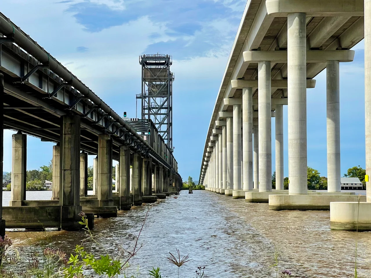

Harwood Bridge
In August 1966, a punt made its final crossing of the Clarence River and an era quietly ended. For generations, drivers heading up the Pacific Highway toward Brisbane had queued at the riverbank near Harwood and waited for a ferry to carry them over the wide brown water. Then the Harwood Bridge opened, and that ritual stopped for good: it eliminated the last ferry on the entire New South Wales State Highway system. The bridge that replaced the punt was no ordinary span, and the story did not end there. More than half a century later, the Harwood Bridge would be retired in turn, kept on not as a highway but as a quiet path for walkers, cyclists, and the people of one small island.
The Last of a Breed
The Harwood Bridge was the grand finale of a vanishing kind of engineering. Through the 1950s and 1960s, the New South Wales Department of Main Roads threw a series of standard-design steel truss bridges across the wide coastal rivers of the north, most of them on the Pacific Highway, taming crossings that had long depended on ferries. Harwood, opened in 1966, was the longest and the last of that family. Its steel trusses carried two lanes of highway from the south bank of the Clarence onto Harwood Island, about 10 kilometres upstream from where the river meets the sea, and roughly 46 kilometres by road from Grafton. To stand beneath it is to see an entire chapter of mid-century roadbuilding distilled into one structure.
A Bridge That Lifts
The Clarence is a working river, and the bridge had to make room for the boats. One of its truss spans is a vertical-lift section, a span that could be raised straight up between towers to let tall vessels pass beneath on their way up and down the channel. It is a deceptively clever piece of machinery: a stretch of highway that could, on demand, simply rise out of the way. For drivers it meant the occasional pause while the deck climbed and a ship slid through; for the river traffic of the lower Clarence, including the boats serving the district's sugar trade, it meant the bridge never fully cut the waterway in two.
Eclipsed, Not Erased
Time eventually outgrew the old bridge. Between 2016 and December 2019, a new crossing took shape just 20 metres to the east: a four-lane concrete bridge running about 1.5 kilometres, high and broad enough to carry the upgraded Pacific Highway without ever pausing for a passing ship. When it opened, the highway moved across to the new structure. But the 1966 bridge was not torn down. It was kept, repurposed to carry local traffic onto Harwood Island and to hold the dedicated, grade-separated footpath and cycleway that survives along its deck. The old steel truss now lives a slower life beside its towering successor, the two bridges standing side by side like a before-and-after of how Australia builds.
Island, River, and a Sweet Industry
The bridge's whole reason for being is the land on the far side. Harwood Island, low and green in the middle of the Clarence, is home to the Harwood Sugar Mill, which has been crushing cane since 1874 and is the oldest continuously operating sugar mill in Australia. For 150 years, cane grown across the lower Clarence floodplain has come here to be turned into sugar, and the bridge is the island's road link to the mainland and the town of Maclean, six kilometres away. So the structure is more than a highway relic. It is the thread that ties a sugar island to the rest of the country, which is why, even retired, it was never allowed to fall.
From the Air
The Harwood Bridge crosses the Clarence River at 29.43°S, 153.24°E, in the Northern Rivers region of New South Wales, about 10 kilometres upstream from the river mouth and 6 kilometres from Maclean. From the air, look for two parallel bridges spanning the wide channel onto flat, green Harwood Island, the older steel truss alongside the long, pale concrete deck of its 2019 replacement; the sugar mill sits nearby on the island. Best viewed at low to medium altitude, 1,500 to 4,000 feet AGL, in clear conditions, with the braided lower Clarence and Woodford Island spreading inland to the west. Nearest airports are Grafton / Clarence Valley Regional (YGFN) upriver to the southwest and Lismore (YLIS) to the north, with Coffs Harbour (YCFS) down the coast and Ballina Byron Gateway (YBNA) to the northeast. Watch for sea breezes and coastal haze near the river mouth.
Nearby Stories
- History of New Italy, New South Wales 19 km away
- Yuraygir National Park 20 km away
- Washpool National Park 25 km away
- Guy Fawkes River National Park 45 km away
- Cape Byron Marine Park 56 km away
- Tenterfield School of Arts 56 km away
- Cape Byron Light 90 km away
- SS Elingamite: Gold, Fog, and a Captain Wrongly Blamed 1803 km away