Hattem
The castle was called the Dikke Tinne - the Fat Merlon - and that nickname tells you almost everything about how the town of Hattem saw itself in 1404. A merlon is the solid stone block between the gaps on a battlement, the part you hide behind when arrows are flying. Hattem's merlons were the fattest in the Low Countries. The walls of Castle Saint Lucia were the thickest in the Netherlands at the time, which is to say someone went to the trouble of measuring all the castles in the Low Countries and Hattem won. The castle is gone now - knocked down in 1778 so the townspeople could reuse its bricks for their houses - but the name survives in a festival the town still throws every two years.
Heem of the Hattuarii
The town's own name carries an old argument about where the people came from. One reading traces it to a heem - a home - of the Chattuarii, a Germanic tribe also written Hattuarii or Hatten. Another simply pulls it from a person, a leader called Hatto. Either way, the place is named after the people who first lived here, and they were here early. Hattem appears in the Codex Laureshamensis, the registry of donations to Lorsch Abbey, around the year 800, when two farmhouses were given to the Carolingian monks. There was no church yet. That waited until 1176, when Hattem became a parish and a chapel was raised - not at the current center of town, but at the Gaedsberg, the God's mountain. The church and the city eventually walked downhill together and met around 1299, when the landgrave Reinoud I van Gelre granted Hattem city rights. The fortified town had already been building itself around the chapel that became the Andreaskerk.
A Minor Hanseatic Voice
Shortly after 1294, Hattem joined the Hanseatic League - one of only nine Dutch cities in that vast Northern European trading confederation. Honesty compels the admission that Hattem played, in the official history's words, a very minor role. The big Hanseatic voices were Lubeck and Hamburg, Bremen and Danzig - not a small fortified town on the IJssel with perhaps a thousand souls. But Hanseatic membership came with privileges, networks, and a kind of mercantile pride that outlasted the trade itself. The last recorded mention of Hattem's Hanseatic tie was in 1615, more than three centuries after the town joined. Today, Hattem markets itself as one of the picturesque Hanze towns of the IJssel - Hanseatic identity polished up for the tourism brochures, but with genuine medieval bones beneath the polish.
Patriots and a Governor-General
Two stories from Hattem's later history are worth carrying with you. The first: in 1786, Hattem and nearby Elburg became flashpoints of the Patriottentijd - the Dutch Patriot movement that sought to break the power of the stadtholderate and bring something like republican democracy to the Netherlands. The stadtholder William V suppressed them, hard, with troops. The Patriots had to wait for the French Revolution to revive their cause. The second story belongs to one of those Patriots: Herman Willem Daendels, born in Hattem in 1762, who fled to France after the suppression, returned with French armies in 1795, and ended up as the 36th Governor-General of the Dutch East Indies from 1808 to 1811 - a position he used to drive the construction of the Great Post Road across Java, a thousand-kilometer route built largely with forced labor that killed thousands of Javanese workers. The mathematician Willem Jacob van Stockum, who solved an early case of Einstein's field equations before dying in a 1944 RAF raid over France, was born in Hattem in 1910.
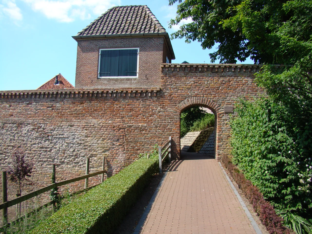
What to Walk Today
Hattem's medieval street plan still runs around the Grote of Andreaskerk and its 13th-century tower. The Dijkpoort, one of the surviving town gates, stands in unmistakable Hanseatic brick, capped with the kind of small pointed turrets that turn a working defensive structure into a postcard. The town windmill De Fortuin still grinds. The painter Jan Voerman, born in Kampen in 1857 and long settled here, made his name capturing the IJssel light and the cows of the river meadows; one of the three museums in the town center is the Voerman Museum. Another is dedicated to the illustrator Anton Pieck, whose fantastical pen-and-ink townscapes inspired the Dutch theme park Efteling and whose work in Hattem makes the case that the town's tight medieval lanes invented a kind of Dutch cozy that we are still chasing. A railway station served Hattem from 1887 until 1950; today you take the bus from Zwolle, two stops, twenty minutes, and you are in another century.
From the Air
Located at 52.474 degrees north, 6.070 degrees east, on the east bank of the IJssel river just south of Zwolle. From the air, look for the compact oval of the old fortified town with the spire of the Andreaskerk at its center and the surviving Dijkpoort gate marking the southwest corner. Best viewed from 2,500 feet. Nearest airports: Lelystad (EHLE) about 45 km west, Twente (EHTW) about 65 km east. The IJssel river is the dominant navigational feature.
Nearby Stories
- Windpark Noordoostpolder 2.7 km away
- Giethoorn 5.1 km away
- Aviodrome 6.6 km away
- Hans Philipp 7 km away
- Haaksbergen 7.2 km away
- Siege of Zutphen (1591) 8 km away
- Sleen 9.3 km away
- Onze Lieve Vrouwetoren 17 km away