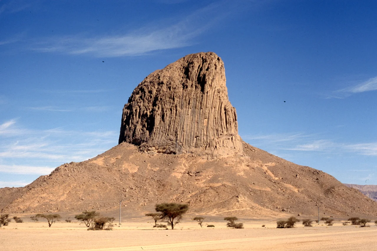

Hoggar Mountains
Cross the Sahara long enough and the land begins to climb. Out of the flat immensity of southern Algeria rises the Hoggar — a great volcanic massif of black basalt spires, eroded calderas, and jagged plugs of ancient lava, straddling the Tropic of Cancer. The Tuareg call it Ahaggar, and to them it is home. To everyone else it is one of the most improbable landscapes on Earth: high enough to be cold, wet enough to be alive, a green-flecked island of biodiversity floating in the planet's greatest desert. Winter nights here fall below freezing. Stand on its heights at dawn and the desert you crossed to reach them disappears entirely beneath your feet.
The Roof of the Sahara
The Hoggar's crown is Mount Tahat, at about 2,908 metres the highest point in all of Algeria, rising from the Atakor volcanic field at the massif's core. These peaks are the bones of dead volcanoes — towers of hard rock left standing after softer surroundings weathered away, sharp-edged and otherworldly against the sky. The most famous viewpoint is the Assekrem plateau, a wind-scoured saddle whose name in Tamashek means roughly "the end of the world." Travelers climb it in darkness to watch the sun break over a sea of volcanic teeth, the light turning the rock from violet to red to gold. It is, by wide agreement, one of the great sunrises anywhere — earned only by those willing to reach this remote corner of the Sahara to see it.
Where the Desert Holds Its Breath
Altitude changes everything. Because the Hoggar sits high, its climate is gentler than the furnace below — still hot in summer, but cool in winter, with rainfall that, though rare and unpredictable, is enough to sustain life the surrounding desert cannot. The massif is part of the West Saharan montane xeric woodlands, a green archipelago where acacias like Vachellia tortilis and Vachellia seyal, wild myrtle, and tamarisk cling to the wadis. This is a refuge for relict species — survivors stranded here when the Sahara dried. West African crocodiles persisted in Hoggar pools into the early twentieth century before vanishing. The rare Saharan cheetah still haunts the Atakor: camera traps recorded several individuals between 2008 and 2010, and Algerian naturalists filmed one in 2020, the first sighting in the park in a decade.
Six Thousand Years of Hands
People have been here far longer than the desert. Across the Hoggar and the neighbouring highlands, rock paintings dating back some six thousand years record a wetter, greener Sahara — herds of cattle, hunting scenes, the daily life of a world that has since turned to stone and sand. The massif is the heartland of the Kel Ahaggar Tuareg, the desert nomads whose camel caravans once carried salt and goods across these wastes and whose culture still defines the region. The oasis city of Tamanrasset, the unofficial capital of the Hoggar, takes its name from an ancient river that drained these heights during a long-vanished humid age. Layer upon layer, the Hoggar is a record of every Sahara that ever was.
A Mountain Used as a Bomb Shelter
The Hoggar also carries a harder, more recent history. In the 1960s, France used the granite of these mountains to hide its nuclear weapons program. At In Ekker, in the massif's northern reaches, French engineers bored tunnels into the Taourirt Tan Afella, detonating a series of underground atomic tests deep inside the rock between 1961 and 1966. The mountains were chosen precisely because their dense stone was meant to contain the blasts. They did not always succeed — one 1962 test vented a radioactive cloud across the desert. It is a sobering coda to a place otherwise defined by deep time and natural wonder: that for a few years, one of the oldest landscapes on the continent was conscripted into the newest and most dangerous of human enterprises.
From the Air
The Hoggar massif is centred near 23.29°N, 5.53°E, covering a vast highland region of southern Algeria. Mount Tahat, the high point at about 2,908 m, anchors the Atakor volcanic field; the Assekrem plateau lies nearby. Nearest airport: Aguenar – Hadj Bey Akhamok at Tamanrasset (ICAO DAAT), to the south. This is significant high terrain — maintain safe clearance above the volcanic peaks, which rise sharply from desert at roughly 1,000 m to summits near 3,000 m. Air is clear and visibility usually superb, but daytime heating over dark rock produces strong turbulence and thermals; mornings are calmer. Recommended sightseeing altitude well above 10,000 ft.
Nearby Stories
- Tin Hinan Tomb 17 km away
- Tamanrasset 28 km away
- Béryl Incident 70 km away
- Tassili n'Ajjer 385 km away
- Acacus Mountains 474 km away
- Gerboise Blanche 584 km away
- Gerboise Bleue (nuclear test) 604 km away
- 2015 Zaria Massacre 1343 km away