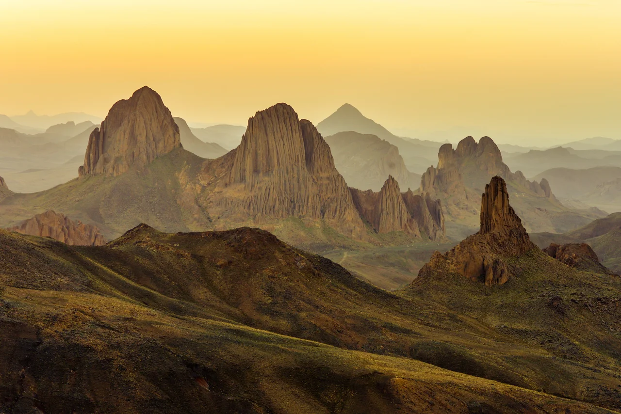

Tamanrasset
Look for the palms first. From the air, Tamanrasset announces itself as a band of green pressed into a wadi — the dry bed of an ancient river — with the black volcanic ridges of the Hoggar rising behind it. This is no small thing in the central Sahara, where green means water and water means life. At roughly 1,300 metres above sea level, the city sits high enough that the brutal desert heat softens by night and the winter dark can dip below freezing. For the Kel Ahaggar Tuareg, this oasis is the capital of their world, the place the caravan tracks converge, and the last reliable comfort before the desert turns truly empty.
Capital of the Hoggar
Tamanrasset is the seat of one of Algeria's largest and least densely populated provinces, a territory of stone and sand bigger than many European countries with a city of roughly a hundred thousand people anchoring it. The Tuareg call this country Ahaggar, and Tamanrasset is its unofficial capital — the chief city of the Kel Ahaggar, the desert people whose indigo-dyed veils gave them the old traveler's name, the Blue Men of the Sahara. Markets here sell what the oasis grows: dates and almonds, citrus and apricots, maize and cereals coaxed from irrigated plots. The city is also a working hub, a place of consulates and bus stations and long-distance taxis that fill, slowly, before grinding off toward In Salah eleven hours north or the Niger frontier to the south.
A River That Vanished
The valley Tamanrasset is built in was not always dry. During the African humid period, thousands of years ago, a great watercourse — geologists call it the Tamanrasset River — drained the Hoggar highlands and ran for hundreds of kilometres before the desert swallowed it. The city took its name from that ghost river. Reach back far enough and the human story here is older still: the surrounding country holds archaeological traces and rock art stretching back tens of thousands of years, the work of people who hunted and herded across a Sahara that was once grassland. Stand in the wadi today, with dust on the wind and the heat shimmering off bare rock, and it takes an act of imagination to picture the water that once made all of this possible.
The Hermit of the Hoggar
In 1905, a French aristocrat-turned-monk named Charles de Foucauld arrived in Tamanrasset and built a small hermitage. A former cavalry officer who had remade himself as an ascetic, he lived among the Tuareg, learned their language, and spent years compiling a Tuareg grammar and dictionary that scholars still consult. In 1911 he established a second, lonelier hermitage atop the Assekrem plateau, a wind-scoured volcanic saddle about eighty kilometres away where the sunrise over the Atakor peaks has drawn pilgrims and travelers ever since. De Foucauld was killed at Tamanrasset in 1916, but the Assekrem hermitage endures, still tended by a handful of monks, and the climb to watch dawn break over the Hoggar remains the signature experience of the region.
Gateway and Threshold
For travelers, Tamanrasset is less a destination than a doorway. It is the staging point for the Hoggar's volcanic spires and the painted rock shelters of Tassili n'Ajjer to the northeast, and the place where Saharan expeditions provision before heading into terrain that does not forgive carelessness. The roads in are unpaved, narrow, and long; the border tracks toward Mali and Niger are best left alone. What makes the city worth the effort is exactly its remoteness — the sense of having reached a genuine edge of the inhabited world, where the desert begins in earnest and the night sky, unpolluted by city light, blazes from horizon to horizon. Two days are enough to know the town. The Hoggar beyond it could absorb a lifetime.
From the Air
Tamanrasset sits at approximately 22.79°N, 5.52°E, at about 1,300 m elevation in a wadi at the southern edge of the Hoggar massif. Served by Aguenar – Hadj Bey Akhamok Airport (ICAO DAAT), a few kilometres from the centre. The Atakor volcanic field and Mount Tahat — Algeria's highest peak at about 2,908 m — rise to the north; the Assekrem plateau lies roughly 80 km away. Skies are clear and visibility excellent almost year-round. Recommended viewing altitude 5,000–8,000 ft to take in both the green oasis ribbon and the black volcanic peaks; daytime heat generates strong thermals over the surrounding rock.
Nearby Stories
- Tin Hinan Tomb 14 km away
- Hoggar Mountains 30 km away
- Tassili n'Ajjer 424 km away
- Acacus Mountains 499 km away
- Gerboise Blanche 616 km away
- Askia Daoud 845 km away
- Tomb of Askia 899 km away
- 2015 Zaria Massacre 1284 km away