Holland
In January 2020 the Dutch government did something quietly remarkable: it told the world to stop calling the country Holland. The official tourism logo was redesigned. The word Holland came down. The letters NL went up. For most of the planet this was confusing news, because most of the planet had always called the place Holland and had no idea it was the wrong name. Holland is one region of the Netherlands. Two provinces, North Holland and South Holland, occupy the western coastal strip where Amsterdam, Rotterdam, and The Hague sit. The other ten provinces have spent centuries quietly resenting being lumped in with it. The mistake is so old, so deep, and so commercially useful that it took an act of national branding policy to begin pushing back against it.
Wood-Land, Not Hollow Land
The name first appears in sources around Haarlem and by 1064 was being used for the entire county. The earliest Latin texts call the inhabitants Hollandi. The word comes from Old Dutch holtlant, meaning wood-land, which makes a kind of sense because the elevated coastal ridges were once forested. A pleasant folk etymology insists Holland comes from hol land, hollow land, a poetic nod to the low-lying polders. It is wrong, but it has the satisfaction of feeling true. Much of Holland is in fact hollow, sunk below sea level by centuries of peat drainage that shrank the surface by as much as fifteen meters. The lowest point in the country, a polder near Rotterdam, sits about seven meters below the North Sea. Continuous pumping keeps the water out. The windmills that became Holland's most exported visual symbol were originally not picturesque, they were industrial machines built to keep the country from drowning.
How One Province Became a Country
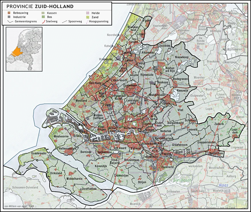
Holland began as a remote corner of the Holy Roman Empire under Count Dirk I in the 890s. By the seventeenth century it had become the wealthiest economic engine of the Dutch Republic, the cultural and political center of the Golden Age, and home to most of the great trading cities: Amsterdam, Rotterdam, Leiden, The Hague, Delft, Dordrecht, Haarlem. Foreigners dealt with Dutch merchants out of Holland's ports. Foreign ambassadors arrived at The Hague. The Republic of the Seven United Provinces of the Netherlands became, in the minds of outsiders, simply Holland. Within the Republic itself, a slow Hollandification took place: the Hollandic dialect became the basis of standard Dutch, the urban culture of the Holland cities became the assumed default. Between 1806 and 1810 the situation became briefly official. Napoleon installed his brother Louis Bonaparte on the throne of what he called the Kingdom of Holland, the formal name of the entire country, even though most of the country was not Holland. The name reflected how natural the elision had already become.
Tulips, Clogs, and the Other Provinces
The Frisians, the Limburgers, the Brabanters, the Zeelanders, the Groningers, all of them have their own languages, their own foods, their own histories. Limburgish is still recognized as a regional language. Frisian is co-official with Dutch. In the late nineteenth century, official Dutch tourism authorities built a stereotype that has been impossible to dislodge: tulips, windmills, klompen wooden shoes, Edam cheese, the traditional dress of the fishing village of Volendam. All of it was Hollandic. Most of it was not even authentically that. The marketing worked. The stereotype became the country in the foreign imagination, and the other ten provinces watched their cultures get erased from the picture. The Dutch even have a word for the phenomenon: Hollandocentrisme. The 2020 rebrand to NL was, in part, a small overdue acknowledgment that the Netherlands is more than its coast.
The Land Is Not Stable
Holland has never sat still. The western coastline has shifted up to thirty kilometers inland over the centuries. Storm surges have broken through the dunes. The Rhine and the Meuse have changed course dramatically and repeatedly. Entire regions disappeared into the sea during the great medieval floods, and the inland sea called the Zuiderzee grew until it nearly cut Holland in half. Only the construction of dikes and the formation of the waterschappen, the water control boards with legal powers older than the Dutch state itself, kept the land from drowning. Land reclamation began in earnest in the sixteenth century. Lakes were pumped dry. Mudflats were diked into polders. The Haarlemmermeer was drained in 1852. The Zuiderzee was sealed off in 1932 and partly drained to create the IJsselmeer and the new province of Flevoland, the only province lying entirely on land that did not exist a century ago. Holland is not a place. It is an ongoing engineering decision, renewed daily by pumps that no one is allowed to switch off.
From the Air
The Holland region occupies the western coastal strip of the Netherlands at approximately 52.25N, 4.67E, with the two modern provinces of North Holland and South Holland together covering roughly 7,494 square kilometers. From cruising altitude the region is unmistakable: a long row of pale coastal dunes running north-south along the North Sea, with the Randstad megacity arc of Amsterdam, Haarlem, Leiden, The Hague, Rotterdam, and Utrecht visible just inland, surrounded by the green geometric grids of polder farmland and the silver lines of canals and the IJsselmeer. Major airports: Amsterdam Schiphol (EHAM) and Rotterdam The Hague (EHRD).
Nearby Stories
- Polanen Castle 1.6 km away
- Gouda 2.6 km away
- Princess Amalia Wind Farm 3.5 km away
- The Green Cathedral 4.2 km away
- Egmond Abbey 7.1 km away
- Dorestad 7.7 km away
- Hollandse Kust Zuid Offshore Wind Farm 11 km away
- Enkhuizen 16 km away