
Holly River State Park
Two hundred fifty men with shovels, axes, and the New Deal in their pockets walked into Webster County in the mid-1930s and started building a state park. They cleared trails. They laid up stone for cabin chimneys. They split timber for cabin walls. They sawed lumber and dug latrines and built the kind of low-key rustic infrastructure that the federal government, in a deliberate decision, was deploying to put unemployed Americans back to work. When they were done they had built Holly River State Park - 8,294 acres of preserved Appalachian forest in a remote corner of central West Virginia, which would become the second-largest park in the state system.
The New Deal in the Woods
The federal alphabet agencies of the 1930s - the CCC, the WPA, and their cousins - left a deep imprint on the public landscape of the United States. At Holly River, the work was done primarily by the Works Progress Administration, which hired 250 local men to build what the West Virginia Division of Natural Resources still calls the New Deal Historic District. The architectural language was uniform across the era and across the country: peeled logs, hand-laid stone, steep shingled roofs, broad porches. The stone for the cabins came from the property itself. The timber was cut from the surrounding slopes. The result was a park that looks, almost a century later, exactly like a park is supposed to look - because Holly River and its cousins are where most Americans learned what parks should look like.
Nine Cabins
The nine cabins built in the 1930s sit along a tributary of the Laurel Fork of the Holly River, each with a stone fireplace and a name rather than a number among the families that come back year after year. They are not luxurious. They are heated by their fireplaces, furnished with the kind of solid wood furniture that survives generations of summer renters, and equipped with kitchens designed for cooking trout and corn on the cob. Cabin 6, the most photographed, has appeared in West Virginia tourism literature for decades. The cabins are booked out months in advance for the prime summer weeks - a small economic phenomenon that traces directly back to a 1936 WPA payroll.
Potato Knob and the Falls
Potato Knob rises 600 feet above the valley floor in a steep cone that the trail switchbacks up. The summit gives one of those Appalachian views where you can see five ridges, three forested hollows, and exactly one other building. Upper Falls drops in a single sheet on Fall Run, a tributary of the Left Fork, with an observation deck and a long flight of stairs that takes you to the pool at the base. The water is cold all year. In winter, when the leaves are down, you can also reach Tecumseh Falls along the Reverie Trail. The waterfall was named for the Shawnee prophet Tenskwatawa, who - according to common attribution - predicted the solar eclipse of June 16, 1806, an event that helped unite Indigenous resistance to American expansion under his brother Tecumseh.
The One-Room School
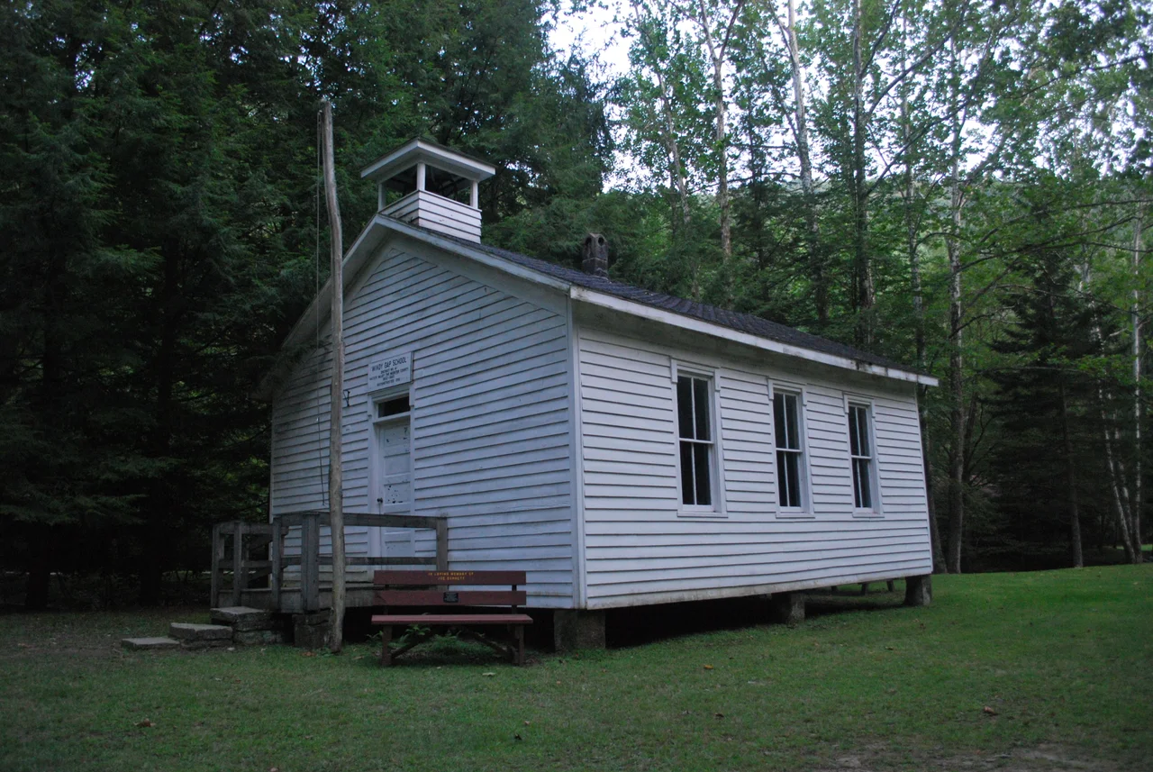
Windy Gap School is not original to the park. It is a one-room schoolhouse that was sitting on a remote tract owned by the Division of Natural Resources, gradually rotting back into the ground. The Holly River State Park Foundation organized a volunteer project in the mid-2010s to disassemble the building, move it to a site near the park headquarters, and reassemble it where visitors could actually find it. The schoolhouse now serves as a small interpretive site - desks, blackboard, woodstove, the smell of old paper. It is a quiet memorial to the kind of Appalachian education that took place in buildings like this until consolidation closed most of them in the 1950s and 1960s.
Festival Weekend
Every Labor Day weekend since 1992, the park has hosted the Holly River Festival - a small-town celebration that combines crafts, music, food, and a fundraising auction for the park itself. The festival draws several thousand visitors over the long weekend to a park that normally sees a few dozen campers at a time. The Hacker Valley road, which is the only way in, becomes briefly congested in the way that the rural roads of West Virginia occasionally become briefly congested. By Tuesday morning, the cabins are quiet again and the deer are back at the edge of the meadow at dusk. The park returns to what it has been since the WPA workers went home: a quiet wooded refuge in the middle of central Appalachia.
From the Air
Located at 38.67 degrees N, 80.33 degrees W in Webster County, West Virginia. Holly River State Park covers 8,294 acres along the Left Fork of the Holly River near Hacker Valley. The park sits at the edge of the Allegheny Plateau in steep wooded terrain. Elkins-Randolph County Regional Airport (KEKN) is the nearest tower-controlled field about 35 nm northeast. Marlinton Airport (KMRT) is about 25 nm southeast. Recommended viewing altitude 4,500 to 6,500 feet MSL. Expect ridge-and-valley terrain throughout the area; valley fog common mornings in the river drainages.
Nearby Stories
- West Virginia State Wildlife Center 2 km away
- Cedar Creek State Park 3.8 km away
- Cranberry Wilderness 4.8 km away
- Camp Bartow Historic District 6.4 km away
- West Virginia Maneuver Area 9 km away
- Gad, West Virginia 9.2 km away
- End of the World Turn 10 km away
- Bath County Pumped Storage Station 12 km away